Involi and AirMap Collaborate with UAS Traffic Management
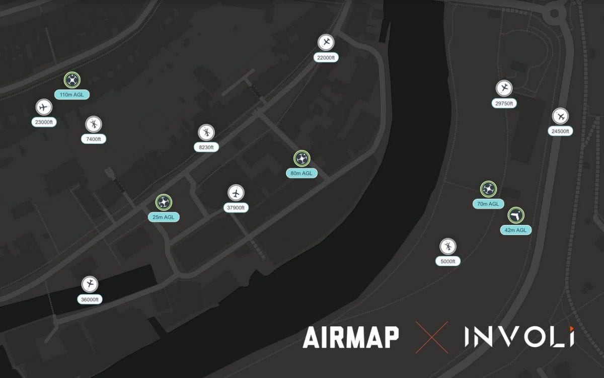
Involi, a complete and reliable air traffic data provider for UAS, otherwise known as drones, and AirMap, the leading global airspace intelligence platform for drones, announce their collaboration to offer a pre-integrated UTM and Air Traffic Awareness solution for safe, efficient, and scalable drone operations.
The safe integration of drones into low-altitude airspace alongside manned aviation has become paramount to cope with the fast adoption of drones in multiple industries. The combination of Involi’s low-altitude air traffic data service with AirMap’s drone traffic management platform enables safe, complex, and autonomous drone applications, such as drone delivery, large-scale agriculture support, surveying, mapping, and countless other use cases.
The integrated solution of AirMap and Involi offers a suite of drone management and flight awareness technologies and services for drone pilots, authorities, and enterprise customers. AirMap’s UAS Traffic Management (UTM) Platform and UAS Service Provider (USP) capabilities enable airspace authorities to deliver safety-critical services to drone operators and other actors operating in low-altitude airspace. As a UTM Supplemental Data & Service Provider (SDSP), Involi’s stream of low-altitude air traffic data is combined with other traffic data inputs within the AirMap UTM Platform to provide a comprehensive visualization of real-time air traffic. This unique traffic data is gathered through Involi’s network of in-house developed detection devices affixed to cell towers and other existing ground infrastructure. Involi’s technology captures aircraft identification signals including ADS-B, FLARM, and other transponders, thus providing comprehensive air traffic awareness, which is critical to ensure safe separation and deconfliction between drone operations and helicopters, gliders, and other low-altitude manned aircraft.
Involi and AirMap are both partners in Switzerland’s Swiss U-space Implementation (SUSI) framework, which is Switzerland’s drone traffic management network infrastructure. Switzerland is one of the foremost countries in the world supporting commercial drone innovations, and Involi and AirMap are helping the country address the challenges of the safe integration of drones into its airspace.
“Through this collaboration, AirMap and Involi offer a comprehensive UTM solution that incorporates real-time data from aircraft operating in low-altitude airspace using ADS-B and other identification technology,” said AirMap CTO Andreas Lamprecht. “Involi’s airspace data will further enhance situational awareness within the AirMap UTM Platform.”
“It was a natural progression for Involi and AirMap to formalize their ongoing technical integration. We are working toward the common goal of automating drone flights and enabling exciting advanced drone applications that offer tremendous economic potential and represent the future of transportation. Joining forces helps bring this future one step closer,” said Involi CEO and Co-founder Manu Lubrano.
About AirMap: AirMap is the world’s leading airspace intelligence platform for the drone economy. Industry developers, drone operators, and airspace managers rely on AirMap’s airspace intelligence and services to fly safely and communicate in low-altitude airspace. AirMap unlocks safe, efficient, and scalable operations by connecting the world’s drones to airspace authorities through an open platform of APIs and SDKs, with integrations by top drone manufacturers and solution providers including 3DR, DJI, DroneDeploy, Matternet, and senseFly. Deployed in the Czech Republic, Japan, Switzerland, the United States, and available in over 25 countries, AirMap leads the industry in delivering technology solutions for UAS Traffic Management (UTM) and U-space to enable safe and responsible drone operations at scale. AirMap supports several drone enablement and research projects globally, including NASA UTM, the European Network of U-space Demonstrators and the U.S. UAS Integration Pilot Programs. To learn more about AirMap, visit: www.airmap.com
About Involi:
INVOLI is a multi-award-winning Swiss company with a mission to safely and efficiently open the sky to all flying objects. Involi presents a paradigm shift in providing the currently missing air traffic data to drones: only by knowing where the danger may come from can one avoid it. Thus “giving eyes to drones” will facilitate their safe integration into an increasingly busy sky, enabling drones to automatically avoid any other flying objects when on a collision course (airplanes, helicopters, drones, parachutists etc.) Our mixed hardware-software system integrates advanced artificial intelligence and space technologies into drone air traffic management systems to unlock the full potential of drones across many sectors such as infrastructure, agriculture, surveying, aerial photography or urban air mobility. To learn more about Involi, visit our homepage: www.involi.com.


