How Flight Evolved is Using Drones and LiDAR to Help Fight US Wildfires
With this year’s wildfire season proving to be the most devastating wildfire season on record, California’s largest utility providers are betting on drones, and LiDAR remote sensing technology – the very same sensors automakers use for autonomous vehicles – and a small team of experts out of San Diego to mitigate another destructive season.
The ferocity with which these wildfires have impacted the state of California is often further escalated due to damaged and at-risk powerlines, overgrown vegetation and gusting winds.
Overwhelmingly, the leading cause of wildfires are often human related, and powerlines and electrical equipment are routinely at the top of the list.
The cost is enormous, to the extent that last year, California state agencies spent nearly $1.8 billion after witnessing historic levels of wildfire death, destruction and displacement.
Even worse, total estimates including fire suppression, insurance, and recovery expenditures is estimated at about $180 billion.
San Diego Gas & Electric and other California utilities have been working with Flight Evolved, a San Diego-based company comprising of a small team of pilots, computer scientists and engineers, to develop ways to mitigate these risks to prevent billions of dollars in damage.
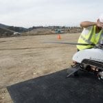
-

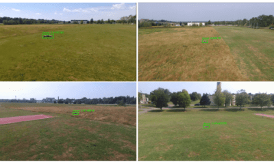
- Flight Evolved members reviewing UAV flight plan before sending unit out for mission.
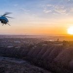
-
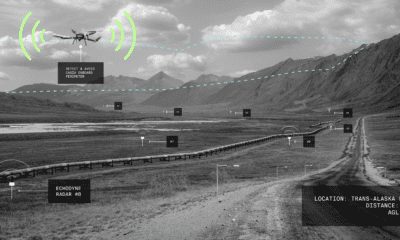
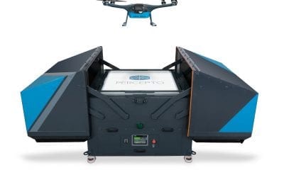
- Flight Evolved uses multiple vehicles to affix LiDAR scanners for various missions, including helicopters.
-
- Flight Evolved UAV completing LiDAR scanning mission.
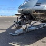
-
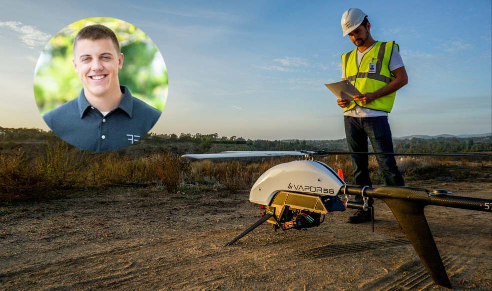
- Flight Evolved member affixing LiDAR sensor to a Pulse Aerospace Vapor 55 UAS. Flight Evolved affixes LiDAR sensors to its fleet of drones or Unmanned Aerial Vehicles (UAVs) to scan large swaths of terrain for utility companies.
By making use of drones and LiDAR, utilities can analyse the results to determine when a pole should be replaced, if vegetation is creeping too close, if line clearances are within CPUC regulations, and other similar findings.
To get a better picture of how LiDAR technology is being used to improve the situation, we spoke with Flight Evolved’s co-founder and COO, David Ilgenfritz.
What have been the advantages of LiDAR in fire and asset monitoring from traditional methods?
LiDAR is a surveying method that measures distances by illuminating an object with a near-infrared laser light and measuring the variation of returns times with a precisely calibrated sensor. Differences in laser return times and wavelengths can be used to create digital 3-D representations of the objects.
LiDAR helps utility companies scan its infrastructure assets and assess vegetation encroachment in a more efficient and cost-effective manner than traditional methods. Flight Evolved utilizes LiDAR sensors on helicopters, drones as well as standard cars/trucks to scan miles upon miles of grid infrastructure in far less time and eliminates human error in the process.
LiDAR allows Flight Evolved to see what trees or brush is too close to their power poles or power lines and act accordingly. Flight Evolved also utilizes LiDAR to help utilities assess infrastructure in remote or hard to access locations, which is a huge financial benefit and improvement to safety. In addition to vegetation management, LiDAR also helps utilities determine how structurally sound their infrastructure is and allows them to schedule maintenance accordingly to avoid potential hazards.
What challenges have been faced in this year’s incredibly destructive fire season?
Following the record rainfall California experienced in 2017, we saw high amounts of new plant/vegetation growth. This growth has served as a fuel source after we endured two-straight summers of unseasonably high temperatures. This combination, in addition to high winds, has led to an already busy fire season, that essentially started over a month early.
Further, the problems are exacerbated by aging infrastructure in the California utilities districts. This infrastructure is feeling the brunt of these weather events and in some cases the events are causing premature equipment failures that can spark fires.
How has LiDAR helped to solve these challenges?
LiDAR provides a highly accurate snapshot of existing infrastructure in relation to its environmental surroundings.
With the increase in weather events in the greater California region, many utilities have needed to get eyes on their infrastructure assets to ensure that things like erosion, vegetation encroachment, and structure lean are properly accounted for and fixed prior to causing an incident. The LiDAR data we collect is being used to re-engineer lines, establish vegetation plans, and alter grading and slopes.
Could you describe one particular success story?
Flight Evolved has been a contributor on an ongoing fire risk mitigation project in Southern California.
As a part of this effort, Flight Evolved is providing highly detailed LiDAR data to aid in re-designing specific distribution circuits for fire hardening purposes.
Our data helps identify structures with potential structural load issues, vegetation encroachment issues, and increases the efficiency of the engineering and design teams in their re-design efforts. With our data, this utility is able to identify, re-engineer, and mitigate future potential fire threats before they become an issue.
What steps will be taken to further improve Flight Evolved’s approach to assisting with wildfires?
Flight Evolved continues to increase efficiency and provide cost savings to customers through improvements of data ingestion, processing, and storage workflows that reduce the time from customer contact to data delivery.
Flight Evolved is dedicated to research and development of LiDAR equipment to increase flight times and more accurately model data. Flight Evolved is also constantly improving internal LiDAR software to account for specific utility needs and processes.
About David Ilgenfritz, Owner and COO
 David is the Co-Founder and Chief Operations Officer for UAV LiDAR company Flight Evolved. Flight Evolved provides data collection and interpretation using sUAS and multiple sensor payloads. Under David’s leadership, Flight Evolved has worked with Fortune 500 engineering and utility companies providing them high-quality LiDAR data. They are on a mission to change the way data is collected through the use of emerging technologies.