Volcanologists collecting information on the active volcano Mt Agung in Bali, Indonesia, have lost their data collection drone. The Ai450 drone, worth around $45,000, was lost during a flight mission to Mt Agung on the evening of Tuesday 23rd January 2018, while it was carrying tools for collection of volcanic gas samples.
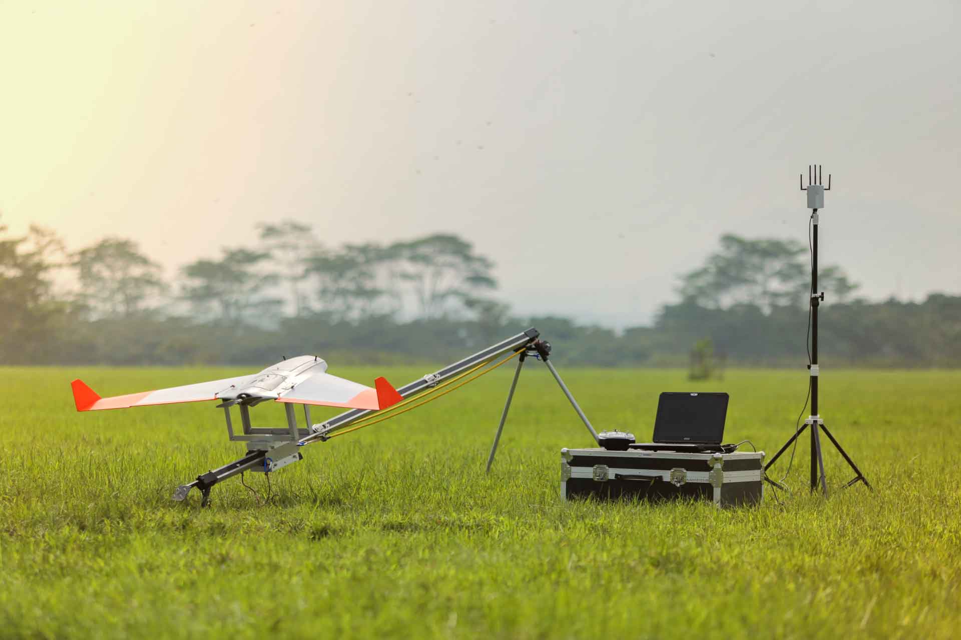
The Ai450 drone, built by AeroTerrascan, has been collecting footage and data for several months near Mt Agung whilst it has been active. The flagship model for AeroTerrascan, it is also commonly used by palm oil plantation owners in Indonesia for surveying and aerial mapping. The latest model, the Ai450-ER possesses improved flying performance over previous models, has a wingspan of 2.4m, a fiberglass composite body and 1080p video capabilities. It’s flight time is a maximum of 70 minutes per battery and it’s communication range is 10 kilometres.
Highly adaptable and able to carry a range of payloads, the Ai450 is also very portable, consisting of a knockdown system that allows high mobility and easy operation in the field. In it’s mission for Mt Agung, the drone was carrying multigas sensor equipment given to The Bali Volcanology and Geological Disaster Mitigation Center (PVMBG) by the U.S. Geological Survey agency (USGS). Volcanologist Devy Kamil Syahbana has reported the PVMBG requested USGS to supply new tools so they may continue monitoring the volcano.
Dr. Adam Fish of Lancaster University spoke with the BBC in December 2017 regarding his work with AeroTerrascan. In addition to using optical technology to take pictures, map and render the craters into a visual object, he described the use of sensors to smell for sulphur dioxide, carbon dioxide and other gases emitted by the volcano. This data assists authorities to respond appropriately to the unfolding crisis.
Play
Mt Agung, which has been showing increased volcanic activity since September 2017, has been the cause of multiple disruptions to international flights as well as the daily life of 150,000 Bali locals who have been forced to leave their homes which are located within the exclusion zones. Currently at its highest alert status, the volcano erupted four times on Tuesday morning. The conditions in which the drone flew was reported by the Tribun Bali to involve thick clouds and strong winds.
Sutopo Purwo Nugroho, spokesman for Indonesia’s Disaster Mitigation Agency (BNPB), tweeted that contact was lost with the drone around midnight and requested anyone who found or saw the expensive UAV to report.
The PVMBG tweeted on Tuesday showing video footage of the drone’s launch:
Footage collected by the Ai450 drone on the day prior to losing contact on Tuesday evening shows considerable gas erupting from the crater of the volcano.
Play
AeroTerrascan is an Indonesian UAV maunfacturing company that has been operating since 2010. Servicing various sectors of industry, they successfully launched a Ai-X1 drone from a National Aviation and Aerospace Institute (LAPAN) research centre in West Java in 2016. The project, named Menembus Langit, collected vital atmospheric and aerodynamic data and the team were later awarded the National Museum of Record accolade for their efforts.