News
Scientists Use Drones to Create World First 3D Map of Volcano
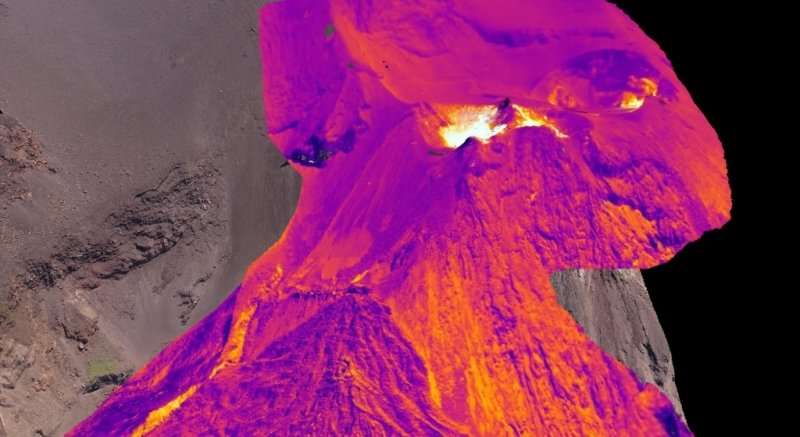
Drones have been instrumental in the creation of the world’s first 3-D thermal image of an active volcano.
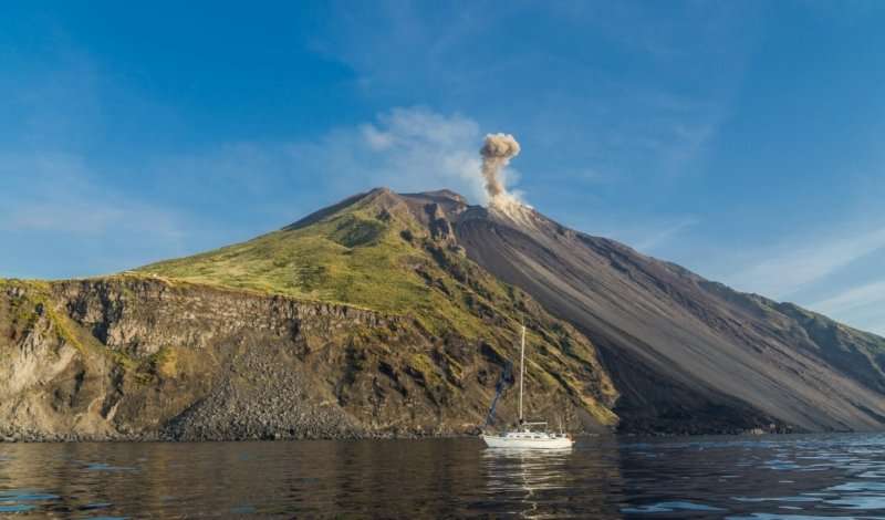
According to geoscientists from the University of Aberdeen, the striking image of the Stromboli volcano in Italy is part of a project to develop methods of detecting subtle changes in volcanic behaviour in order to predict the likelihood of an eruption.
Using high-precision cameras mounted to an aerial drone, Professor John Howell, from the University of Aberdeen said they captured the volcano in hundreds of aerial photographs. They then used software to stitch them all together to create a 3D map of the volcano’s surface. “From there we can overlay the model with images from a thermal camera, allowing us to see the thermal structure of the volcano in 3-D,” he said.
The project, which is part of a collaboration between scientists from the Universities of Aberdeen and Oslo aims to develop an autonomous volcano monitoring system that is more accurate, safer and cheaper than current methods. Current methods are often unaffordable in developing countries, which unfortunately is where most of the world’s active volcanoes can be found.
The volcano of Stromboli in Italy | University of Aberdeen
In an article on phys.org, Prof Howell explained how the method gives scientists more insight into volcanic activity.
“This thermal structure gives us significant insight into changes in the volcano. If we see certain areas are unexpectedly hot then it might be an early warning sign, especially if the ground has swelled.
“These are very small movements so not easily detectable, but by using the latest high-precision cameras we can notice subtle changes to the volcano that might signal an imminent eruption.
“The ability to deploy a drone really close to a volcano means that as well as getting high precision thermal mapping and imagery, we can also deploy portable seismometers and gas sensors in areas that are too dangerous for people to go.”
While their initial work has indicated there are some significant challenges to be overcome before the technique is fully functioning, Prof Howell said the early results are promising.
“Drone technology is moving so fast that we could have a system fully up and running in a few years,” he said. “Being able to send a low cost portable drone unit to any volcano around the world could really revolutionise how we monitor volcanos and be a game-changer for the people who live and work in their shadow.
“Ultimately this technology could help us build a much better idea of how volcanoes behave and in the future could save lives.”
https://www.youtube.com/watch?v=pLjYNMDV9aI


