Delair Expands Drone Mapping and Surveying Solutions to Canada in Deal with Cansel
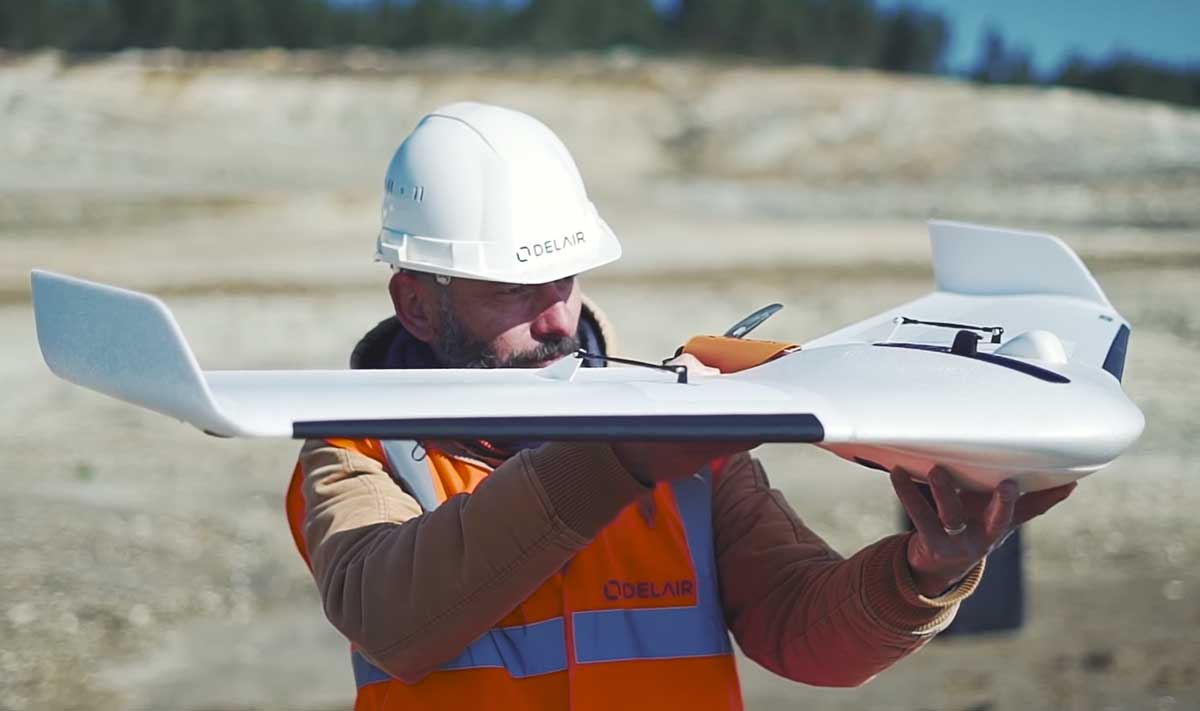
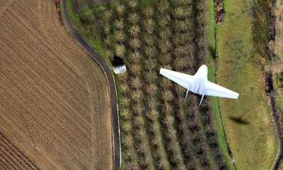
Delair, a leading global supplier of commercial drone solutions, today announced an agreement with Cansel, a full-service provider of surveying and mapping solutions to the Canadian market. Cansel becomes the first Canadian reseller of Delair’s innovative Delair UX 11 long-range drone, and the two companies plan to rapidly expand the agreement to include the entire Delair product line.
In addition, Delair confirmed that its entire portfolio of fixed-wing drone products has been certified as compliant by Transport Canada under its regulation of the UAV sector. Cansel is a certified drone operator per the regulations of Transport Canada, the government agency responsible for UAV operations, a status which requires the use of certified drone products. For more information refer to the Transport Canada compliancy list here.
The Cansel/Delair agreement targets a market characterized by wide-area mapping and surveying needs, making the advantages of long-range aerial viewing and data collection well-suited for a range of industries. Cansel brings five decades of experience in this area, and the addition of solutions based on the Delair platform will allow Cansel to expand its capabilities to provide even more efficiencies and accuracy to its customers. In addition to offering Delair products, Cansel also plans on offering drone-based complementary services to Canadian based companies, such as training, integration of air- and ground-based technologies and processing via innovative and powerful cloud based services and desktop solutions.
Delair’s long-range, fixed-wing drones with sophisticated artificial intelligence (AI) analytics and advanced machine learning algorithms are today sold in more than 70 countries. In 2016, the company established its North American headquarters in Los Angeles to address the expanding demand in the region.
“Having Delair solutions in our portfolio gives us a wider array of options for helping our clients with their mapping and survey needs. The range and distance of Delair’s UX11, as well as the high-performance functionality of its operational and sensing technology, will allow us to deliver highly effective approaches to aerial data collection that has tangible ROI for companies in many sectors,” said Martin Trudelle, Vice President at Cansel.
“The Canadian market is an exciting one for UAVs and we see the ability to bring great value to business operations there. From agriculture to mining, to construction, transportation and oil and gas, our track record of improving efficiencies through insightful analysis of data will be an important part of what Cansel can now offer,” said Marta Jubero, Channel Sales Director at Delair.
Cansel will provide dedicated sales, service support and customer advice for the recently introduced Delair UX11 – an innovative photogrammetric professional mapping drone solution. The UX11 is capable of onboard data processing, PPK-as-you-go, and both wireless and cellular communications to ensure survey-grade results anywhere. Where allowed, the drone is also designed for beyond visual line of sight (BVLOS) operations.
All of Delair’s solutions are designed to make it easy and cost-effective for enterprises to adopt commercial drones and support a seamlessly integrated workflow – from hardware to data acquisition services, to data processing software. This integrated approach enables commercial enterprises to automatically and instantly collect aerial intelligence, analyze and quickly integrate it into their daily business processes. This also provides for a rapid ROI.
How useful was this post?
Click on a star to rate it!
Average rating 0 / 5. Vote count: 0
No votes so far! Be the first to rate this post.
We are sorry that this post was not useful for you!
Let us improve this post!
Tell us how we can improve this post?

