Saildrone Covers Canadian West Coast to Enhance Fisheries Survey
Two small robot boats made by California’s Saildrone have been launched off the coast of Canada this week to enhance surveys being conducted by Fisheries and Oceans Canada (DFO).
Part of a collaboration between DFO and NOAA Fisheries, they have been sailing in the Pacific Ocean since Tuesday to monitor fish populations along the west coast.
They are part of a wider project by the National Oceanic and Atmospheric Administration Agency (NOAA) which is employing eleven such vehicles in total which is also aimed at monitoring changes in the Arctic Ocean and tracking weather in the tropics of the Pacific Ocean.
“The saildrone is an amazing device and provides us with an array of information, in some cases information that hasn’t been readily available,” says NOAA oceanographer Jessica Cross, who is involved in the Arctic Ocean project.
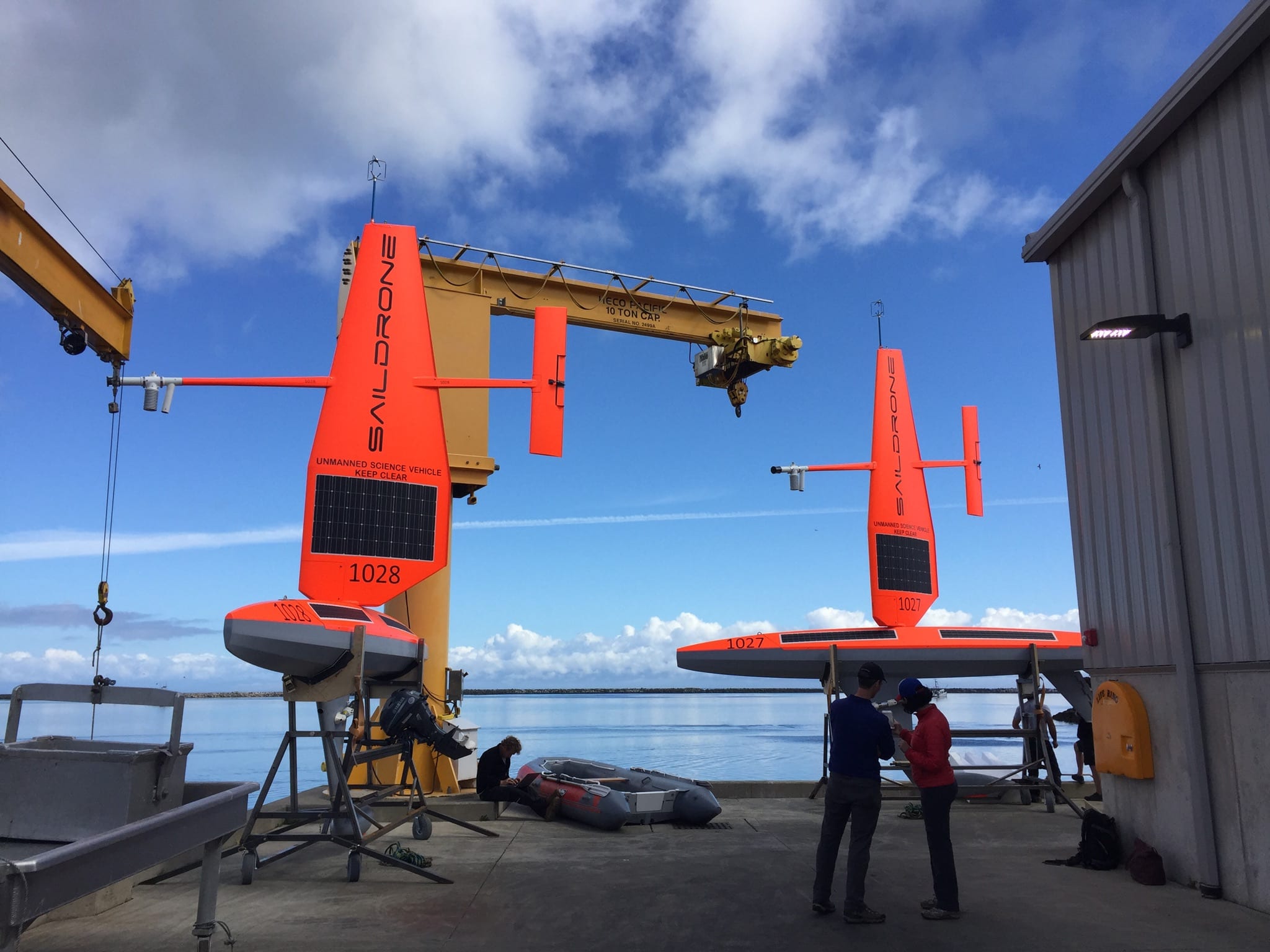
Technicians prepare the first two Saildrones for launch from Neah Bay, Wash | NOAA Fisheries/NWFSC
The sailboat drones being deployed off Canada will collect data on populations that fall under the shared jurisdiction of both Canada and the United States, reducing costs and increasing efficiency in an effort to replace much larger research vessels.
First, they will sail from the north end of Vancouver Island to California, writes Michael Millstein, spokesman for the US Ocean and Atmospheric Observing Agency (NOAA).
They will then turn south towards San Francisco, joining the main project fleet from Alameda, California.
Four of the Saildrones will replicate the transects normally taken by research vessels, with a fifth assessing fish species and numbers on areas near the shore to efficiently survey migrating fish stocks.
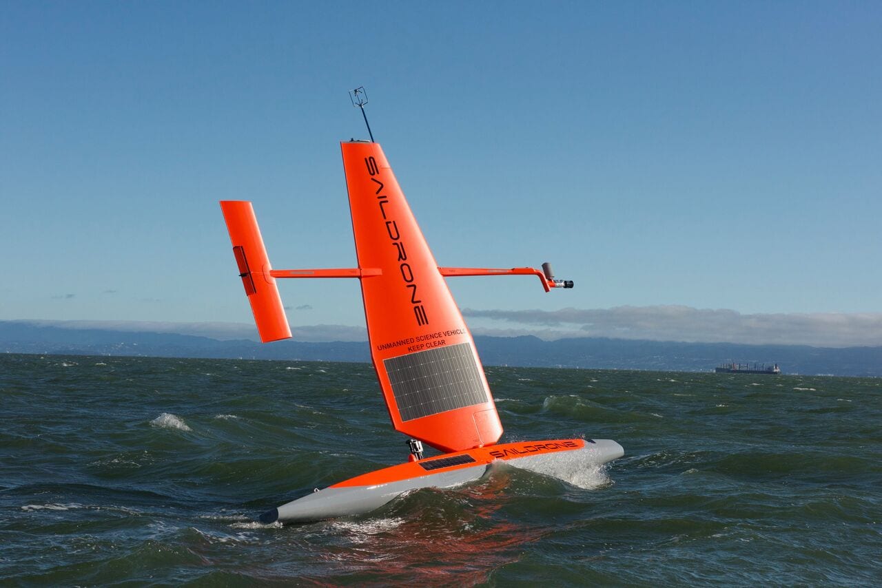
For 100 days, the Saildrones, which are powered by wind and solar power will also monitor weather conditions, water temperature, salinity, and carbon dioxide concentration. The data will then be transmitted to researchers.
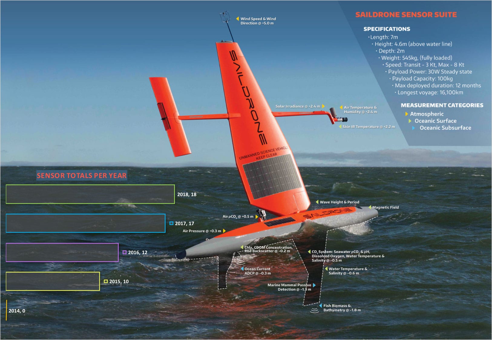
This infographic details the sensor capabilities of a saildrone. Since Saildrone Inc. and NOAA teamed up in 2014, new sensors have been added each year to collect a growing array of oceanographic, fisheries and meteorological data with a total of 18 sensors as of 2018. Download the Image to better read the text | University of Washington/NOAA
“This partnership is putting some of the most important new marine technology to work for the West Coast,” says Toby Garfield, who is Acting Deputy Director of NOAA Fisheries’ Southwest Fisheries Science Center, and part of the team managing the fifth Saildrone.
“The more complete and accurate data we have, the better decisions our fisheries managers can make in real terms of catch levels and seasons.”
During this mission, drones will observe the abundance of Pacific hake, a species managed jointly by the United States and Canada with a fixed percentage for fishermen on both sides of the border.
“All of this data will be integrated to better understand the distribution of fish,” says Stephane Gauthier, a Fisheries and Oceans Canada researcher.
He adds that seven-meter long drones also allow researchers to monitor areas that are difficult to access for long periods of time.
“We can deploy several at a time and they can monitor large areas for extended periods, which is not always possible for our research vessel,” he says. We can not be everywhere at once. ”
Saildrones are deployed around the world, including in Australia where they are being used to monitor the ocean and the effects of climate change.


