DroneDeploy Releases Intelligent Cloud Photogrammetry
![]() DroneDeploy, a drone software platform with the largest drone data repository in the world, today announced the release of Map Engine— the industry’s first machine learning-driven photogrammetry software. This release comes after a successful beta period where it processed 30K maps per month for more than 4,000 clients across 180 countries.
DroneDeploy, a drone software platform with the largest drone data repository in the world, today announced the release of Map Engine— the industry’s first machine learning-driven photogrammetry software. This release comes after a successful beta period where it processed 30K maps per month for more than 4,000 clients across 180 countries.
[bctt tweet=”“We have brought together the latest advances in cloud computing, computer vision, and machine learning to build a best-in-class photogrammetry pipeline that delivers accurate results in record time—no matter your workflow.” @dronedeploy” username=”dronebelow”]
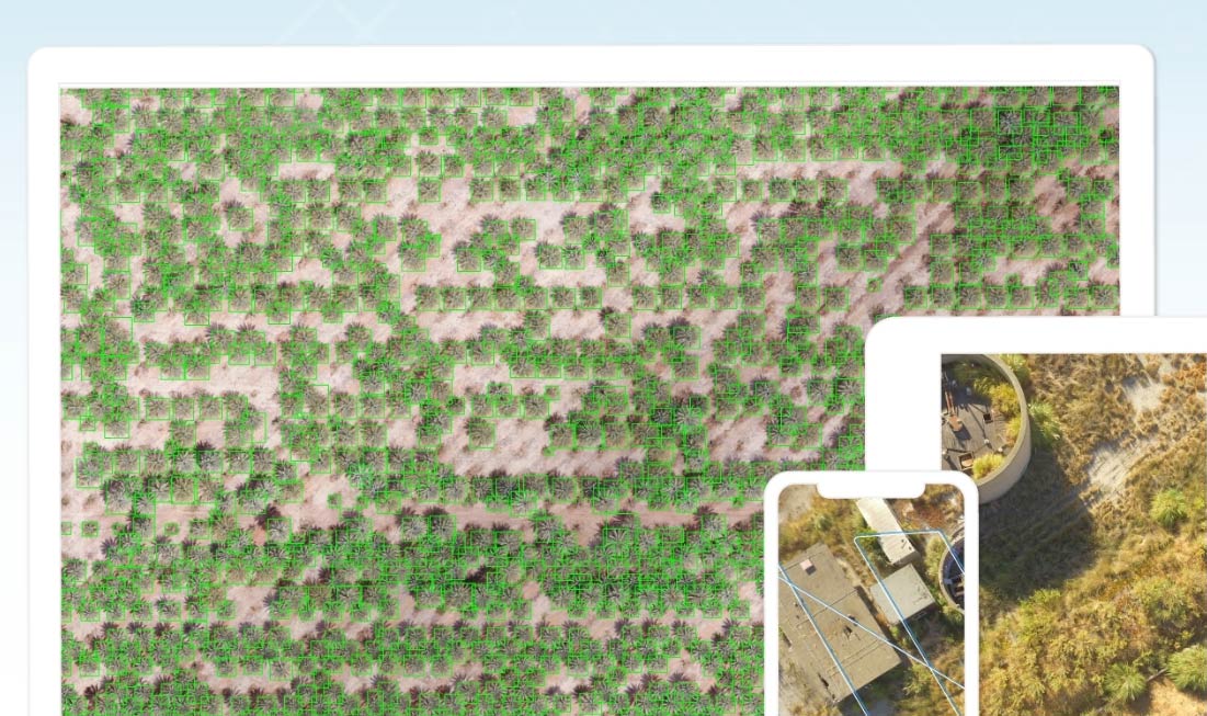
DroneDeploy’s Map Engine generates high-resolution maps and 3D models from drone imagery collected in the construction, energy, agriculture, and surveying sectors. The new processing engine leverages the latest cloud infrastructure and machine learning technology to deliver high-quality results and help customers reduce on-prem hardware and maintenance costs.
“Map Engine tracks billions of points in aerial images to simultaneously reconstruct 3D scenes and the trajectory of the drone,” said Nicholas Pilkington, DroneDeploy’s CTO. “We have brought together the latest advances in cloud computing, computer vision, and machine learning to build a best-in-class photogrammetry pipeline that delivers accurate results in record time—no matter your workflow.”
This release includes four major improvements over earlier beta versions:
1. Improved Speed: Map Engine now generates maps and models 30-50% faster. Scenes made up of hundreds of images can be processed in under an hour.
2. Improved Accuracy: Industry-specific accuracy improvements for Agriculture, Construction, and Solar generate higher-quality results.
3. Large Map Support: Maps of up to 10,000 images (100GB) can now be quickly and accurately processed (in beta).
4. Mobile Uploads: Customers can now wirelessly transfer images to the cloud with Mobile Uploads (in beta) for immediate processing.
The Map Engine codebase integration began two years ago with DroneDeploy’s acquisition of leading photogrammetry solution 3DN, which had already been in development for five years. Since launching in Beta last January, Map Engine has processed 100M gigapixels of drone imagery. Its machine learning capabilities enable customers to gather better data, drive faster insights, and automate time-consuming workflows—helping drones become an essential tool on every job site.
The next release of Map Engine is scheduled to be unveiled at DroneDeploy’s annual user conference on October 11th, 2018 in San Francisco. At that time, significant updates that integrate a broad set of AI tools into Map Engine will be announced.


