Airborne Response Teams with Edgybees and UgCS to Assist Hurricane Florence Response
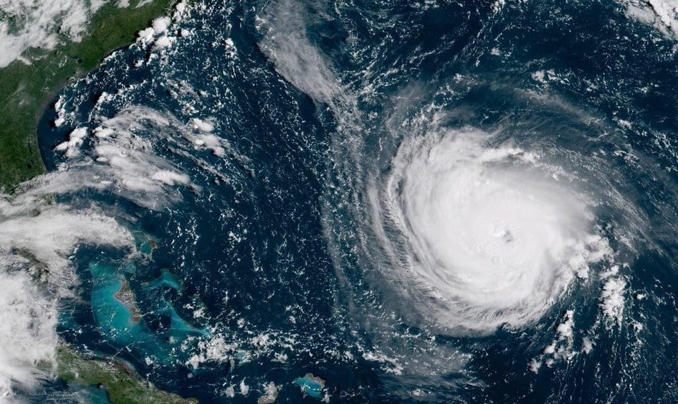
As potentially devasting major Hurricane Florence approaches the U.S. mid-Atlantic coast, UAS-based disaster response experts Airborne Response has partnered with Edgybees, the creators of Edgybees First Response Suite, and SPH Engineering, the developers of UcGS flight control software, to provide emergency personnel with cutting-edge aerial search and rescue (SAR) software for drone operations.
The combined team effort is designed to help first responders using unmanned aircraft systems conduct more effective SAR operations in areas devastated by wind, rain, and flooding from the storm. The Edgybees, UgCS and Airborne Response teams will work around the clock to help public safety remote pilots in the path of Hurricane Florence to activate the software and begin planning search and rescue operations that can be launched as soon as weather conditions allow.
“Edgybees First Response was specifically created to help remote pilots conduct effective search and rescue operations during a major disaster like Hurricane Florence,” says Christopher Todd, President, Airborne Response. “UgCS is the world’s premier flight control software which allows UAS operators to execute professional search patterns. Each of these tools can be extremely valuable to flight teams conducting SAR missions in the wake of the storm.”
Edgybees technology empowers first responders to understand any emergency operational scene instantly with real-time, collaborative visual intelligence technology. The software allows responders operating drones to easily decipher street names, general locations, and even house addresses through Edgybee’s augmented reality platform which overlays onto a video feed from a drone.
UgCS provides operators with a variety of quickly customizable, professional search patterns that can be easily deployed in for emergency flight operations. Based on the flight altitude input by the operator, the UgCS software will automatically calculate key variables such as the course heading and track spacing necessary to provide the prescribed coverage area for a search target.
“We’ve tested these systems and they works,” states Todd. “When effectively used, this technology can save the lives of victims who are in distress and need to be rescued.”
All three companies have committed to having support personnel accessible throughout the response phase of the storm to assist first responders with activating and using the software for flight operations.
“We will have subject matter experts standing by ready to assist any agency who needs support installing, activating, and using Edgybees and UgCS for their flight operations,” says Todd.
Accredited public safety agencies and other search and rescue organizations responding to Hurricane Florence can receive additional information and request software activation keys by visiting http://florence.
About Airborne Response
Based in Miami, Airborne Response provides unmanned systems experts to capture aerial imagery and data from the world’s most challenging environments. Airborne Response is developing the World’s Largest Air Force™ specializing in public safety, critical infrastructure, security, and disaster response UAS training and flight operations. Airborne Response personnel train and work alongside first responders and industrial subject matter experts both within the U.S. and internationally. For more information on Airborne Response, please visit: http://airborneresponse.com
About Edgybees
Edgybees is the leader in real-time visual intelligence technology, providing critical software that enables for the most accurate, collaborative virtual worlds of any complex environment. Its First Response (“FR”) C2 (command and control) system for professional drone users in emergency response organizations is currently operational in over 70 organizations in US, Australia, Europe and Israel. Founded in 2017 and headquartered in San Diego, Edgybees has raised $6.4M to date. For more information, visit: https://edgybees.com/
About SPH Engineering / UgCS
SPH Engineering offers unmanned systems integration services and software development. UgCS is a unified mission planner for all popular UAV platforms to plan and fly drone survey missions providing toolset for safe and efficient UAV land surveying and industrial inspections, e.g. custom elevation data import, Photogrammetry and Geotagging tools, LIDAR, Magnetometer and GPR linear and aerial survey planning tools with terrain following mode. UgCS Mapper – offline mapping tool to create high-quality 2D or 3D orthophoto maps with option to generate elevation models, enabling the stitched orthophoto maps to be automatically added as map overlays into UgCS. GPR-UAV-UgCS integrated solution – a GPR mounted on a drone enables to see through the surface of ground, ice, rocks, freshwater, and buildings or through structures at unsafe and hazardous environments without compromising the safety of staff. Drone Show Software is a complete solution to set up a drone swarm show. Discover: https://ugcs.com