News
Search and Rescue Under Forest Canopy Using Multiple Drones
Lost hikers in forests are always a challenge for the searchers. In times when helicopters cannot get through forests and woods due to the thick tree canopy, researchers have started using autonomous drones which can bob and weave through trees and aid these searchers.
The only challenge, however, is that the GPS signals used to guide the aircraft can be unreliable or nonexistent in forest environments. In a paper that’s soon to be presented at the International Symposium on Experimental Robotics conference, a group of MIT researchers describe an autonomous system for a fleet of drones to collaboratively search under dense forest canopies – where the drones would use only onboard computation and wireless communication – no GPS required.
Using Laser-Range Finders for Position Estimation
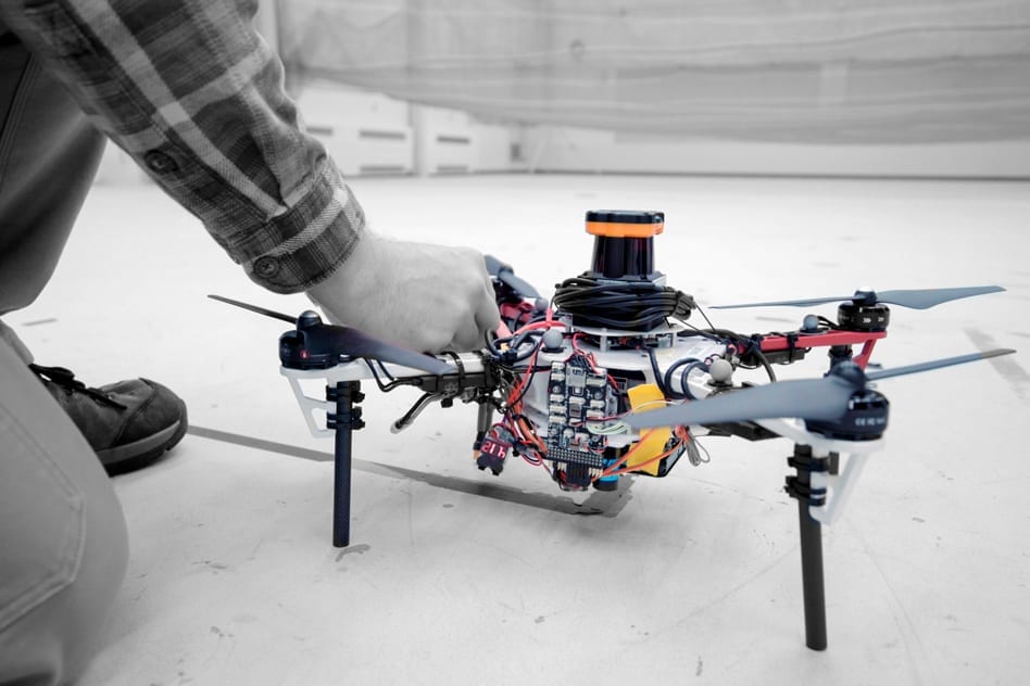
Each quadrotor drone is equipped with laser-range finders for position estimation, localization as well as path planning. As the drones fly around, they create an individual 3D map of the terrain, recognized by algorithms as unexplored and already-searched spots, so that the drone knows when it has fully mapped an area.
In a real-world implementation, however, drones would come equipped with object detection in order to identify missing hikers. They would tag the hiker’s location on the global map – and humans could later use this information to plan a rescue mission.
As the first author of this paper says, the goal is to “replace humans with a feet of drones to make the search part of the search-and-rescue process more efficient.”
After testing multiple drones in various simulations of randomly generated forests, the researchers also tested drones in a forested area within NASA’s Langley Research Center. In both of the sets of experiments, each drone mapped a roughly 20-square meter areas in about 2-5 minutes and fused the maps together in real time. The fleet of drones also performed well against a set of metrics such as overall speed and time to complete missions, detection of forest features and accurate merging of maps.
Exploring, Mapping and Seeing the Final Results
When it came down to the actual exploring and mapping, the researchers mounted LIDAR systems on each drone, creating a 2-D scan of the surrounding obstacles by shooting laser beams and measuring the reflected pulses. This, according to them, was the perfect way to detect trees.
The end result came in the form of a map with 3D terrain features, where trees appear as blocks of colored shades (blue and green) and are easily transmitted. The unexplored areas are dark but turn to gray as they are mapped by drones.
To sum things up, the researchers compared their model with a traditional method, finding that their research could significantly cover more area in a faster way and with higher average speeds.


