News
Remote Sensing in Humanitarian Logistics – Satellites, Airplanes and Drones
Remote Sensing in Humanitarian Logistics – Satellites, Airplanes and Drones
In disaster situations, whether natural or man-made, logistics are crucial for rescue operations and preventative measures. Effective humanitarian operations require information and data acquisition, each of which are key factors in determining their success. Information management, however, is largely under-researched, acting as a computational bottleneck for humanitarian logistics. Rapid acquisition of profound data is augmented by the usage of remote sensing technologies such as satellites, aircrafts and small drones – depending on the scope and field of usage.
Since a lot of research work has been done regarding each individual remote sensing technology, there is a scarcity of research work linking different platforms. This problem was identified, highlighted and addressed by a research article published in the Proceedings of the Hamburg International Conference of Logistics (HICL). The article is titled, ‘Remote Sensing in Humanitarian Logistics – An Integrative Approach‘, aims to combine different technologies.
Comparison of Different Remote Sensing Platforms
Different remote sensing platforms are to be compared considering numerous aspects and criteria.
Airborne and drone platforms have significantly higher spatial resolutions as compared with satellite images, even though the spatial resolution of satellite images has increased in recent years.
Airborne platforms and drones may have the ability to acquire oblique images of an area under observation. Oblique imagery can allow more specific processing and analysis methods.
Moreover, drones can be applied for ad hoc, quick response assessments with live broadcasts in a 360° angle and their susceptibility to cloudy weather situations is lower. The higher spatial resolution and accuracy of airborne and drone platforms result from the fact that their flying altitude is significantly lower, particularly those of small drones.
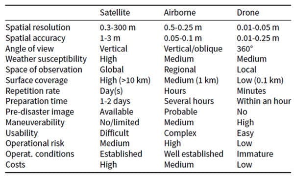
As one would expect, the observed space and the resulting surface coverage is substantially lower as well. Here, satellites make use of their inherent advantages.
Contrarily, satellites are restricted by their predefined orbit and speed, which consequently limits their repetition rate and their preparation time compared to other platforms.
The periodic flight path of satellites might be a disadvantage regarding their flexibility; however, it enables the availability of pre-disaster images, which is beneficial for comparison reasons and necessary for specific map analysis methods.
Advantages of drones arise from their high flexibility; they are rapidly deployable and their application can be adjusted to the operations’ requirements easily. Note that drones are only rapidly deployed if they are already on site. Otherwise, the transportation to the disaster scene can restrict their short preparation time. Furthermore, the complexity of use as well as the operational risk is lower for drones than for the other platforms, whereas skilled personnel is generally required for remote sensing applications.
However, whereas the deployment of satellite technology and airborne platforms has been established in the humanitarian context, the use of drones implies several legal and ethical issues.
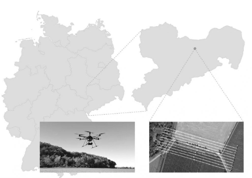
Test flight area and drone (own figure)
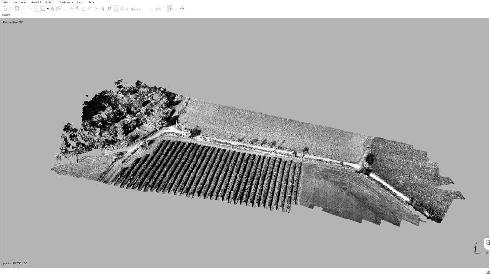
Thick point cloud generated by Agisoft Photoscan (screenshot)
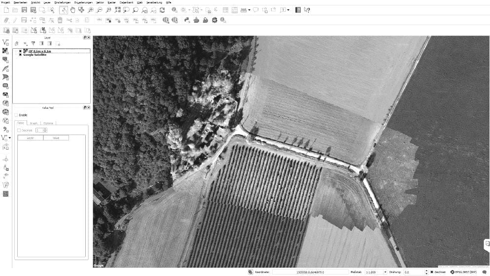
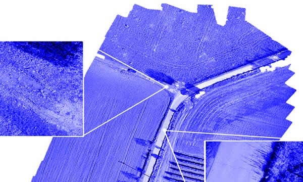
QGIS with Google layer and orthoimage, 0.1 x 0.1m (screenshot)
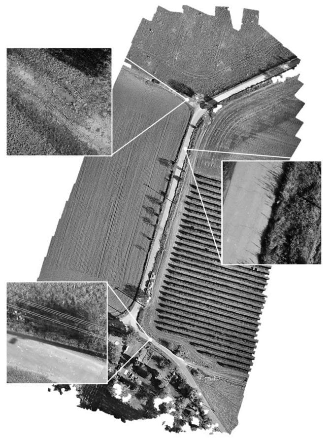
Orthoimage (40 m, 1 cm2/Px) (own figure)
Integration of Remote Sensing Platforms
The researchers aimed to integrate different platforms by developing models for data acquisition and processing systems and integrating them into a GIS using an open-source software, QGIS. The software allows recording, manipulation, management, and presentation of spatial data. A GIS enables the combination of different remote sensing data, such as satellite or airborne images, as well as geographical maps. The authors experimented with different platforms to test their in the case of which, freely available Google Maps layer and the orthoimage were imported.
By experimenting with two drones and comparing their obtained results in real time with the data obtained from satellites, the authors were able to relate the data obtained from different platforms. Quoted, “As a result of the two drone test flights and the subsequent processing of the acquired remote sensing data, orthoimages and DEMs with a resolution of up 1 cm2/Px could be generated. The quality of geo-referencing can also be stated as high-grade, as their deviation is less than 20 cm (absolute) and the total computing time was between 107 and 165 min.”
Conclusion
- Each remote sensing platform has its own particular advantages as well as limitations as compared with other such platforms.
- It is therefore beneficial to benefit from the advantages of individual remote sensing platforms and account for the limitations of each platform with other platforms by integrating different platforms within the same operational system.
- Based on experiments that instead of collecting data from a single platform, collect data from different platforms and integrate this data to refine it in order to achieve better resolution and quality, integration of different remote sensing platforms is feasible and effective.
Citation: Remote sensing in humanitarian logistics : an integrative approach, Christian Hein and Henning Hünemohr and Rainer Lasch, Proceedings of the Hamburg International Conference of Logistics (HICL) – DOI:10.15480/882.1793 – http://tubdok.tub.tuhh.de/handle/11420/1796


