News
Counting Hippos with Drones
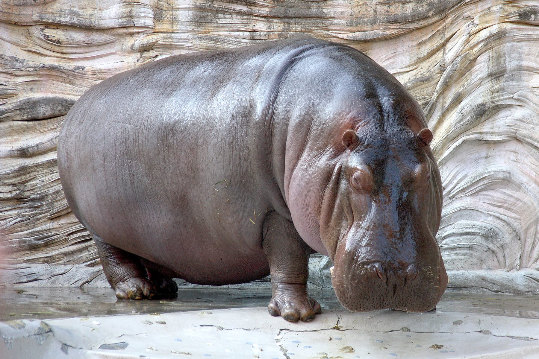
The hippopotamus is a vulnerable species that is difficult to monitor – especially when it comes to its general population for conservation purposes.
Thanks to the rapid evolution of consumer drones, survey protocols for the monitoring of wild animals are continuously being developed. A proof for this development is a new study which aims to determine the optimal flight parameters for accurate population estimates. Aside from this, the study aims to also evaluate the effects of three major environmental factors: wind speed, sun reflection and cloud cover.
A group of authors and prominent researchers in the field begin their paper by estimating the population of the two main hippo schools (Dungu and Wilibadi II) that are located in Garamba National Park in the Democratic Republic of Congo. With eight observers present, the researchers took 252 photos over the Dungu school, representing a total of 2016 experimental units.
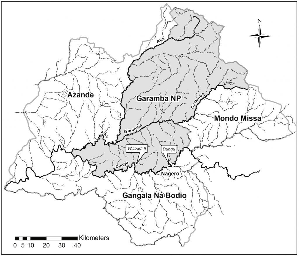
Map of Garamba National Park (DRC). The two study sites, Dungu and Wilibadi II hippo schools, are located in the southern area.
“A detection rate and a level of certainty were associated with each experimental unit, and five parameters were related to each count: flight height, three environmental parameters (sun reflection on water surface, cloud cover, and wind speed), and observers’ experience,” they noted.
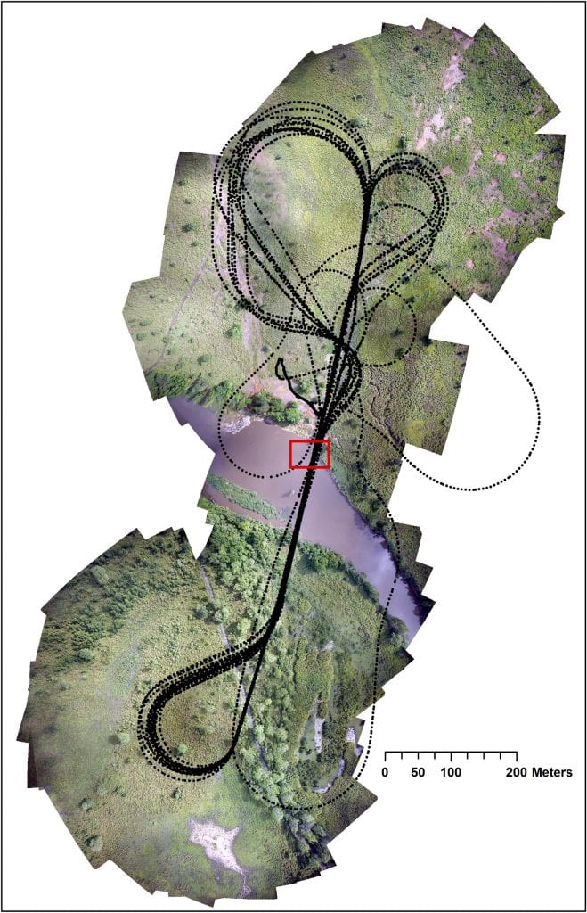
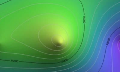
Flight plan tracking over the hippo school of Dungu. Black dots represent GPS points taken constantly during the flight and the red rectangle shows the location of the hippo
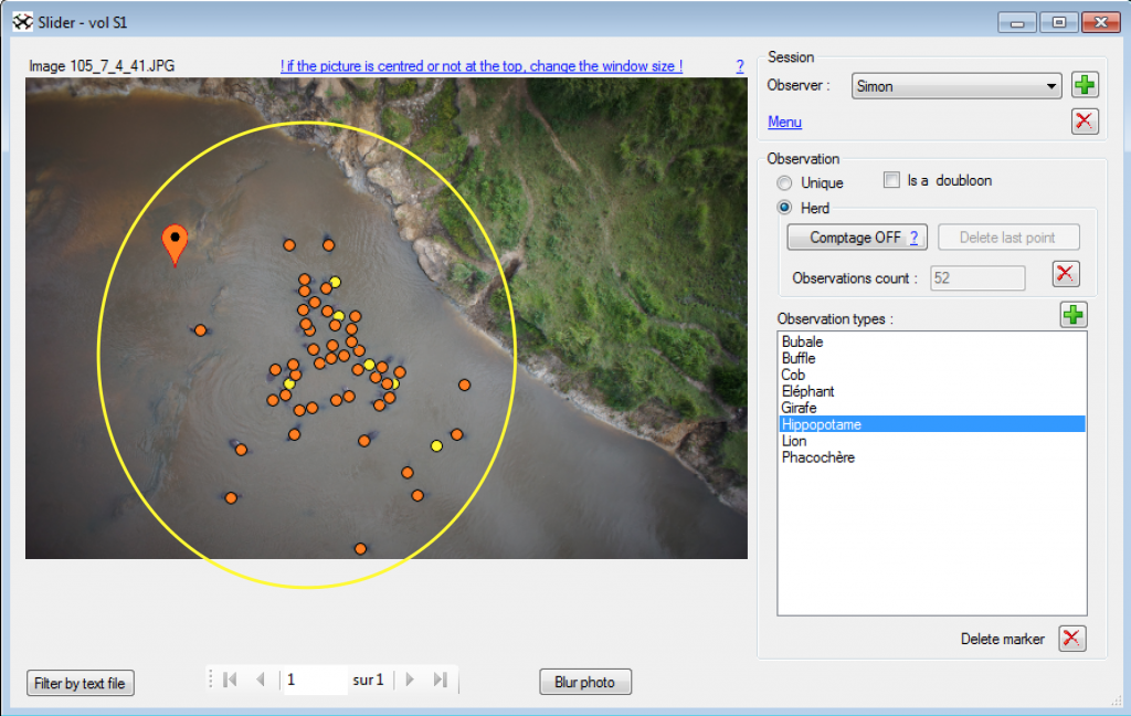
Interface of WiMUAS used to review the photos and detect animals. Orange points mark definite observations and yellow points possible identification. The yellow circle represents the area within which observers had to make their observations. The photo in this example was taken at the height of 41 m at 08:01. The environmental parameters recorded for this picture are cloud cover 1, sun reflection 0 and a wind speed of 3 m.s-1.
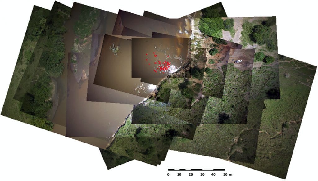
Overlap of 15 geo-referenced images. Red dots are the detected hippopotamuses recorded in the vector layer.
From lake shores to drawdown zones of reservoirs and riverbanks, the researchers follow different areas when tracking hippos as endangered species. The efficiency is in these cases an important source of bias which leads to underestimates – especially when hippos live in large groups.
At the same time, it is difficult to monitor a group of hippos and the lack of precision is crucial here – especially when there are groups present and there are visibility constraints (which make it hard to count how many hippos are involved). Therefore, the methods used in this study produced variable results.
Taking All Of The Factors Into Account
As the results show, the flight height reduced the observers’ confidence in their detection ability – rather than the detection itself. For accurate counts of large groups, an average height of 150 meters was shown to be the ideal compromise between animal detection without zooming in as well as the area that is covered in one frame.
However, the researchers have also taken wind speed and sun reflection in account. As they noted in their results:
“Wind speed had little influence on the counts, but it affected the performance of the UAS. Sun reflection reduced the detection rate of hippos and increased level of certainty, while cloud cover reduced detection rates slightly. Therefore, we recommend flying when the sun is still low on the horizon and when there is little cloud, or when cloud cover is light and even. This last point reinforces our recommendation for flights early in the day.”
The counts also showed major differences between groups of inexperienced and experienced observers. For example, the experienced ones in the study achieved better detection rates and were generally more confident in their detection. They managed to detect 86.5% of the hippos on average – compared to the lesser percentage in the inexperienced examiners.
An Appropriate Method For Tracking Hippos
What’s safe to conclude is the fact that this observation method was found as appropriate for use by experienced observers. With that, the results show that hippo surveys, regardless of the study site, are perfect for counting these endangered species and tracking their existence.
“These results confirm the use of correction factor 2 for hippo surveys, regardless of the study site, as it accounts for hippo behavior. Optimum counting and cost efficiency were achieved with two trained observers counting 7 pictures.”
Final Words
As we can see from what’s stated above, this study is ideal as an approach for routine surveys of the hippopotamus which is a species that is usually ignored in wildlife counts. Thanks to drone technology, however, it can be rapidly improved and unmanned aerial systems (UAS) can become a very useful way to track and monitor the activities of other endangered species as well.
Citation: UAS imagery reveals new survey opportunities for counting hippos, Julie Linchant, Simon Lhoest, Samuel Quevauvillers, Philippe Lejeune, Cédric Vermeulen, Jean Semeki Ngabinzeke, Basile Luse Belanganayi, Willy Delvingt, Philippe Bouché. PLOS, Published: November 14, 2018, https://doi.org/10.1371/journal.pone.0206413