News
Remote Tourism with Drones
Tourism is a booming industry which contributes to the economic progress of towns and villages, and promotes the heritage and the history of communities. Tourism has taken on different forms over the centuries and in recent decades, the need to explore remote areas have led to the adoption of several forms of remote heritage exploration, usually through the use of multimedia such as audio video and images exploration.
Most forms of remote video tourism are either provided pre-recorded (i.e. where the video is captured offline, stored and then made available on a platform usually through social media) or live
(where the video is delivered to users in real-time as events unfold).
The emergence of digital technologies, multimedia and social media platforms have given this mode of exploration new light, as users can now immerse themselves in far-away lands through the use of virtual reality and 360 degree media. Facebook and YouTube platforms now support streaming live 360 degree images and videos – also known as photospheres and videospheres respectively – which place the user at the centre of the action.
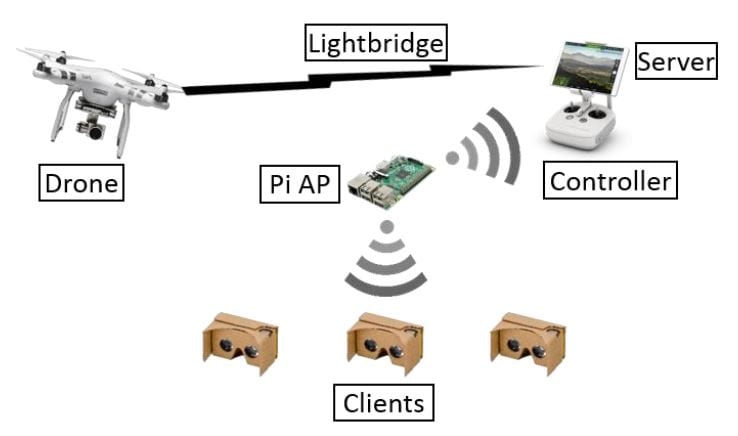
“Aerial Virtual Reality: Remote Tourism with Drones“, a submitted manuscript published on IED by researchers from University of St Andrews, UK, proposes a portable system for group-based exploration of remote landscapes in real-time with the use of a drone, a Raspberry Pi controller and an android server.
The primary purpose of this portable system is to allow tourists or users to experience landscapes, buildings and different views from different angles and different lines of sight without having to go through the strenuous task of professionally recording and studying what they wanted to see. The better view of different sites offered to a group of tourists was supposed to sound as organic or natural and possible so as to heighten the experience of the tourists.

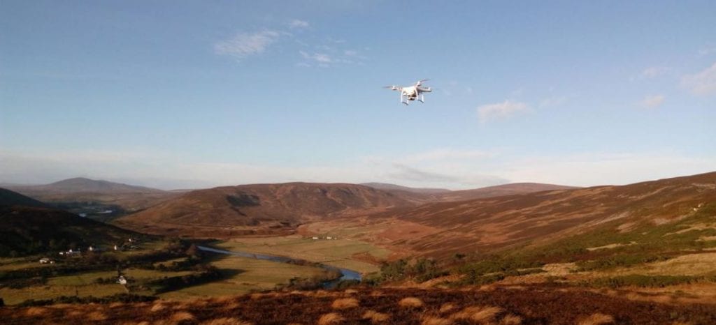
DJI Phantom 3 Advanced flown over the Strath of Kildonan
Equipment used:
- DJI Phantom 3 Advanced drone
While the researchers also tested the DJI Inspire 1 drone, they decided to use Phantom 3 due to its specifications that fit perfectly well for the desired usage as the camera installed on the drone can record 1280×720 pixels at 30 frames per seconds and the battery that powers the drone has enough capacity to return a flight time of as much as 23 minutes, which is quite some flight time for a small drone. - Wireless Infrastructure
Raspberry Pi microcontrollers are very popular amongst users and programmers from all sectors which adds to its commercial availability and ease of usage. A Raspberry Pi 3 Model B running hostpad (Host access point daemon) was used to create an access point which the server and clients connect to. Since the Raspberry Pi module does not require much power or voltage for its operation, it can be powered completely with just a power bank, which is what the researchers used to power the microcontroller. - Server
The server used for the testing was a simple android smartphone application. The server app implements a callback method which receives chunks of the raw video from the drone source and sends the chunks as datagram packets to the subscribing clients over the wireless network. - Client
Just like the server, the client was also developed as an android application. It receives chunks of the raw video from the server and parses the raw video in real-time using ffmpeg, an open-source, multimedia framework – the collected video is rendered to be displayed on the Virtual Reality setup used by the client, which is what the user looks at or experiences.

System architecture

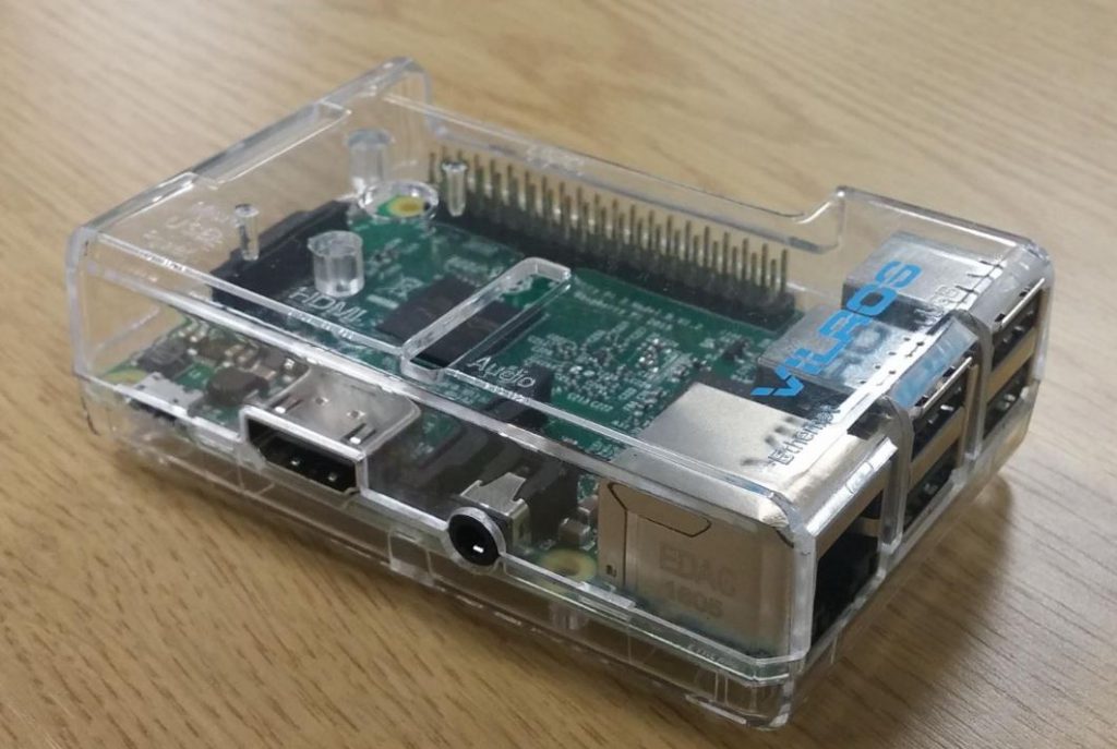
Raspberry Pi in a transparent plastic case
Field Testing
The researchers observed the public response to this technology by testing their designed system with volunteers at a local park. The drone was flown over the local landscape in a slow, circular motion so as to observe the iconic parts of the community. While the drone was being flown, pairs of participants used the virtual reality headsets to receive the drone footage, where one person actively controlled the gimbal while the other passively received the drone footage. The control switched between the pair every minute, so that the active client became passive and the passive client became active. Each pair had 5 to 10 minutes to see the landscape using the headsets, after which they passed on the headsets to the next pair.
Results
The participants, for the most part, showed a positive response to the setup they used.
“it was awesome because you get to see the town from different heights, angles and sides”
“it lets you see the world from a different perspective”
“…you would not see stuff like that when you are on the ground”
The users primarily confirmed the success of the objective of the developed product – a heightened experience and a much better view of a landscape or a building.
Citation: Aerial Virtual Reality: Remote Tourism with Drones, A. Fabola, A. Miller and I. Duncan, https://elk.adalidda.com/2018/11/Aerial-Virtual-Reality.pdf


