News
FAA and Kittyhawk Update B4UFLY Mobile App
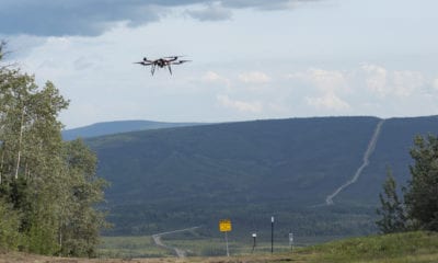
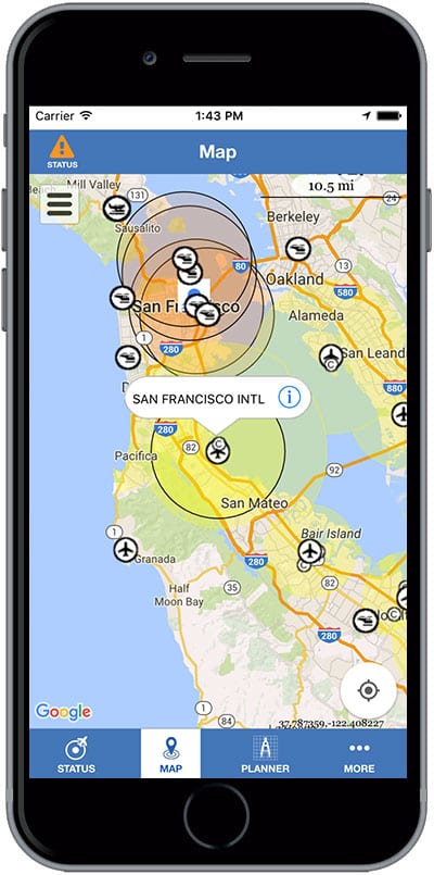
Drones in action, be they involved in search and rescue operations or purely for recreation are a common sight in the skies these days. In an attempt to help amateur drone enthusiasts identify no fly zones the Federal Aviation Administration (FAA) has launched a newer version of its first mobile app designed to let recreational drone pilots know where they should and should not fly. B4UFLY is the name given to the redeveloped app for which FAA partnered with Kittyhawk.
The current B4UFLY has red, orange, or yellow color-coded light status indicator to restrictions on drone flight in any area. While B4UFLY will continue to be available to the public until the new app is deployed the data reflected in the current app will continue to be updated regularly, but no new features will be added to it.
With focus on user experience Kittyhawk will use their recently released Dynamic Airspace product to power the new and improved B4UFLY mobile app.
While operating drones in controlled airspace near airports commercial drone pilots use the FAA’s Low Altitude Authorization and Notification Capability (LAANC) to obtain instant airspace authorization.
Considering with the requirements established in the FAA Reauthorization Act of 2018, the FAA might allow B4UFLY updated with LAANC capabilities for recreational drone pilots. Since recreational do not have to request permission for flying in controlled airspace, they don’t use LAANC.
Until recently recreational drone pilots weren’t required to notify the airport operator and air traffic control tower if their drone flying was within five miles of an airport.
However, In Sec. 349 of the Reauthorization Act, a new precedent is set for recreational operators, requiring them to obtain prior authorization from the Administrator or designee before operating in controlled airspace. As the FAA works on implementing the provisions of the Act and updates the B4UFLY app, it is likely that recreational drone pilots will be required to use LAANC like commercial operators.
The FAA is known to have collaborated with private-sector companies in the past for initiatives to improve the navigability and safety of the national airspace. Dan Elwell, Acting FAA Administrator was quoted saying- ‘As drone sales increase and our nation’s airspace becomes busier and more complex, it’s vital that we work smarter and partner with the private sector to develop innovative products that advance safety.’
Kittyhawk is an enterprise drone operations software company that has been an FAA LAANC UAS Service Supplier since October 2018. Being an official LAANC UAS Service Supplier, Kittyhawk sources airspace data from the FAA directly and thus provides up-to-date and accurate airspace data, that helps vastly improve the flying experiences of all kinds of operators.
Joshua Ziering, Founder of Kittyhawk said, “We believe that Kittyhawk needs to be building our industry alongside of our company. Our goal is for our enterprise customers to be flying as much as possible. Flights don’t happen easier or more frequently when negligent operators are shutting down airports, breaching Presidential TFR’s, or endangering our national security.”
Download the current B4UFLY from the App Store for iOS and Google Play store for Android.