News
Drones Map Radiation in Chernobyl Exclusion Zone
Drones and Artificial Intelligence (AI) combined have yet again emerged as the perfect solution for reconnaissance and data gathering over the inaccessible and hazardous Chernobyl’s “Red Forest” – one of the most radioactive locations on Earth which has just been surveyed by UK scientists using a suite of drones.
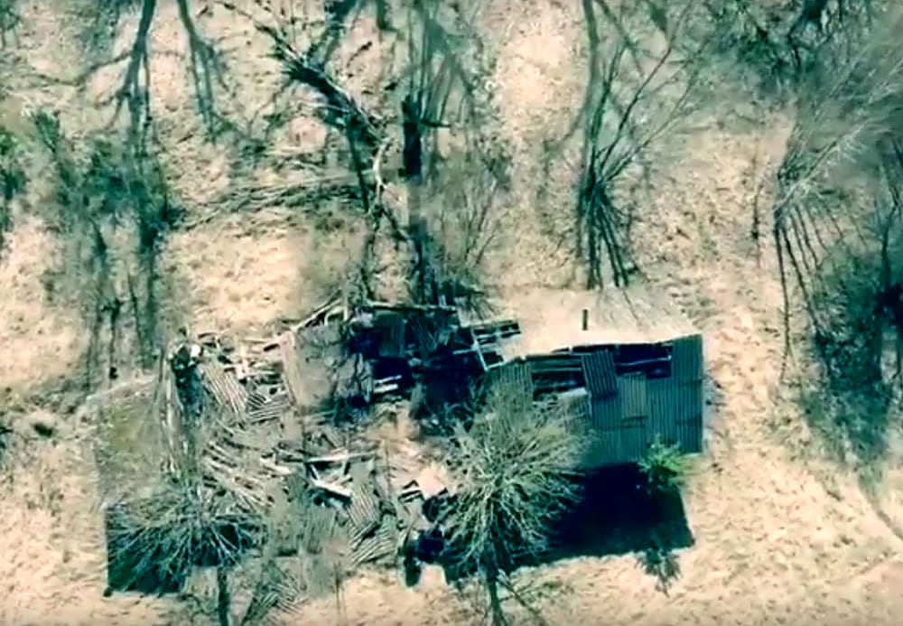
The Red Forest merely 500m from the Chernobyl nuclear complex was affected in the immediate fallout from the 1986 explosion and fire in the plant’s number-4 flawed reactor . The novel sensors equipped robotic aircraft flew over the Red forest giving up-to-date information on the sites with the greatest contamination. Some areas are still strictly out of bounds to humans.
The UK’s National Centre for Nuclear Robotics (NCNR) has developed a drone-mapping system that allows scientists to investigate hazardous places from a safe distance. The NCNR is a nationwide consortium of research experts tasked with developing the next generation of technologies that can be used to clean up Britain’s 4.9-million tonnes of legacy nuclear waste.
A general radiation map is created by using data from fixed-wing craft flown in a grid pattern at approximately 40mph (65km/h) at treetop level.
A follow up is then carried out by with rotary-wing drones which can hover and use their sensors to acquire high-resolution, 3D information. The drones also identified a few unexpected hotspots.
Prof Tom Scott, from Bristol University and co-director of the NCNR, told BBC News, “They were trying to separate out the contamination and thereby reduce the volume of the waste, “adding, “The legacy left at that facility is essentially spent nuclear fuel scattered on the floor, which was giving a very high radiation dose -about 1.2 millisieverts an hour.”
The NCNR team plans more surveys in the coming months of additional areas in Chernobyl’s 2,600km² Exclusion Zone, which has been permitting more people entry over time.
Some 70,000 tourists have already visited the zone last year and plans are to use large areas of land deemed now to be low risk for solar generation.
The British mapping exercise will help refine the protocols used to ensure the safety of all entrants to the exclusion zone. Specialists in robotics, artificial intelligence (AI)/machine learning, sensors, electronics and materials are working across eight institutes, centred on a hub at the University of Birmingham with the goal of using autonomous robots to efficiently and safely curate the waste.
These tools are far more advanced than the systems people will know from car assembly lines, said Prof Rustam Stolkin from the University of Birmingham. “These robots are completely autonomous; they use robotic vision systems; they see objects and understand their position, their size and their shape and can clear a random, cluttered heap of objects with no prior knowledge of those objects. This is the frontier of international robotics and AI research.”
The NCNR’s drone system is already being tested for mineral prospecting. Prof Scott said, “The drones fly at a height which means they’re much more sensitive than if you fly in a helicopter or an aeroplane,” With such accuracy and reduced risk factor the NCNR drone technology will definitely serve as an important tool for research.


