News
Scientists Develop Drone Tech to Study San Francisco Bay
Environmental scientists can estimate the health of rivers, bays, wetlands and other waterways by studying the flow of sediments suspended in the water, and from the mud that forms when these sediments settle to the bottom. Drones are now enabling this study.
Measurements of suspended sediment concentrations of waterways reveal a lot. Suspended sediments can trap toxic pollutants and prevent the formation of fish-killing red-tides, explains Oliver Fringer, professor of civil and environmental engineering at Stanford. Measuring and predicting how sediment flows form mud will help reveal how waterways will respond to rising sea levels and climate change. But until now, studying sediment flows — also known as measuring turbidity — has been slow, imprecise and labor-intensive, hampering efforts to better understand the health of waterways.
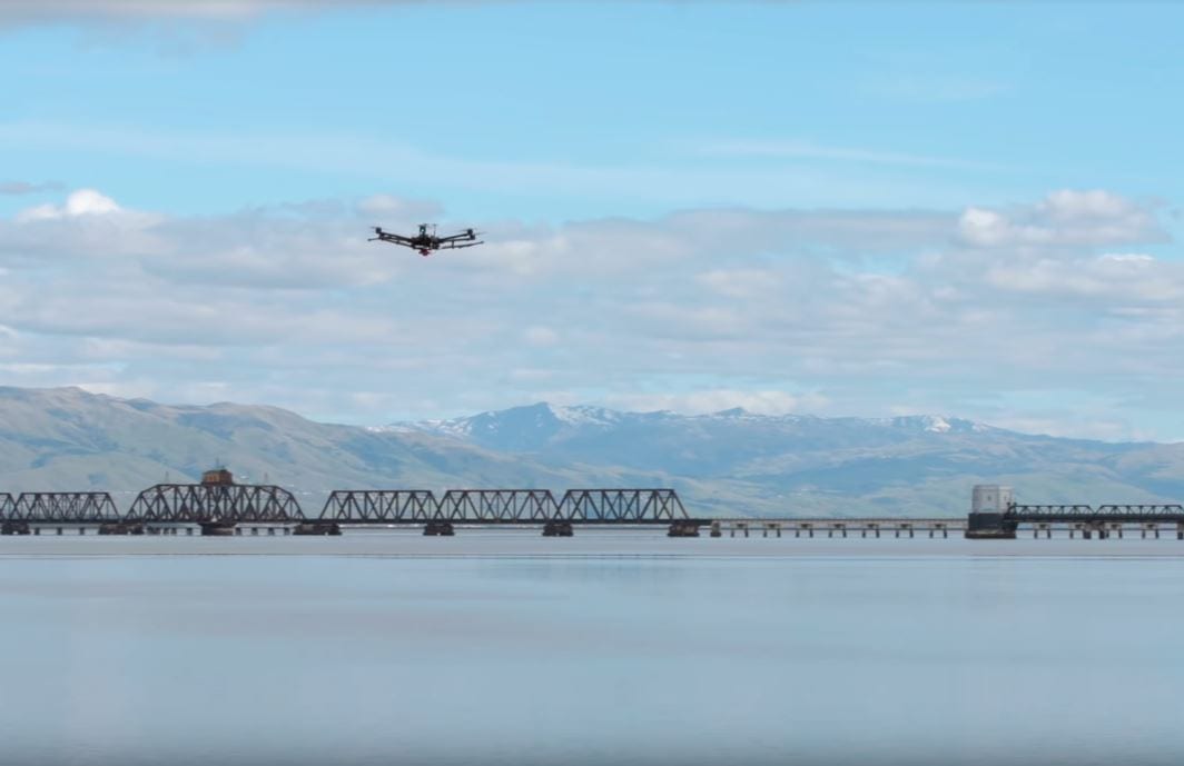
Fringer hopes to develop a specially instrumented aerial drone to measure sediment flows in San Francisco Bay. Measuring 4 feet in diameter, the drone flies over 100 feet above the water. Its camera is calibrated to pick up very specific wavelengths of light. Certain wavelengths near the infrared band of the spectrum correspond to the sediment. Other colors correspond to the chlorophyll and to the organic nutrients that feed algae. The drone can revisit a location as many times as necessary, clicking high-resolution photos at the pace of one per second, painting a detailed picture of turbidity.
Currently Researchers lower a Secchi disk of alternating black-and-white quadrants into the water to observe at what depth it becomes too murky for the disk to be seen. This might provide good information about a particular spot, but is ambiguous about the dynamics of a broader area. Some scientists try to cover more area by dragging sophisticated sensors from boats that move back and forth across the water. But boats can’t operate in shallow areas and are costly to operate, making it difficult to measure turbidity changes over time. Satellites are also being used to cover large areas, but they collect relatively low-resolution data and only pass a spot once every few days. The drone, Fringer says, offers a cost-effective, high-resolution alternative.
The new system was designed by Joe Adelson, a PhD candidate in civil and environmental engineering, whose collaborators include CEE undergraduate student Sienna White. Fringer oversaw the project under the auspices of Stanford’s Bob and Norma Street Environmental Fluid Mechanics Laboratory. According to Fringer measuring the turbidity of San Francisco Bay using drones will enable collecting granular information about other bays, wetlands and waterways. “Any large river flowing through populated areas, like the Mekong in Vietnam or the Mississippi, has problems with muddy sediments and red tides at its mouth,” Fringer says.
Giving environmental scientists a way to collect more data on turbidity will help in developing computer models for forecasting sediment flows in different parts of a waterway, a process almost as complex as making localized weather predictions. This research received seed grant funding from the Stanford Woods Institute for the Environment’s Environmental Venture Projects program.