News
Rocketmine Partners with UNICEF in Malawi’s Unique Drone Corridor
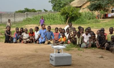
Rocketmine has been appointed the survey & mapping partner for the United Nations Children’s Fund (UNICEF), in its Drones For Good project, in Malawi. Rocketmine has been commissioned to fly over 21,000ha per month, across the country, to assist in UNICEF’s efforts to identify high-risk flood areas. The project has been awarded at a maximum contract value of USD$330,000.
Adverse weather conditions, such as flooding from heavy rains, create logistical hurdles and delay the delivery of lifesaving humanitarian aid in Malawi. Exacerbated by a HIV pandemic within the country, these delays result in mothers waiting up to two months to establish the HIV status of their babies. This in turn causes interruptions to treatment for those that may test positive – as a result, half of all babies born HIV-positive, in Malawi, die before the age of two.
Rocketmine aims to effect change by assisting the disaster management aspect of the UNICEF project. Rocketmine’s drone data solutions will be utilised for mapping, situational awareness and risk- informed programming within Malawi.
This project is an addition to the humanitarian drone corridor, launched by UNICEF in July 2017, in collaboration with Malawi’s Civil Aviation Authority (CAA). It is lauded as the fastest way to meet safety requirements for manufacturers and operators to test long-range drones, in curbing the logistical issues inherent in Malawi.
Rocketmine’s managing director, Chris Clark, shared his sentiments, “We are honoured to be part of this ground-breaking UNICEF project. It’s not every day a company like ours gets called to provide drone data solutions that will assist in solving critical humanitarian issues and potentially save lives.”
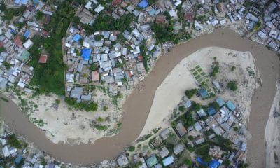
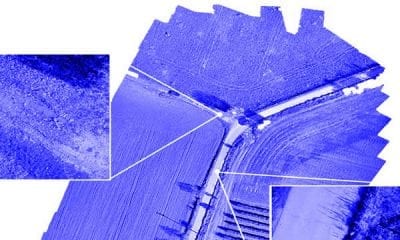
Rocketmine will create large scale detailed preparedness maps which will accurately depict the terrain before a disaster event. This will enable teams to compare these maps to images taken before and after a disaster in order to quickly identify problem areas and effectively facilitate remedial action. Sophisticated flood modelling and aerial images of wells and water sources will form elements of the preparedness plan.
“The sky is the limit when it comes to playing our part on this UNICEF project.”- Chris Clark
“This humanitarian drone testing corridor can significantly improve our efficiency and ability to deliver services to the world’s most vulnerable children,” said UNICEF Office of Global Innovation Principal Adviser Christopher Fabian.
The Humanitarian UAV Testing Corridor will facilitate testing in three main areas:
- Imagery – generating and analyzing aerial images for development and during humanitarian crises, including for situation monitoring in floods and earthquakes;
- Connectivity – exploring the possibility for UAVs to extend Wi-Fi or cellphone signals across difficult terrain, particularly in emergencies;
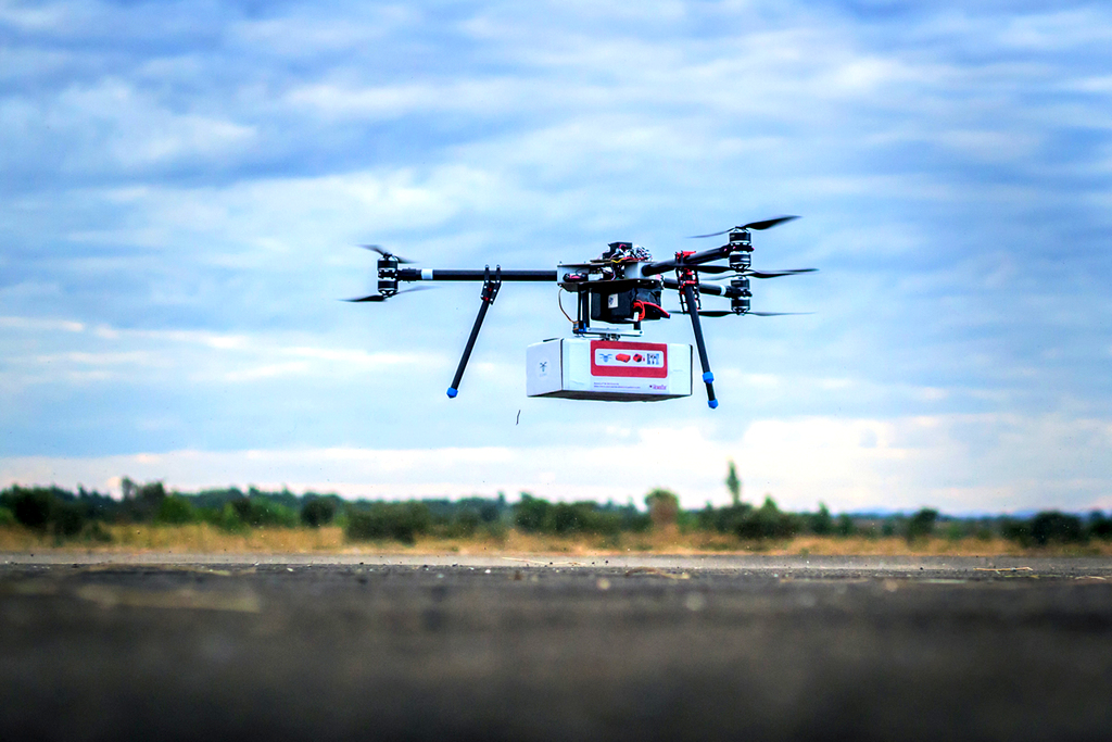
- Transport – delivery of small low weight supplies such as emergency medical supplies, vaccines, and samples for laboratory diagnosis, including for HIV testing.
The Testing Corridor
The air corridor details were determined in consultation with the Malawi Department of Civil Aviation and in line with the government’s new regulatory framework. Specifications include:
- Maximum distance of 80km (to efficiently test transport drones)
- Altitude limit at 400 metres above ground
- The UAS corridor will run for 1-2 years.
All UAV projects tested in the corridor will have to abide by the UNICEF innovation principles – meaning open source, open data, sharable, designed for scale.