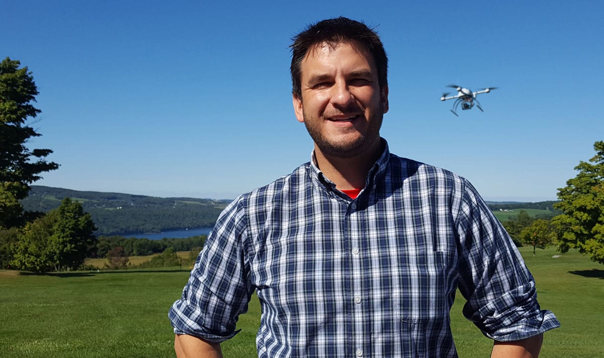
An Interview with Mike Dziok, Marketing Director at Microdrones
Mike Dziok, Marketing Director for Microdrones has more than 20 years of experience in management, marketing, communications and dealer development. His work spans a range of technology industries including media, HVAC, and, now, unmanned aerial vehicles for geospatial applications.
Dziok explains, “I’ve always thrived on helping to take abstract ideas from concept to completion. Microdrones is a dream job for me in that I’m working alongside brilliant people who are creating an industry. The marketing role in this type of business is heavily dependent on content… being able to articulate the benefits, value and efficiency of new technology while encouraging users to adopt it. Every day is an adventure.”
Can you tell us about the history of Flyterra and Microdrones?
After years of aviation industry experience, Vivien Heriard-Dubreuil, President of Microdrones, saw the future opportunity for commercial drones and professional mapping applications. In early 2013, he acted on those insights and moved to the United States to start a drone services company in North America. Flyterra was born in Canada, where, at the time, regulations were more favorable for using drones for commercial applications.
Meanwhile in Germany, another innovator had been developing what would become the backbone of our integrated solutions: the Microdrones unmanned aerial vehicle. To produce complete, application-specific solutions, you need extraordinary aircraft combined with perfectly integrated sensor payloads, as well as workflow and software that helps professionals procure actionable data.
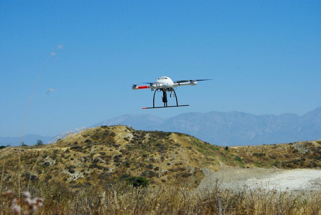
After researching many manufacturers, Vivien and his team determined that Microdrones was the clear choice. That’s because Microdrones has always built easy to deploy VTOL aircraft (vertical take-off and landing) that are resilient, durable, and able to withstand heat, cold, dust and dampness. With carbon fiber construction, low rpm motors, long battery life and a proprietary auto pilot system, the Microdrones platform is perfectly suited to withstand the rigors of daily commercial field use.
A Microdrones UAV became the first drone to cross the Alps in 2013, can you share some insight into that maiden crossing, challenges etc?
Equipped with a high definition camera, an md4-1000 crossed the Gotthard massif from Switzerland in the direction of Italy. The complex record flight took just 25 minutes and was monitored and documented by a professional stunt and film team. The Microdrones team in Siegen Germany did a great job with this mission. Helicopters and multiple cameras accompanied the md4-1000 on its way over the Alps. Several companies, including Mercedes-Benz, were involved in the demonstration.
That flight was a very complex challenge for a remote controlled quadrocopter, and required a long flight time, precision and resilience from the UAV. The md4-1000 flew the entire 12 kilometer stretch in GPS Waypoint mode, avoiding high voltage power lines, telephone lines as well as a cable car. Atmospheric conditions of sun and snow as well as altitude differences of more than 1,600 metres added complexity to the planning and flight operations.
The mission proved that Microdrones aircraft can handle a wide range of demanding conditions, which makes it ideal for daily field work. When our surveying and mapping customers see this video, they know that our systems will make a good fit for rugged daily work.
Today what industries does Microdrones typically serve?
No smart business person will just buy a drone. That drone must be adapted and integrated with sensors and geospatial hardware that performs a specific task reliably. Industries are being revolutionized, not by drones, but by smart integration of drones with sensors that take advantage of a drone’s ability to smoothly carry payloads high above the earth.
Microdrones offers complete solutions that integrate the aircraft with the payloads for specific commercial applications like surveying, mapping, inspection, mining, construction, and precision agriculture. Geospatial professionals rely on our mdMapper packages to get the job done every day. From basic mapping to survey-grade results, Microdrones helps professionals to work smarter.
Your business is made up of two parts, mdAircraft and mdSolutions, can you provide our readers an introduction to each one?
Actually, mdAircraft and mdSolutions go hand in hand, in almost all cases.
For more than a decade, Microdrones has been building and perfecting unmanned aerial vehicles. We developed the world’s first commercial quadcopter and our innovation continues to drive the industry. Our team has created the highest-quality aircraft and integrated the most advanced sensors, accessories, and kits. More importantly, our solutions are being used to revolutionize the way work is performed. Most users purchase our aircraft as part of a complete package that includes everything they need to perform applications like land surveying and mapping.
Our mdMapper packages combine industry-leading UAVs with payloads that were specifically designed for industrial applications like surveying, mapping, inspection, construction, mining, volumetrics, and precision agriculture. These packages provide complete solutions that include aircraft, sensors, accessories, custom mounts, workflow, software and even an Android tablet app that makes it easy to plan, monitor, adjust, and analyze your missions anywhere.
mdTector, our latest release, gives customers a perfectly integrated aerial methane detection ideal for inspection pipelines and gas infrastructure for leaks- while keeping people out of situations that are difficult, dirty or dangerous.
Some users, specifically as it relates to custom research, start with just the aircraft and then we help them customize it to the industrial or research solution they are creating.
How do your mdAircraft product range span the drone market?
From entry-level aerial mapping packages to robust hard-working direct georeferencing systems, Microdrones can meet the needs of a wide range of geospatial professionals.
Compact but robust, the md4-200 aircraft at the heart of our mdMapper200 solution is lightweight and easy to transport – yet tough enough to stand up to rough weather and daily use.
Our features our hard-working mdMapper1000 to cover more area per flight, users enjoy the longest flight time on the market, superb stability, and resistance to rough winds, harsh weather, hot temperatures, high voltage, and strong magnetic fields.
Our mdMapper1000DG helps experts in surveying and mapping to cut costs, save time, and push limits – without GCPS.
Our largest drone the md4-3000 UAV can fly quicker, reach higher, and carry more… that opens it up to a world of possibilities in carrying heavier mapping cameras and LiDAR hardware.
https://www.youtube.com/watch?v=L6BbXZTZCtc
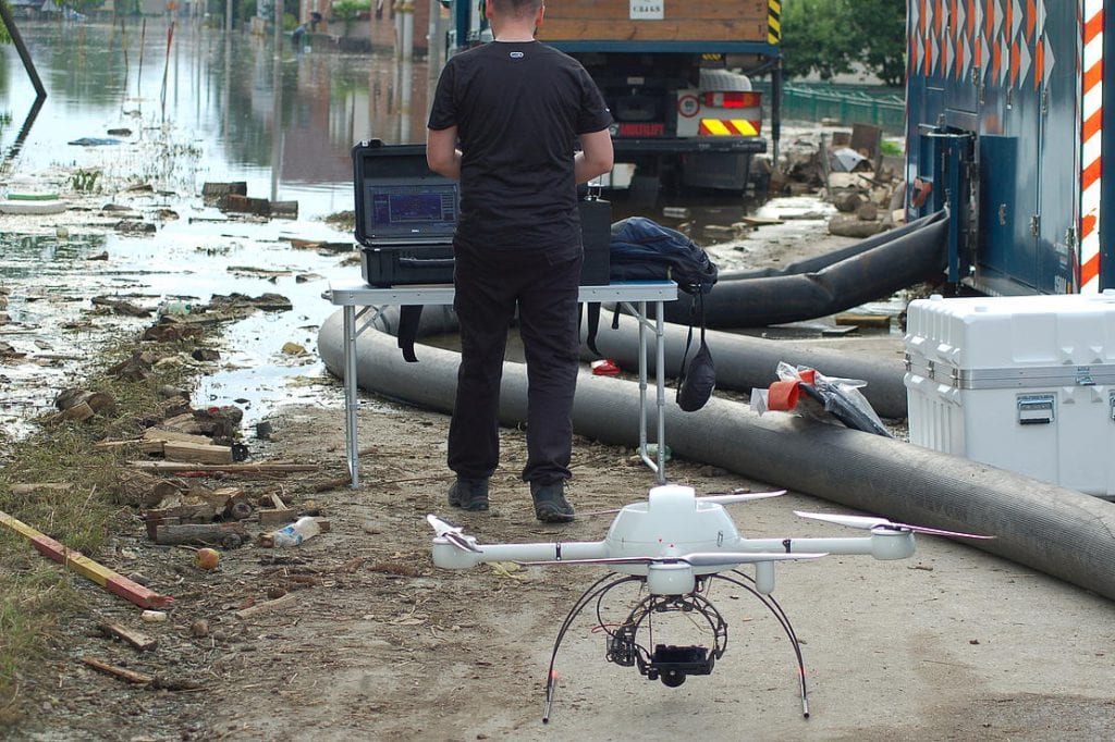
mdTector1000 CH4 is a fully integrated aerial methane inspection package that is purpose-built for professionals who are responsible for inspecting methane gas infrastructure. It consists of a Pergam gas sensor, mounted and integrated perfectly with a Microdrones md4-1000 UAV, and includes an onboard HD video link. That means that you can see in real time what you are detecting with the laser sensor.
The market is becoming more and more competitive, what’s Microdrones doing to stay ahead of the pack?
Microdrones is investing worldwide in the best and brightest minds. We often talk about offering the complete solution: aircraft + integrated payload + software + workflow + PEOPLE = results.
You can’t just put a drone and sensor combo in a box and ship it to a customer and have them get a result. You need exceptional people to develop integrated solutions, earn customer trust, train users and develop relationships over time.
We’re a technology company for sure but the backbone of this company is good old fashioned people that work hard, love what they do and solve problems.
We are focusing our efforts on specific markets and applications so that we can be the best solution.
Your drones are used heavily in field research, can you share a recent success story that Microdrones has been involved in?
Four companies conducted a joint field trial at Horneburg near Hamburg early October 2017, on the shores of the river Elbe. During the trial simulation, it was shown how a child could be rescued using a specially equipped Microdrones md4-1000. The flight took place outside of the drone operator’s range of visibility, so the Microdrones UAV was equipped with a thermal imaging camera as well as a specially developed cellular radio module.
The module allowed the drone to be controlled remotely via Deutsche Telekom’s LTE network. Image and position data were transmitted in real time to the DLRG mission control center via cellular radio. A drone tracker jointly developed by DFS and Deutsche Telekom was used in the process. It is capable of representing the drone’s position on an aerial map.
The field trial was part of a research project launched in November 2016. The goal? Safe integration of unmanned aerial systems (UAS) in ground-level airspace via cellular radio. To this end, the partners developed what is referred to as a “hook-on device”, which is mounted on the drone.
Weighing about 50 grams, this device contained a GPS module and a cellular radio transmitter unit, through which the position data was transmitted to the cellular radio network. A prototype for a UAS air traffic management system (UTM) that records the transmitted data and plots the drone’s position is also being developed. This would not only increase safety in uncontrolled airspace, but also enable flights at a greater distance outside the controller’s range of visibility, providing the basis for a wide range of future drone application scenarios.
Your website also cites some exciting cases studies, from crumbling dams, ancient burial grounds to research and rescue ops, what stands out as the most rewarding and why and is there anything else exciting to be added to that list from 2017?
We have several exciting and important research projects on various levels of interest. Whether it is helping to detect missing people as in the DLRG mission or measuring snow depth around a mountain to determine avalanches, our teams are putting technology to relatable challenges that help solve real problems.
These projects are just examples of how Microdrones UAVs can be used to quickly provide measurements or information. Our applied technology benefits various industries including the oil and gas sector, the construction sector, the utilities and infrastructure sector and the inspection field in general. It can be used for corridor mapping roads, railroad networks as well as for high tension power lines and towers. Drones allow remote access to areas humans cannot readily access.
The U.S. government recently announced the Unmanned Aircraft Systems Integration Pilot Program, how might this impact Microdrones?
Better integration of unmanned aerial vehicles into the airspace is key to commercialization and adoption of our technology on a broader basis.
When Part 107 was put into effect by the FAA in the summer of 2016, we saw an instant increase in the seriousness of our prospects to buy. That’s because the barrier of uncertainty was removed.
The same applies here- better integration into airspace means more clarity, more certainty and therefore better adoption and growth for our industry in the United States.
Where do you envisage the greatest potential for growth in the industrial UAV/UAS market?
At Microdrones, we are very excited about our upcoming LiDAR systems. LiDAR provides quick acquisition of data to generate pointcloud models, which can be used for many applications in construction, surveying, agriculture and more. In 2018, we will release a full lineup of LiDAR systems that will answer the needs of professionals everywhere. Our first system will be the mdLiDAR1000. You can check out a quick teaser of that here.
Where and what will you be exhibiting next?
We will be exhibiting at the ILMF and SPAR 3D events in the US as well as at the Intergeo in Germany in 2018. We will be focussing on gas detection and LiDAR solutions. We have an especially exciting presence planned at ILMF. On the heels of that event, on February 8th, we are sponsoring a special ASPRS workshop on LiDAR, and following that up with our own afternoon session, specific to our new mdLiDAR1000 package. It’s a complete solution consisting of drone, LiDAR, software, workflow and training.
Looking to the future where do you see Microdrones in 10 years-time?
Microdrones offers the most valuable UAS platform in the world for commercial users. When you combine that with our proven results in integration, workflow and customer support, we’re confident in our ability to be the best unmanned aerial surveying, mapping and inspection company. We’re signing up dealers within the Trimble network at a very healthy pace. That backbone of geospatial experience and trust becomes our pipeline to deliver real viable solutions to professionals worldwide. It’s a great adventure!