News
Incredible Drone Footage Solves Antarctic Penguin Island Mystery
It was a mystery that had two scientists working for NASA scratching their chins. Heather Lynch, Associate Professor of Ecology & Evolution Stony Brook University and colleague Mathew Schwaller had been examining satellite imagery of the Danger Islands, a chain of remote, rocky islands off of the Antarctic Peninsula’s northern tip and saw what was clearly guano stains.
“Until recently, the Danger Islands weren’t known to be an important penguin habitat,” says co-PI Heather Lynch. But the images told an unmistakable story: there must be a significant penguin population visiting these islands. But what type were they, and for what reason did they go there?
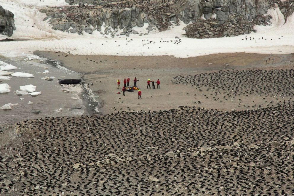
To discover more, Lynch teamed with Stephanie Jenouvrier, a seabird ecologist at the Woods Hole Oceanographic Institution (WHOI), Mike Polito at LSU and Tom Hart at Oxford University to solve the mystery. They arranged an expedition out to the islands to find and count the colony, taking with them a modified commercial quadcopter drone so they could aerial capture images of the entire island.
“The drone lets you fly in a grid over the island, taking pictures once per second. You can then stitch them together into a huge collage that shows the entire landmass in 2D and 3D,” says co-PI Hanumant Singh, Professor of Mechanical and Industrial Engineering at Northeastern University. As developer of the drone’s imaging and navigation system, he arranged for his team to use neural network software to analyze the massive images pixel by pixel, finding the penguin nests autonomously.
Scientists visit the Danger Islands to count the Adelie Penguins | Stony Brook University
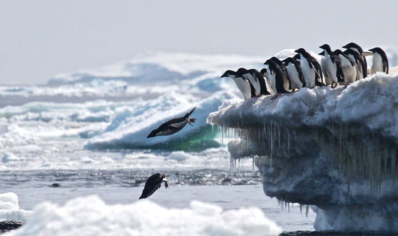
What they found was incredible. For 40 years, it was believed that the total population of Adélie Penguins had been steadily declining. One of the most common species of penguin on the Antarctic Peninsula, they play a vital role in the Antarctic food chain, states the WWF, feeding on tiny creatures like small fish and krill, and providing a source of food for leopard seals, killer whales and other predators.
In this new study led by WHOI, new insights on the Adélie penguin are proving invaluable. Their paper in the journal Scientific Reports this month states they have discovered a hitherto unknown “supercolony” of more than 1.5 million of the penguins.
Lynch says these supercolonies have gone undetected for decades, partly because of how remote the islands are, and how inaccessible they are due to the treacherous the waters around them. Even in the southern summer the surrounding ocean is filled with near inaccessible thick sea ice.
It’s another fantastic example how UAVs can help us better understand the world around us. The accuracy of images provided by the drone meant that insight was gained not only on the dynamics of the penguin population, but also on the effects of climate change on sea temperatures and sea ice and therefore the region’s ecology.
Michael Polito, coauthor from Louisiana State University and a guest investigator at WHOI, said, “Not only do the Danger Islands hold the largest population of Adélie penguins on the Antarctic Peninsula, they also appear to have not suffered the population declines found along the western side of Antarctic Peninsula that are associated with recent climate change.”
An accurate update on the size of the population of this supercolony also provides an invaluable benchmark for future change, noted Jenouvrier. “The population of Adélies on the east side of the Antarctic Peninsula is different from what we see on the west side, for example. We want to understand why. Is it linked to the extended sea ice condition over there? Food availability? That’s something we don’t know,” she says.
The research results will also support the proposed Marine Protected Areas (MPAs) near the Antarctic Peninsula, adds Mercedes Santos, from the Instituto Antártico Argentino (one of the authors of the MPA proposal). “Given that MPA proposals are based in the best available science, this publication helps to highlight the importance of this area for protection,” she says.


