Drones and LiDAR: Monitoring the Mediterranean Coast
On the Mediterranean coast, where the shoreline is being continuously reshaped by the complex interactions of geology, climate and ocean, the use of LiDAR by drones to monitor erosion is proving extremely helpful to a group of geologists.
The project, which is being led by the French Geological Survey (BRGM), and backed by a consortium of regional private companies and public laboratories, has been set up to address the impact of coastal erosion in an area known as Roussillon Plain, near Perpignan, on the availability of drinking water.
As a coastal region with a high influx of tourists each summer, and a strong agricultural industry, there is considerable demand on fresh water. At the same time, coastal geology and climatic changes result in significant erosion which has the potential to allow saltwater to introduce into groundwater reserves that form part of the local drinking water catchment, it was reported in GIM International.
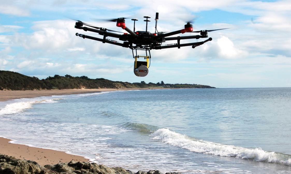
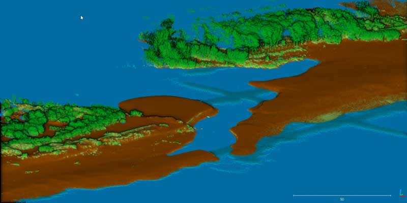
Survey area: the Têt estuary landscape | YellowScan
As part of the project – known as DEM’EAUX – partner YellowScan have been charged with conducting LiDAR surveys using drones to investigate the availability and possible evolution of groundwater by mapping change and providing input for erosion and sedimentations models.
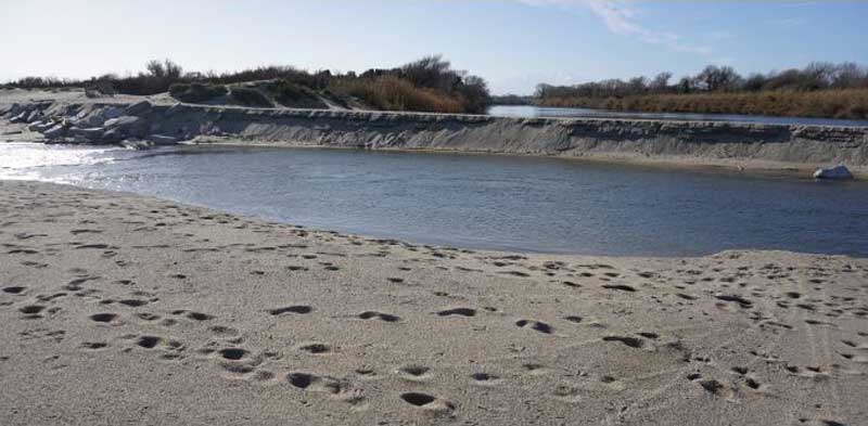
To test the viability and accuracy of the methodology, a pilot project was conducted on the mouth of the River Têt. With its origin in the Pyrenees, the Têt experiences extreme changes in water flow and as a result, its estuary endures wide-ranging changes, affected by both the seasons and extreme weather events.
UAV LiDAR technology was chosen over the current photogrammetric techniques implemented by BRGM, due to its superior ability to render terrain models, faster data processing times and improved reliability of data over surfaces with weak textures (eg undulating sand dunes as opposed to steep hills).
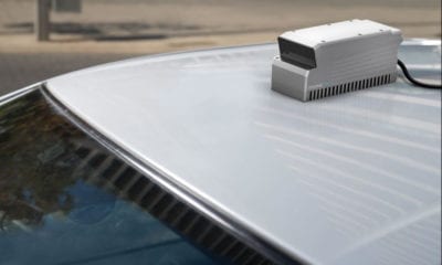
The pilot flights were operated by unmanned aerial vehicle (UAV or ‘drone’) survey company L’Avion Jaune, using their OnyxStar FoxC8 HD, a professional octorotor UAV which has a maximum payload of 3kg and is designed to fly in windy conditions often experienced on coastlines.
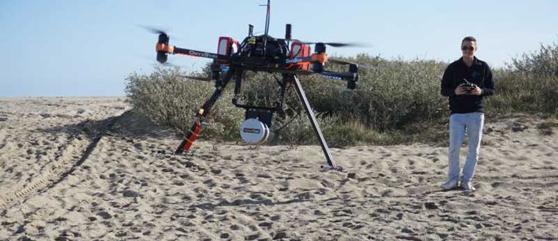
The UAV equipped with the Lidar system | YellowScan
Using YellowScan’s Surveyor Lidar system, which builds on the Velodyne VLP16 laser scanner, a 900m-long section of the shoreline, from the sea to 100m inland was surveyed. Flights were performed 30m above ground level at a speed of 5m/s, allowing collection of an average of 400 points/m² of data, which is in excess of minimum requirements for erosion/sedimentation monitoring.
YellowScan software was then used to generate images from post-processed trajectory and Lidar sensor data, with further data analysis and modelling performed with the TerraSolid modules TerraMatch and TerraScan.
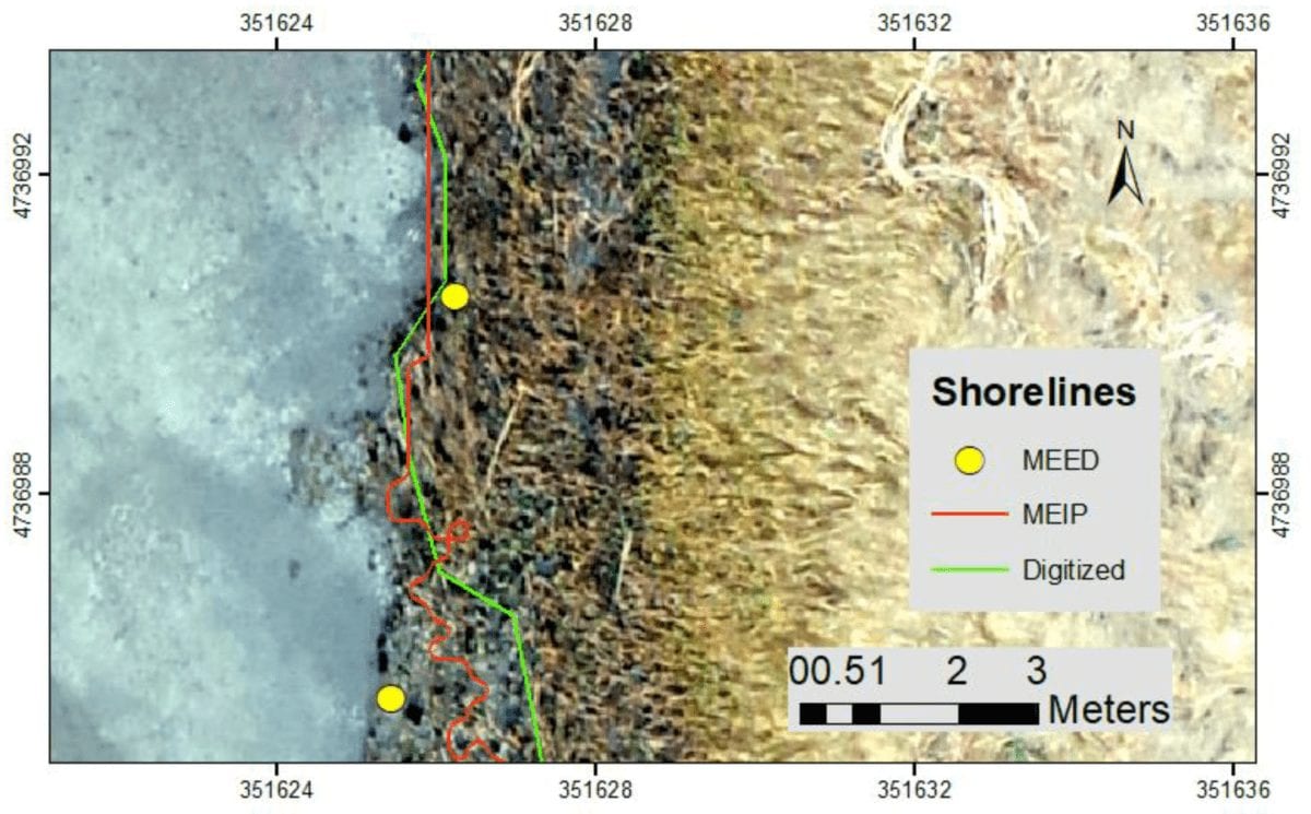
The researchers noted that differentiating between land and breaking waves on the shore was not an easy task, with the constant changing of the water height upon the beach. But all in all, five distinct regions were identified: ground, water, and three different heights of vegetation, and the final results were accurate enough to be considered successful despite the demanding test conditions.
Sea surface echoes are only present underneath the UAV track and in the swash zone. The remaining water surface has been coloured in plain blue | YellowScan
The pilot project has confirmed the suitability of using LiDAR payloads on drones to produce a comprehensive survey on a coastline characterised by morphological changes, and in fact, the desnity of data collected could be reduced significantly without compromising final model accuracy.
However, there were limitations to productivity due to current BVLOS restrictions on drone flights. As current regulations allow, a range of 10km of coastline per day in favourable conditions, can be reasonably expected. The researchers estimate that with relevant BVLOS permits and a drone with longer flight potential, they could cover up to ten times that.
To achieve this, YellowScan are testing their LiDAR systems in several fixed-wing UAVs and hope soon to apply these successes in operational surveys.
The DEM’EAUX project will continue after next winter’s storms, with the project continuing over the next two years, allowing the researchers to better understand the dynamics of the river estuary.