Industry
Drone Deploy’s Live Thermal Maps Provide Immediate Insights – But Only for iOS Users
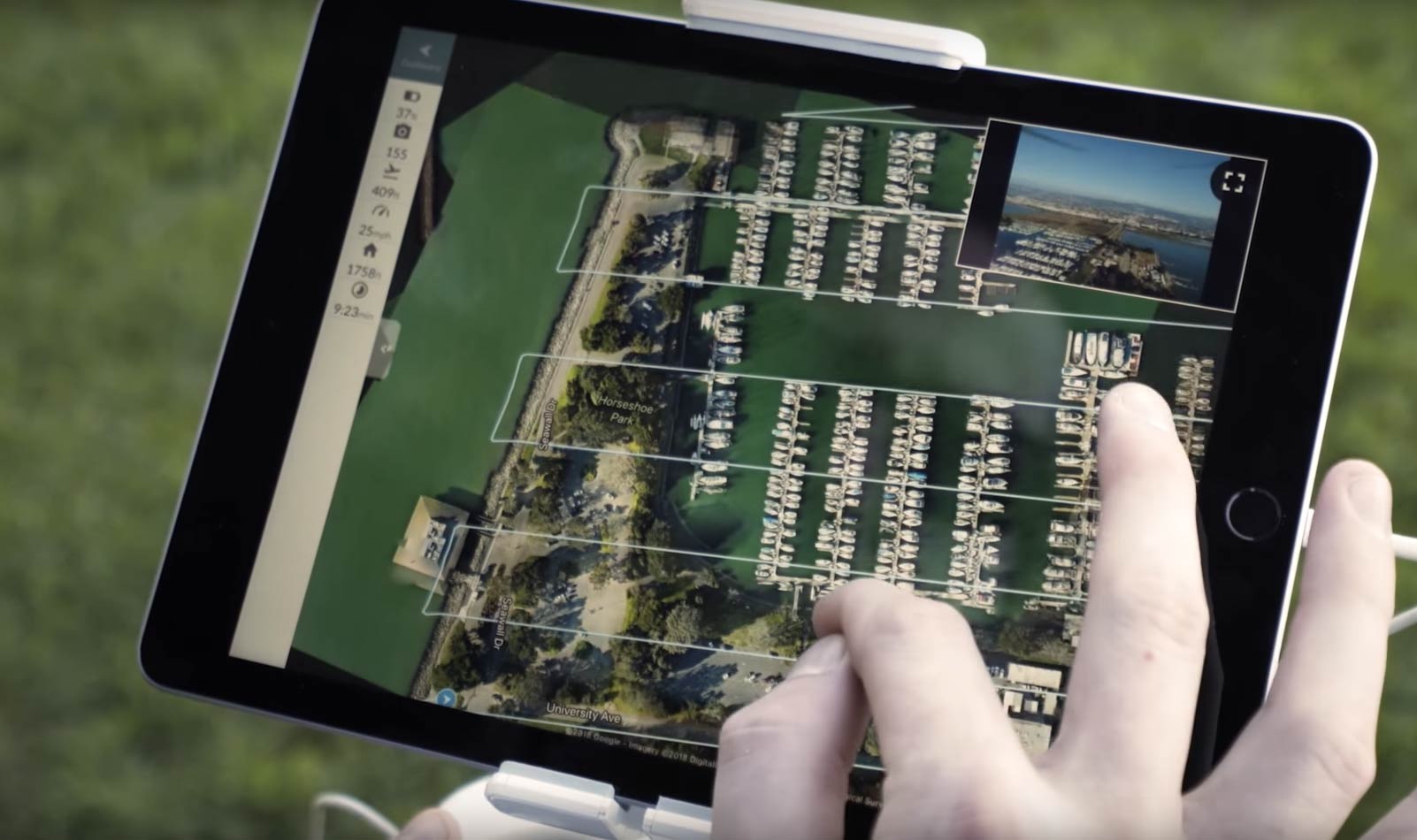
A first-of-its-kind live thermal mapping feature for drones has been released by drone software company DroneDeploy, bringing to its customer base a real-time solution for a broad range of industries.
Inspections in many industries are traditionally time-consuming when done manually, and the introduction of drones to fields such as infrastructure inspection, construction and even public safety have benefited from the new perspective drones have to offer.
Even using existing thermal sensors and software for inspections can be relatively slow, relying on poor resolution and post-mission analysis of data.
Being able to view the thermal data as it is captured is a feature that many customers have been asking for, says Mike Winn, CEO of DroneDeploy.
For this reason, DroneDeploy are now bringing real-time capabilities to their drone software solution stable, providing immediate insights as the mission unfolds without the need for a computer, memory storage or internet connectivity.
The solution, called Live Map, is certain to make life easier for drone operators working in precision agriculture, first responders, solar energy, construction and roofing – anywhere real-time thermal imaging is required to give the operator a better picture of any given situation.
“Rather than searching for a needle in a haystack, you have a map to tell you right where to look,” said Grant Hagen, Virtual Design and Construction Manager at The Beck Group. “The work input to value output with drone-based thermal imagery is game-changing. It’s unlike anything else in construction technology right now.”

Source: DroneDeploy
Using Live Map does not mean foregoing full-resolution maps and 3D models produced via DroneDeploy’s standard and enterprise mapping solutions.
“Plan flights as you normally would. Toggle on Live Map to generate a map in real-time. DroneDeploy will capture the images you need to create a full-resolution map and 3D model in parallel,” the company says on their website.
Certain data can also be viewed offline from Live Maps, such as plant health data – although it is not clear as yet what the memory requirements for the iOS mobile device would be for this functionality.
Post-flight, this data can be synced with the cloud allowing the operator to take measurements and add notes.
While DroneDeploy’s standard mapping applications are available for both iOS and Android device users, currently Live Map is only available for iOS (Apple) smartphones and tablets.
The company cites the diversity of Android device specifications as the underlying reason for this, saying, “The computing limits of mobile processors and wide range of Android devices on the market make it difficult to optimize Live Map for Android at this time.”
“Starting with iOS has allowed us to deliver this solution to customers much faster. We’ll continue to evaluate making Live Map available to our Android customers, but no specific date has been set at this time.”
Live Map will also currently only work for owners of DJI Phantom 4 drones and newer. Drone Below has reached out to DroneDeploy to find out when and if the solution will available for other DJI drones (or indeed drone of other brands) in the future – stand by.
Editor’s note: DroneDeploy have confirmed that Live Map saves to the phone or tablet’s memory. Once connected to the internet, the maps sync to the cloud, and they can also be shared via Airdrop to a local apple device without a connection in the field. To use Live Map, a newer iOS devices, that is the iPhone 7 and above is required.
Additionally, DroneDeploy have confirmed that Live Map is only available to DJI drones, thanks to DJI’s Occusync technology, which isn’t available from other drone manufacturers.


