Industry
Drones Being Used in Many Water-Related Applications
Drone technology and its innovative uses are reaching several aspects of day to day living. A bird’s eye view that drones provide by reaching relatively inaccessible locations, while offering better spatial and temporal resolution is rated far better than satellite imagery. The Drone Watch project, led by Cranfield University and funded by the Natural Environment Research Council (NERC), for example, could provide detailed aerial imagery when optical satellite data was compromised due to heavy cloud and where synthetic aperture radar (SAR) satellite data – designed to penetrate clouds – could not easily distinguish water from urban features.
It was the drone footage of the Western Cape’s nearly empty Theewaterskloof Dam that highlighted the stark reality of the drought to Cape Town residents, prompting them to intensify their water-saving efforts. Drones played a vital role in mapping the extent of flooding and assess damage to property and infrastructure during the UK’s disastrous 2015-2016 floods.
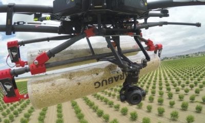
In South Africa drone technology is being utilized by the agriculture sector for water-related applications. Drones facilitate ‘precision agriculture’. Apart from helping to optimise production and minimise wastage, this reduces runoff and hence the pollution of nearby water resources. Farmers are now using multispectral sensors on drones to get a picture of crop health via Normalised Difference Vegetation Index (NDVI) mapping, to identify areas of plant stress.
Environmental scientist, Marinus Boon, conducted South Africa’s first used UAV photogrammetry based study that for wetland delineation and health assessment. Drones also have considerable potential for the assessment, monitoring and management of river systems.
“In inaccessible areas, drones could be very useful in finding EWR sites,” says Delana Louw, of Rivers for Africa eFlows Consulting. Locally, drones could also be particularly helpful in mapping riparian invasive plants, erosion hotspots and pollution point sources, as well as monitoring river restoration and rehabilitation efforts.
In another creative manifestation of drone technology application, a team from South Carolina’s Clemson University used a hexacopter fitted with flotation attachments making the drone could land on water surface. This preserved battery life and ensured inclusion of more monitoring points besides eliminated the need for additional sensors to take measurements at precise depths.
Global engineering firm, Hatch, developed a device for deploying a 1.2 litre Niskin bottle from a drone for collecting water samples from flooded pits and tailings ponds at mine sites. This innovation avoids exposing staff to hazards associated with sampling from steep and unstable banks, such as falling, drowning or contact with toxic chemicals.
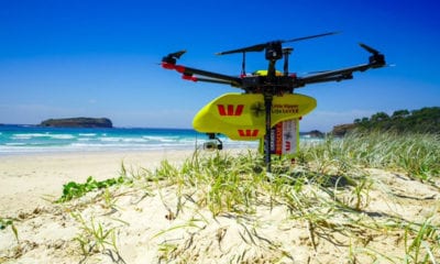
Drones have also been trialled for mapping the distribution of nuisance filamentous algae like Cladophora and invasive aquatic weeds, such as water hyacinth and salvinia, with some success. Drones are used for wildlife research and conservation purposes the world over; as also for assessing sanitation needs in refugee camps, and for search and rescue efforts during flood disasters. It seems the sky’s the limit for drone-based technology, and rapid growth of drone use in the development and adoption of water-related applications is expected.
Source: http://journals.co.za/docserver/fulltext/waterb_v17_n4_a2.pdf?expires=1534974545&id=id&accname=guest&checksum=2421FECA37F7283326D650E18A75DE6A | The Water Wheel July/August 2018 | Sue Matthews, The age of the drone – Keeping an eye on the nation’s water

