Industry
Drones in Digital Agriculture: Ensuring Food Security Through Data Collection
Nowadays, the use of digital technologies has significantly improved many fields. One of them is agriculture. Believe it or not, agriculture is a crucial element of ensuring food security for many countries – and an element of growth for many industries.
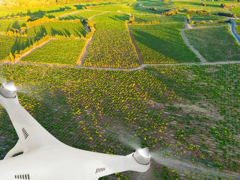
However, agriculture has never been more dependent and reliant on data. Nowadays, there is no easier way to collect agricultural data than with the use of unmanned aerial vehicles (UAVs). Through proper data collection and monitoring, farmers can get useful insights about the state of agricultural fields such as their size, the level of germination, the state of vegetation and many other important factors.
Increasing the Effectiveness of the Decision-Making in Agriculture
Data collection in agriculture has been the basis of one recent study at the Astrakhan State University in Russia, where the author (A.V. Koshkarov) is outlining the most demanded areas of agriculture for monitoring in order to increase the effectiveness of the decision-making during the process.
As the author begins the study, agriculture is a crucial element of ensuring food security in countries – which is why it plays an important role on the global scale and regional economy. The use of technology in agriculture can be one of the sources of growth in the industry – and the technology such as precision farming, data collection and analysis can all be initiated using various mechanisms such as using unmanned aerial vehicles.
Identifying the Farmers’ Understanding of Data Collection (and How Can it be Improved) with a Survey
It all began when a survey of farmers of the Astrakhan region was first conducted to identify the most demanded areas of agriculture in order to increase the effectiveness of the decision-making process. The survey, as the paper notes, used a questionnaire to interview 42 farmers who were over 18 years of age and engaged in crop production.
The aim of the study was to identify the farmers’ understanding of data collection and analysis technologies in agriculture as well as their readiness to implement such technologies and identify the most demanded data.
Obviously, the most important data in this study were the stages of plant growing which included the stage of growth, stage of sowing, stage of preparation of fields for sowing, the harvesting stage, the state of vegetation and soil analysis.
Using Drones with Multispectral Cameras in Agriculture
Understandably, the main aim of using drones in agriculture is to collect data and act upon it. For that reason, drones with a multispectral camera are used, allowing farmers to take field shots in special spectra. To identify the state of vegetation, the visualization of such data will identify problem areas in agricultural fields and monitor the level of germination and growth.
Here, the unmanned aerial vehicles (UAVs) or drones have three main varieties: fixed wing, helicopters and multicopters. Here, helicopters and multicopters are better suited and can fly low and slow compared to fixed with unmanned aerial vehicles. On the other hand, fixed wing drones can cover large volumes of fields and therefore collect more data due to the higher speed and altitude of the flights. They can also carry a large payload and use more sensors to collect data.
As the paper outlined, there are several drones which are perfect for use in agriculture, including:
- DJI Matrice 100
- BirdsEyeView FireFLY6 Pro
- AgBot
- Honeycomb AgDrone
- Trimble UX5 Multispectral UAV
- eBee SQ; Ag 360
- The Sentera PHX; The Sentera OMNI AG; The Indago AG
- Sentera NDVI Upgrade for DJI Phantom 4 PRO
- SOLO AGCO Edition UAV
- AgEagle RX60, RX47 & RX48
Potential Limitations in the Use of Drones in Agriculture
When it comes to the actual limitations, just like almost everywhere, there are a few in this industry and technology. Here, the challenges include the high cost of the devices, the short battery life and the potential restrictions in some legislations – as well as the need for proper training for working with devices like these (and their related software).
However, all of these challenges are becoming more and more addressed by the authorities. Most importantly, the value of unmanned aerial vehicles in agriculture definitely outweighs any challenge and as such should be considered by every farmer.
The Use of UAVs in Every Stage – Precise and Accurate
From flight path planning to flying and shooting fields, image processing and analysis of the results, farmers can gather all the info they need about their soil, land or farm – and take immediate action towards resolving any potential problem.
In the end, the main advantages of drones compared to satellite imagery is that they can be used more often to collect more data – and always deliver precise and accurate results despite the changing weather conditions.
Reference: https://moit.vivt.ru/wp-content/uploads/2018/04/Koshkarov_2_18_1.pdf


