News
New Study Analyzes and Presents the Risks of Drone Collision Near Airports
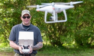
A new study by researchers at the Embry-Riddle Aeronautical University in Florida found that remotely operated consumer drones exceeded the 400 feet AGL mark in 6.8 percent of the flights tracked. The findings were revolutionary, and presented information that many analysts and drone-related specialists did not know.
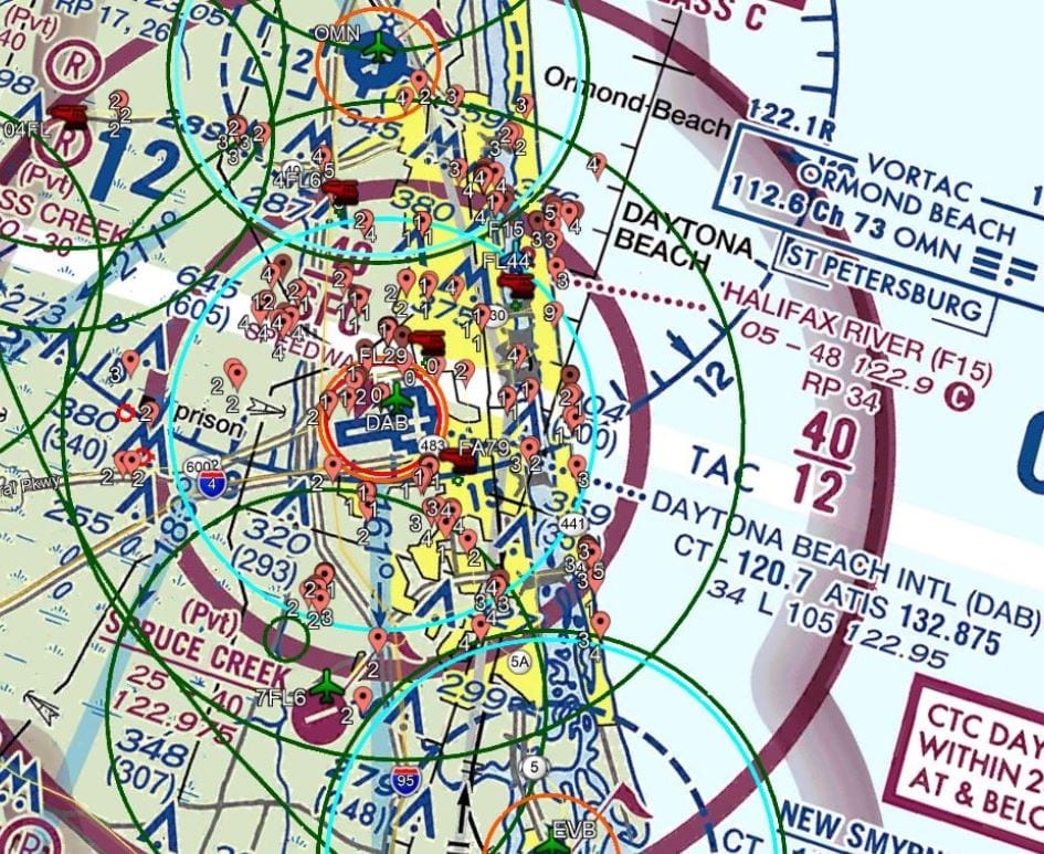
Analyzing the Average Flight Vicinity of Drones (Near Airports and Heliports)
For example, some of the findings showed the potential aviation inference and safety hazards that were caused by small unmanned aircraft systems (sUAS/drone) especially because of a case where one drow flew as close as 0.25 NM from the Daytona Beach International airport’s approach path. Their response to this was using a DJI AeroSpace unit (a passive radio-frequency sensor) to detect, identify and track the DJI-manufactured drones – mounted to a building close to the Daytona Beach International Airport (DAB) in Daytona Beach, Florida.
The study took into account a total of 192 flights made by 73 separate DJI platforms, evaluating and detecting them during a 13-day period in May 2018. The results showed that drones usually operate to as close as 0.50 NM to public airports and 0.35 NM to heliports.
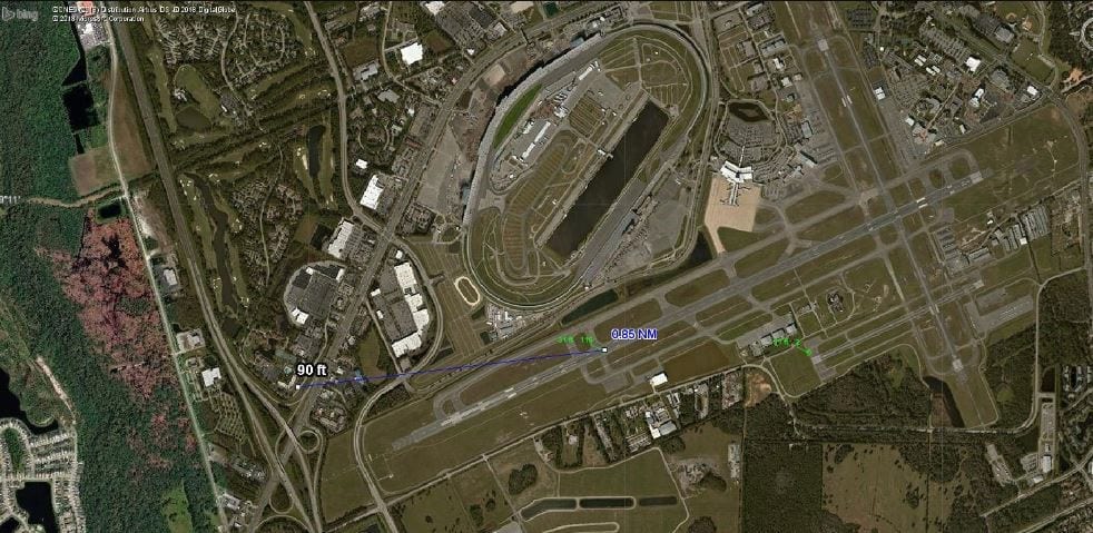
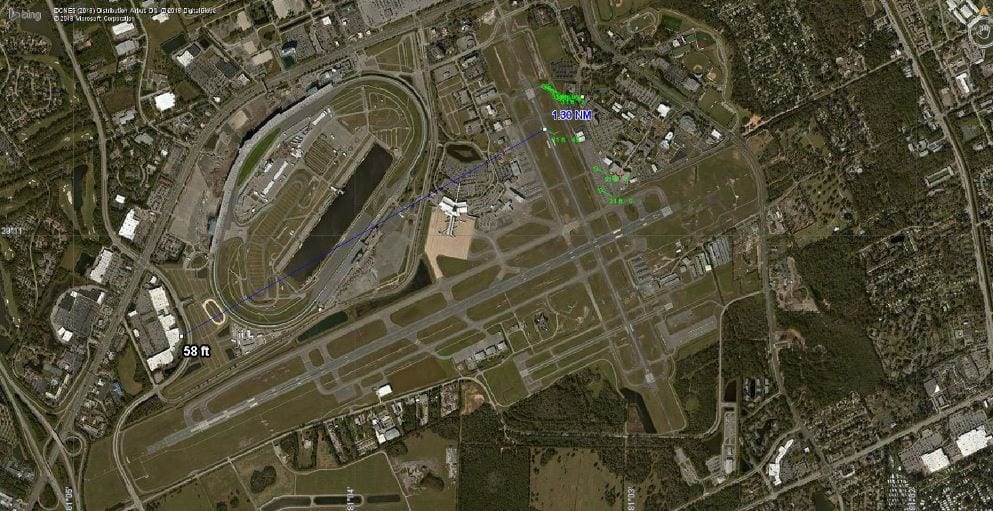
sUAS activity on DAB Runway7L approach
UAS activity near DAB Runway 7L
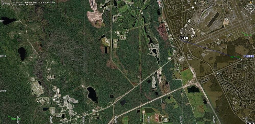
UAS activity near Builder’s Square, a commercial sector near the Daytona Beach Speedway
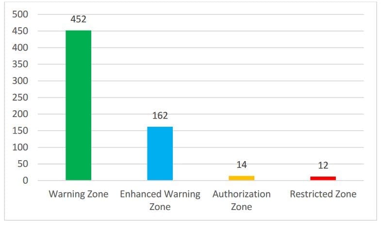
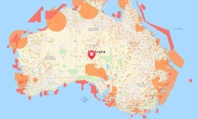
Cumulative distribution of detecteds UAS activity within categories of DJI geofencing zones.
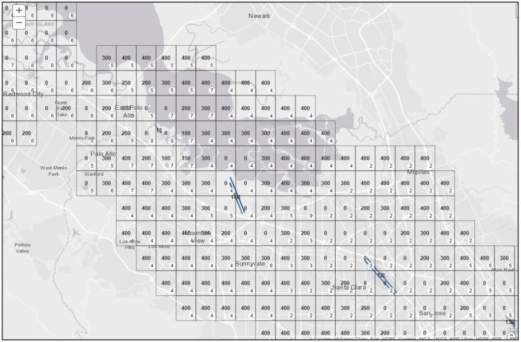
LAANC Administrative Tool. Provides LAANC segmentinformation. Maximum altitudes of each segment are listed in black text, withutilization dataindicated by numerical values in the white circle of eachrespective segment. The administrative tool contains filters that can display active authorizations or cumulative authorizations, including approved 14 CFR107.205(h) airspace waivers. Used with permission, courtesy of Baum (2018)
Using Different Sets of Data to Compare the (sUAS) Flights of Drones
Researchers also used references from the FAA and its Facility Map (UASFM) which shows the maximum altitudes for authorized Part 107 operations in order to gauge the potential detected sUAS flights for interference with manned aircraft. The authors also used different sets of data to compare the times, locations and altitudes of manned aircraft with sUAS flights.
As one excerpt from the study reads:
“In [one] case, the sUAS was detected at 90 feet (MSL) within 0.25 NM from the approach path of Daytona Beach International Airport, Runway 7L. Just seconds before this detection, an aircraft was on approach to Runway 7L. Assuming the pilot was performing the published ILS approach, the aircraft would have crossed the Runway 7L threshold crossing at a height of 58 feet AGL (88 feet MSL). It is highly probable that the aircraft descended through the UAS altitude while on approach.”
From this, the authors noted that the Low Altitude Authorization and Notification Capability (LAANC) had not yet been implemented in the area and compliance with the UASFM altitudes was not mandatory at the time when the data was collected.
Looking For Ways to Ramp up the Effectiveness in the Geofencing Infrastructure
Comparing the data with the geofencing zones, the study also looked for potential indicators of the effectiveness of the geofencing infrastructure. As the data collected shows, the researchers noted that “geofencing zones are relatively ineffective at preventing or deterring operators from flying unless they impose operational restrictions.” Therefore, geofencing is not a tactic that is suitable – and is one that can be easily overridden by the operator in the realm of the sUAS operations.
What’s interesting is the fact that DJI confirmed this study and announced that it is “improving its geofencing technology to refine the airspace limitations for drone flights near airports, in order to provide smarter protection for airplanes in critical areas.”
The company also noted that the upgrades take into account standards that were laid out in the new FAA Reauthorization Act and will therefore be phased in starting in November this year. According to recent data, it is estimated that DJI holds a market share of 72% and its products account for the majority of the sUAS operations in the United States.
Integrating Manufacturer-Imposed Geofencing Protections with the FAA and Making Improvements in the sUAS Activity
As a result of the findings by the authors, the ERAU research team recommended making improvements in sharing information about the sUAS activity with pilots of manned aircraft. According to the team, there must be integration in the manufacturer-imposed geofencing protections with the FAA LAANC UASFM grid system and unlock codes that will be issued for authorized flights.
In the end, the authors also note that they intend to repeat the study at additional airports.
Citation: Wallace, R. J., Kiernan, K. W., Haritos, T., Robbins, J., & D’souza, G. V. (2018). Evaluating Small UAS Near Midair Collision Risk Using AeroScope and ADS-B. International Journal of Aviation, Aeronautics, and Aerospace, 5(4). https://doi.org/10.15394/ijaaa.2018.1268