News
Aerial Surveys for (Improved) River Dolphin Monitoring
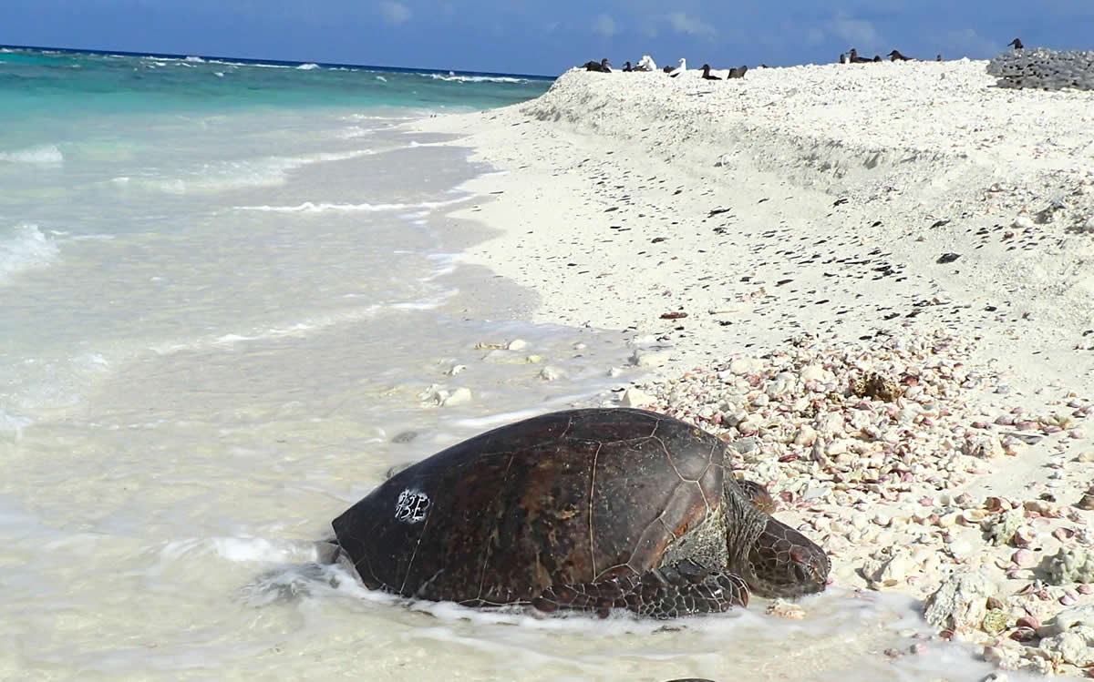
Threatened species conservation is a hot topic nowadays – and obtaining the right estimates in order to model the population dynamics and adjust management actions is a goal in this field. Mammals such as river dolphins, however, are hard to track and usually surveyed from canoes, with an assumption that visual counts are exhaustive estimates of animal population.
Monitoring the Path of Dolphins with a New Technology
This is why right now, it is critical to find and develop a new technology and survey method that would monitor the path of dolphins and track their actions. In a new paper, a group of authors at the University of Freiburg, Germany, are proposing a technology that aims to improve the reliability of dolphin monitoring as well as all wildlife in general.
The technology was even tested in an experiment where the Araguaian river dolphin was in the focus – during the water season in a lake system in the Amazonian forest, Brazil.
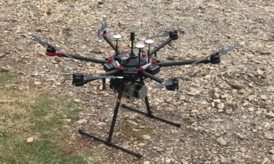
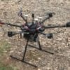
After developing the technology, the authors made a survey which was designed to monitor the river dolphin in 56 survey units within six main survey sectors, deploying two canoes navigating at the same time. The first of them had a single operator holding the blimp and recording data with a camera, while the second one performed standard visual counts of dolphins.
Even though the visual counts were 75% effective, aerial drones mostly benefit this type of (dolphin) monitoring with their ability to spot dolphins from up in the air and record more dolphin groups (which are difficult to detect).
Regardless of the efficiency of the visual method, the aerial one was able to detect more individuals, dolphin groups and calves, which are otherwise difficult to detect. The differences in performance between the two methods were also remarkable, indicating that aerial monitoring is a great way to track dolphins.
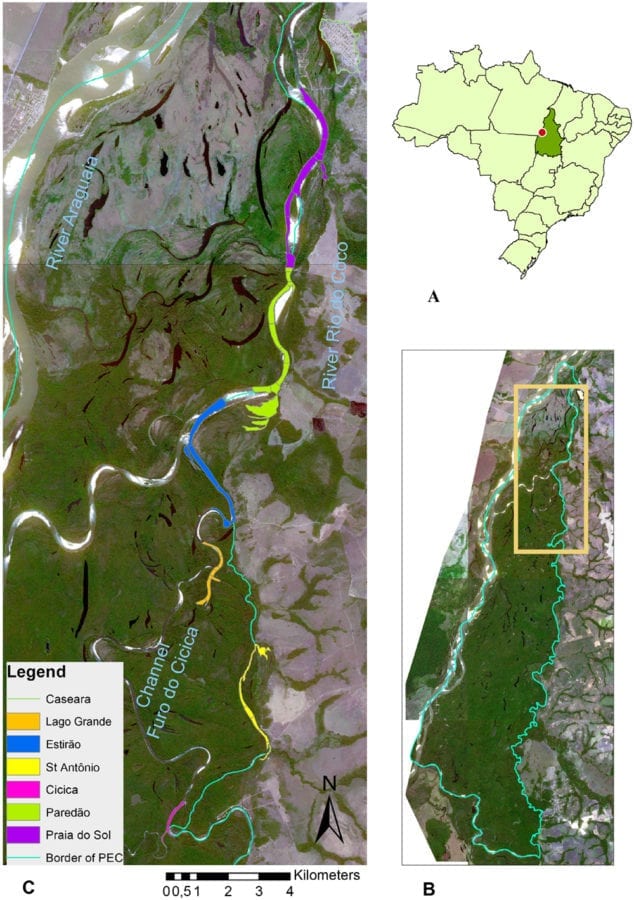
Map of the study site. (A) Location of the Tocantins State, Central Brazil, indicating the area where Parque Estadual do Cant~ao (PEC) is located (dot). (B) PEC border (green line), within which the current study has been carried out (orange frame). (C) Study site map with the location of the six sectors where river dolphins were surveyed. Survey sections were located along the Channel Furo do Cicica and the River do C^oco as well as secondary river arms and lakes. (Source of satellite images: Rapid Eye, July 2015).
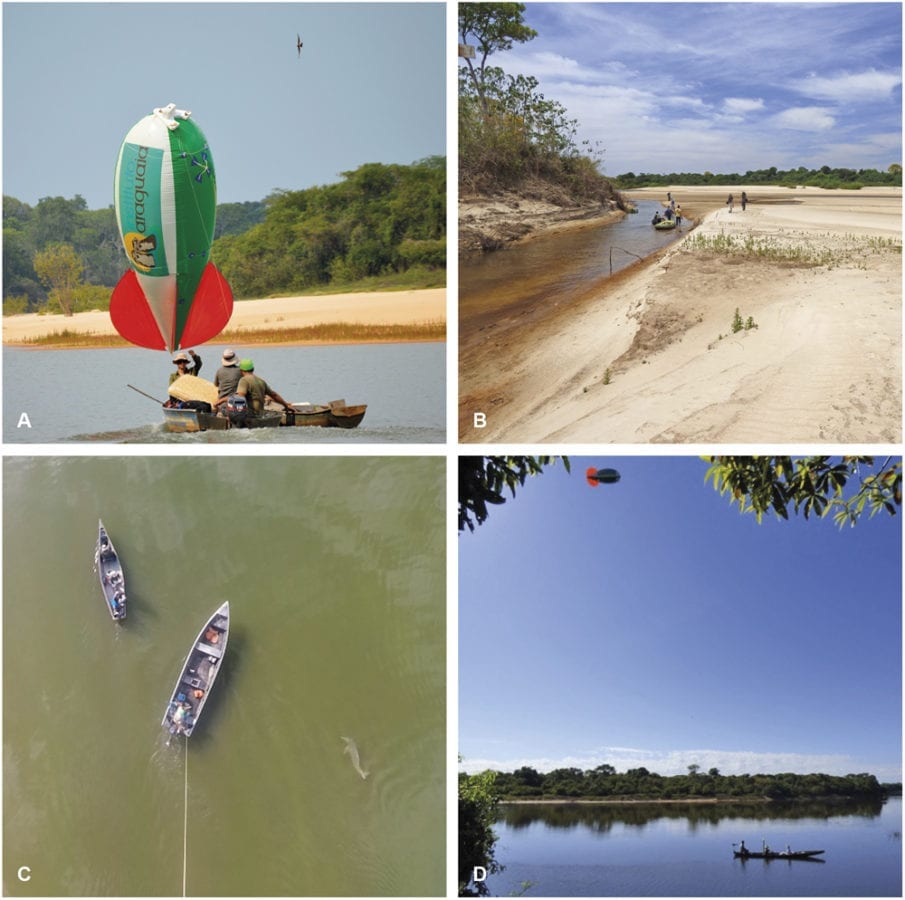
River dolphin aerial survey using the blimp. (A) Researchers leaving the base camp for an expedition to the survey sector St. Antonio. (B) Boats and equipments had to be dragged over shallow water and sand banks to access more remote study areas. (C) Screenshot of a video filmed by the GoPro camera on the blimp, showing the boats and one river dolphin. (D) Researchers adjusting blimp flight height to fixed altitude prior to the beginning of a survey session.
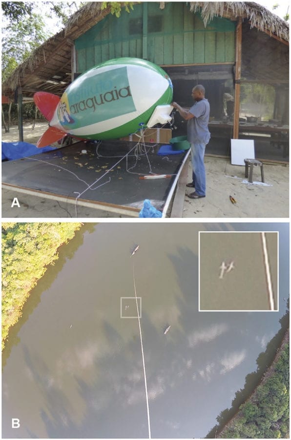
River dolphin aerial survey using the blimp. (A) Field assistant makes adjustments of the styrofoam system that held the GoPro camera on the blimp. (B)
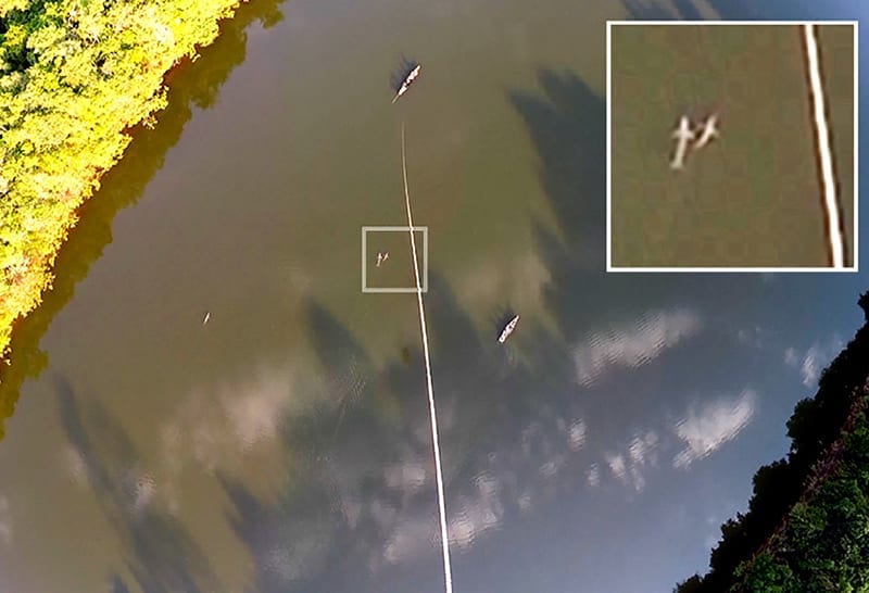
Screenshot of a video-recorded by the blimp camera during a survey of Inia araguaiaensis in the sector Estir~ao. Three dolphins are visible: a pair showed in the
enlarged picture detail, plus a solitary one further left down. It is also possible to spot the two boats deployed in the survey, the bottom-right one with observers performing the visual survey, and the top-left one responsible for holding the blimp through a tether line.
A Solution that Leads to a Promising Future
The results of the research by the authors and the entire experiment could serve as a benchmark for monitoring dolphins. The authors clearly noted the differences between the two methods and showed that the visual counts from canoes are less exhaustive surveys than aerial surveys, providing a less expensive method to count aquatic mammals.
In the end, the results can also be used to correct the current visual count estimates – and be developed in blimps and drones covering and monitoring other wildlife surveys. To sum things up, the authors hope that their solution could lead to a promising future in the conservation and management of threatened species.
Citation: Improving river dolphin monitoring using aerial surveys, Julia S. Fürstenau Oliveira George Georgiadis Silvana Campello Reuber A. Brandão Simone Ciuti – https://doi.org/10.1002/ecs2.1912