News
Drones for Forestry and Rangeland Management
There have been numerous innovations in the field of drones or unmanned aerial vehicles (UAVs) which has resulted in these devices being heavily adopted for surveying properties. In a new publication, a group of authors try to familiarize users with the potential use cases in which drones and sensors could be used – addressing some of the challenges that may be encountered in forestry surveying.
As the authors note in the beginning of the paper:
“Collecting images from UAVs using hobby- or professional-grade systems and special software can provide useful information about our forests and rangelands. There is still progress to be made in understanding potential applications, possible users, and best management practices. Also, because this is a new and emerging technology, small-acreage landowners intent on surveying their own properties may have technological questions and concerns to address, and should stay aware of important regulatory issues.”
They further address the platforms, challenges as well as a detailed plan to familiarize users with the various types of UAVs and sensors and share their ideas for application while providing a full overview of the relevant laws and regulations and addressing some of the challenges that may be encountered.
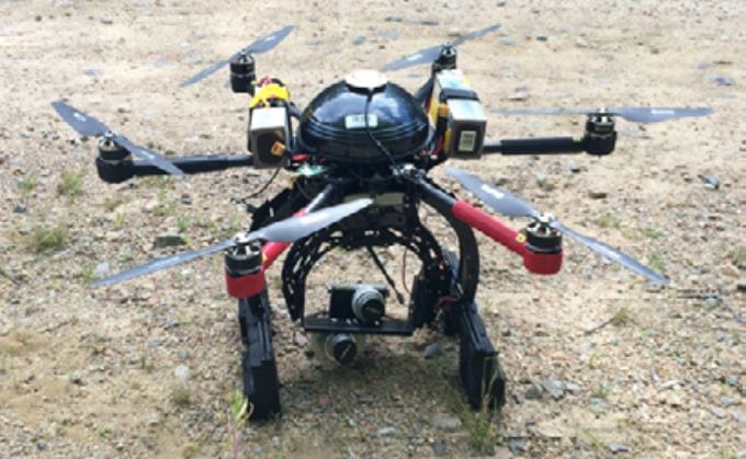
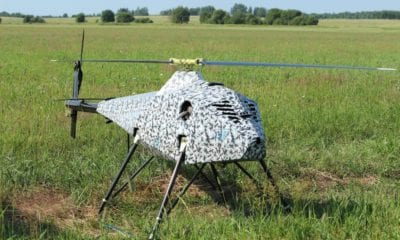
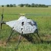
A small 6-blade rotorcraft, like this one used for research in eastern Oregon forests (top), is capable of carrying large sensors. A more affordable (around $500), entry-level hobbyist rotorcraft (center) can provide useful imagery and information but sometimes lacks autopilot or the ability to carry heavy sensors
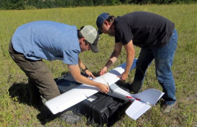
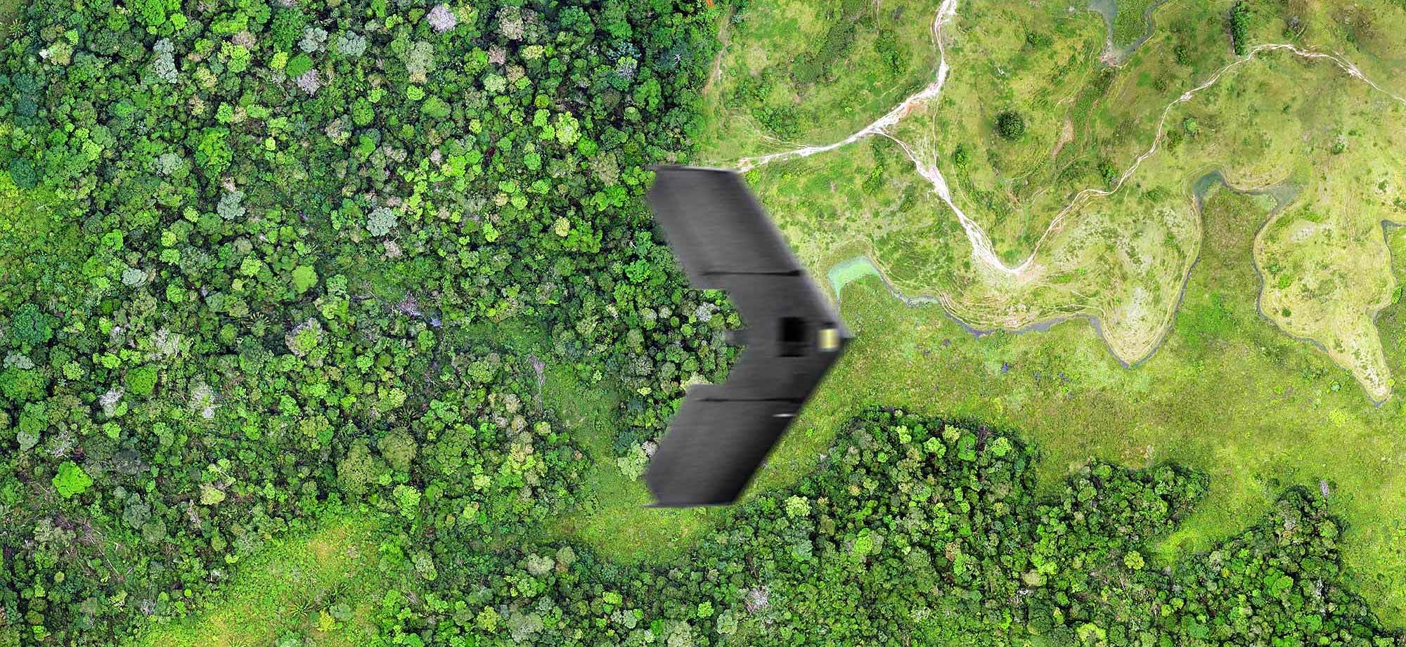
A fixed wing aircraft (bottom) provides a platform from which to collect imagery over larger swaths of land using autopilot functions and image-stitching software but requires larger landing areas.
Reviewing the UAV in Detail: Types, Cameras, Sensors, Applications
To begin that, the authors are reviewing the two types of UAV aircraft to choose from – fixed wing and rotorcraft – addressing their advantages and especially addressing the benefits of fixed wing UAVs mainly because of their longer flight times and greater area coverage.
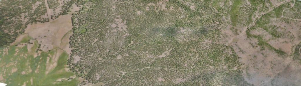
Mapping using a fixed wing aircraft can produce maps for larger properties in a much shorter time and with fewer concerns about battery life. Maps at this scale are generally not achievable using rotorcraft systems.
In the sections afterwards, the authors focused on the cameras and sensors that are used in UAVs right now – from built-in ones to video ones which are perfect for ordinary photography and can be controlled and viewed live through your cell phone.
As they noted:
“Mapping landscape features (such as topography, streams, and vegetation) and monitoring change are two high-priority applications for which UAVs are uniquely suited. For example, using UAV mapping technology, you can create a map of your property or monitor for forest pest activity.”
Last in terms of their features is the actual appliance of drones. The applications, according to the authors of this paper, are mainly related to topography, streams and vegetation – all of which beneficial for forest pest monitoring.
They specifically note that the variety of cameras used in such scenarios is big, and the applications demand specific sensors based on their level of specialization. In practice, they address that drones must have the right equipment, operate in a flight that is pre-planned and fly around objects that can easily be distinguished as ground control points.
On top of this, the authors indicate that hiring a professional specialized in such monitoring can also be a great idea.“Another option to consider is hiring someone to collect imagery for you. Finding a company will vary by location, and currently only a few companies offer this type of service in Oregon. However, this is likely to change,” they conclude in their ‘In Practice’ section.
Citation: Ducey Mark, Michael Palace, Franklin Sullivan, Ethan Blair, Joel Hartter, Paul T. Oester (2018). Unmanned Aerial Vehicles (Drones): How they operate and their potential for improving your forest and rangeland management. OSU Extension Catalog. https://catalog.extension.oregonstate.edu/em9190 https://scholars.unh.edu/faculty_pubs/274/
Related Video: Forest Damage Assessment Using Micro Drones