Construction & Mining
Drones in Construction Planning, Performance and Contract Close-Out
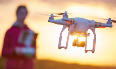
Quadcopter drones and other unmanned autonomous vehicles (UAV’s) have become common -place and their use is widespread among consumers and professionals in numerous industries. Aerial imagery and video can provide useful perspectives and have great value in communicating progress, for use in documentation of site activity and for use in marketing services.
Drones, either through imagery or LIDAR, can further provide quick and accurate surveying information, which is valuable for positioning of facilities and activities. LIDAR data can also be used effectively for quality control and for quantity measurement.
Imagery also has further applications in safety evaluation, productivity improvement, security and real-time job-site monitoring. Such additional uses have the potential for making a real impact on successful project delivery while increasing and competitiveness.
Progressive construction companies and service providers throughout the globe recognize this potential and see significant promise for tangible return on investment. This paper will evaluate these opportunities for quadcopters and other UAV’s based on experiences of the authors in using drones in Dubai and in the United States. The examination concludes with evaluation of the opportunities and avenues for research using UAV’s.
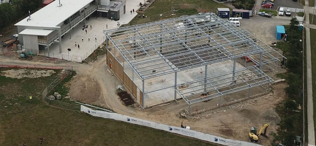
Drone captured imagery of construction status [Source: Wikimedia Commons, March 2018]
Listing the Plethora of Opportunities for UAV Integration
Researcher Edgar P. Small of the University of Delaware decided to focus on the plethora of opportunities for UAVs in construction planning, performance and contract close out. In his paper, he describes drones as “ubiquitous throughout the globe for hobbyists and within professional communities” and shows that surveying and construction are one of the most notable professions where the integration of these quadcopters has become common over the past decade.
As Edgar Small states:
“Today, drones are frequently routinely employed somewhere in the delivery of a construction project along the life-cycle from concept through completion. This increase in the use of drones makes sense as resulting aerial imagery has great value in documenting, communicating and recording current conditions with visual perspectives previously unavailable without large expense. Considering just aerial imagery, the prevalence of drones makes sense at nearly all levels and for all participants in the project delivery process. Planners and designers can use aerial imagery in conceptual and preliminary design. Construction professionals can use imagery to layout construction sites and monitor job-site activity, owners can use likewise use the imagery for marketing and business development.”
Amazing Benefits Result in Amazing Opportunities
Small then begins listing the different types of drones, starting from consumer and commercial drones which are already used in a number of industries, from agriculture to surveying, forestry and ecology. Since they are low cost and have increased power and size, increased flight times and ranges as well as respectable flight load carrying capacities, drones like these open up the possibilities when it comes to their potential uses.
Speaking of uses, Small focuses on drones in construction, where the base imagery and videography of drones can be seen through countless of examples. He addresses all the sites and the benefits of drone-based aerial imagery as well as the potential opportunities that include construction progress photography and development, preconstruction planning and evaluation, visual inspection and auditing, safety improvement, volumetric measurement and 3D modeling.
Current and Future Applications and Research in the Use of Drones for Construction
There are numerous research activities on drones for construction explored through a search of peer-reviewed journals and conferences. When it comes to the future applications of drones, the author is quite confident that there are a lot of potential uses.
As Small concludes:
“Drones are ubiquitous and widely employed, most frequently, for capturing of imagery and videos regarding construction site conditions. The information is then used for wide variety of purposes, including but not limited to: planning, for site monitoring, for safety evaluation, for promotion and marketing, and for surveying. Drones can also be coupled with LIDAR for surveying purposes and the development of digital terrain models and digital elevation models. Thermal imaging cameras can also be employed for a variety of purposes, such as quality control. Photographic, video and live-stream data can further be used for monitoring, control, inspection and so on, when accessed and acted upon by experienced professional personnel. ”
Small also accents that as research advances, more automation will be integrated and the technology will become more pervasive – as well as expand its reach and develop new ways to use drones.
Citation: Opportunities for UAV’s in Construction Planning, Performance and Contract Close-Out, Edgar P. Small, University of Delaware, Creative Construction Conference 2018, CCC 2018, 30 June – 3 July 2018, Ljubljana, Slovenia, DOI 10.3311/CCC2018-079 – https://repozitorium.omikk.bme.hu/bitstream/handle/10890/5741/CCC2018-079.pdf?sequence=1

![ommercial Drone with Aerial Mounted LIDAR [source: Cargyrak , Wikimedia Commons, accessed 4/29/2018]](https://dronebelow.com/wp-content/uploads/2018/12/Capture-38.jpg)


