News
Ordnance Survey Developing Solar Powered, High Altitude Pseudo Satellite Drone
Mapping organisation Ordnance Survey plans to launch a solar-powered drone to capture higher quality images of the Earth.
Ordnance Survey told the BBC that while there are satellites in place to broadcast images of the Earth, they lack in being able to capture images with resolutions high enough for land surveys or maps and that void will be filled by its Astigan craft.
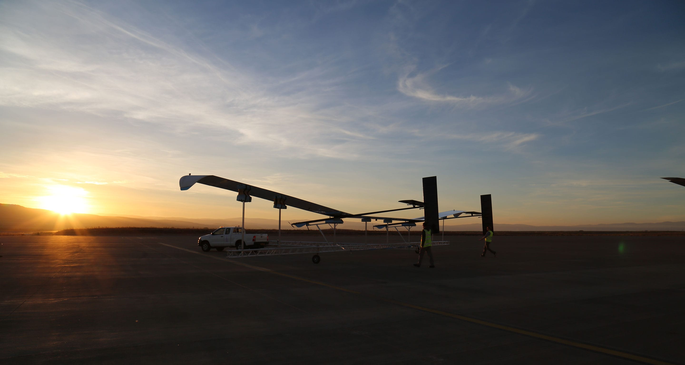
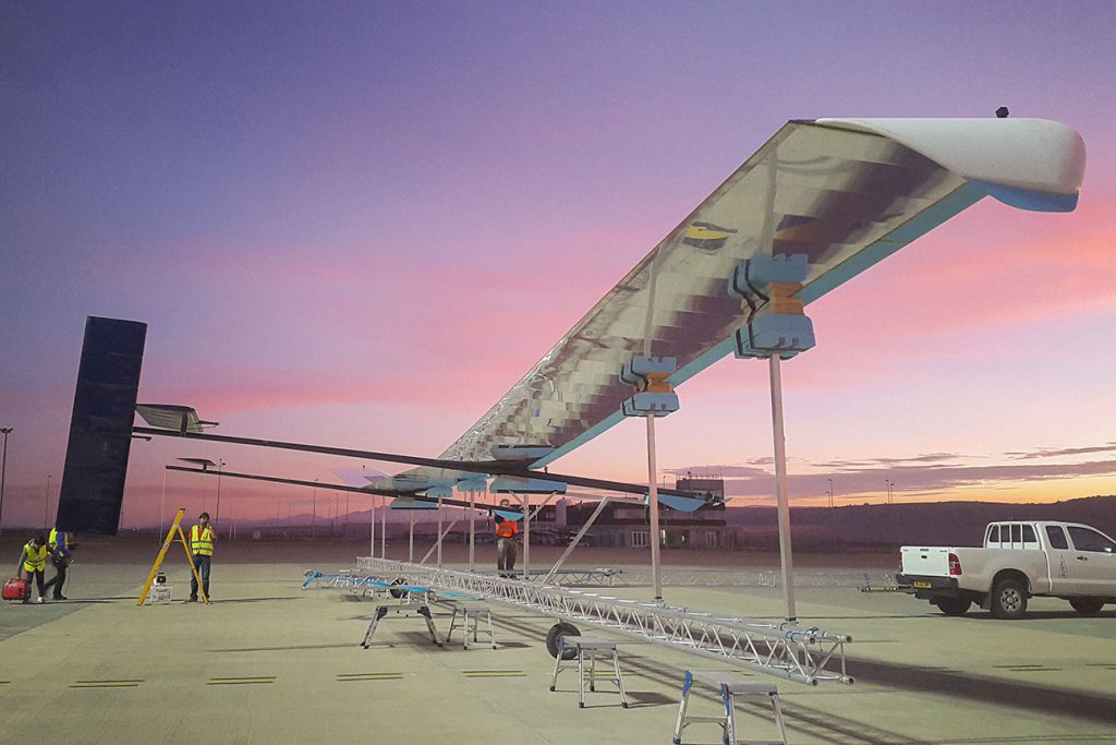
The Astigan craft will fly higher than commercial airliners at 67,000 ft (20,400m), and could circle the Earth for 90 days before it needs to land. It will collect images and data for businesses and organisations to use. Ordnance Survey hopes to launch “fully operational high-altitude tests” of the craft before the end of 2019. Astigan is based in Bridgwater, Somerset and 51% of it is owned by Ordnance Survey.
Geospatial data and mapping derived from aerial imagery capture is only one example of the benefits of #Astigan. See how else it could be used: https://t.co/0H93VF5ZQq pic.twitter.com/t6CgJFiZzw
— Ordnance Survey (@OrdnanceSurvey) February 12, 2019
The Astigan drone is a high-altitude pseudo satellite. Rather than circling the planet, it will be controlled from the ground and sent to map large areas of interest.
Neil Ackroyd, acting Chief Executive Officer of Ordnance Survey explained, “Our current mapping capabilities are driven by two efforts, one is using fixed-wing aircraft to take photos for our revision programme. Then we have our field surveyors on the ground, supported by data from local authorities and the land registry. What the Astigan project does is gives us the capability of using aircraft, but quicker and at significantly lower cost.”
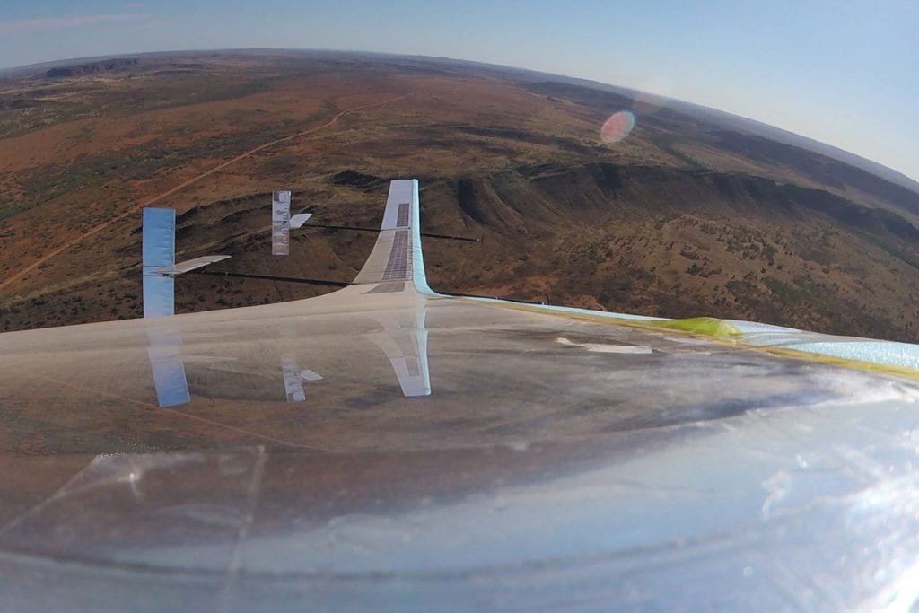
Allaying fears of any privacy breach Mr Ackroyd said, “It’s hard to see people vertically, as you can only see the top of people’s heads.” The cameras the Astigan craft will be equipped with will be similar to those on mapping aircraft. Ordnance Survey stated it would not be possible to identify people on the images. The drone captured images are also unlikely to find their way on services such as Google Maps or Bing since the drone will be used to collect images and data for use in commercial and industrial applications strictly.
Apart from mapping the UK, Ordnance Survey plans to offer mapping services to countries that otherwise might find the costs preventive due to their vast geographical expanse. The platform will also be made available to companies who might also be allowed to attach their own sensors and cameras to track climate change for instance.
Interestingly, Ordnance Survey operates from the same factory that once housed Facebook’s Aquila internet drone project. The space became available after Facebook abandoned its drone plans, but Ordnance Survey says that is where the similarity ends and that there is otherwise no link between the two drone projects.


