Conservation
Drones Used to Map Antarctic Penguins
A team of researchers undertook an unmanned aerial vehicle (UAV) survey with the aim of ascertaining the suitability of the use of small and lightweight fixed-wing electric engine powered UAVs for mapping penguin colonies in remote areas of the Antarctic.
The UAVs flew over colonies along a 30-km stretch of the remote coast of southwest King George Island and northwest Nelson Island (South Shetland Islands, Antarctica) during the austral summer 2016/17 during the five‐day survey comprising 16 flights.
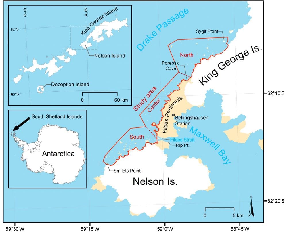
The study area extends for about 30 km along the coast of northwest Nelson Island and southwest King George Island (South Shetlands Islands, Antarctica) and is divided into three subareas (North, Center, South). Maps created with data from the SCAR Antarctic Digital Database.
Researchers Christian Pfeifer, Andres Barbosa, Osama Mustafa, Hans-Ulrich Peter, Alexander Brenning and Marie‐Charlott Rümmler backed by Thuringian Institute of Sustainability and Climate Protection (ThINK), Leutragraben, Germany; Department of Evolutionary Ecology, Natural History Museum, CSIC, José Gutiérrez Abascal, Madrid, Spain; Institute of Ecology and Evolution, Friedrich Schiller University Jena, Dornburger Straße Germany and the Department of Geography, Friedrich Schiller University Jena, Löbdergraben 32, 07743 Jena, Germany completed this drone survey. The results were published in Drones — an international open access, peer reviewed journal.
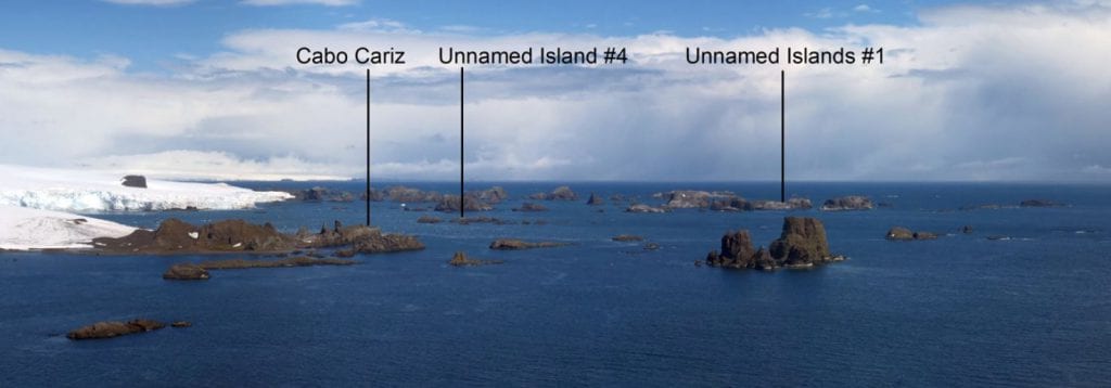
Panorama image of the northwestern coast of Nelson Island showing the typical landscape with numerous islets and rock outcrops along the glacierized coast, including some penguin colonies in the back (photograph taken on 4 January 2017).
Antarctic marine ecosystems undergo enormous changes as a result of climate change and fishery. UAVs have an unprecedented potential for measuring these changes by mapping indicator species such as penguins even in remote areas. The multiple UAV flights covered a total distance of 317 km to determine the exact position of 14 chinstrap penguin colonies, including two small unknown colonies, with a total abundance of 35,604 adults.
The UAV survey was carried out during a period of late incubation or early chick‐rearing before chinstrap penguin chicks leave the nests and form crèches. UAV BORMATEC Ninox was used by researchers to map the remote offshore islets. The UAV’s wings and fuselage were made of foam (Expanded Polypropylene) making it very durable for landings on rougher ground and allowing fast repair of smaller damages in the field.
The off‐the‐shelf UAV was modified to carry a camera and perform long‐distance flights beyond the visual line of sight (BVLOS) even in windy weather. To maximize the flight range, the UAV was equipped with an additional battery. For better control under harsh weather conditions, an airspeed sensor was installed. A lightweight (60g) MAPIR Survey‐2 RGB digital camera was used for data capture. The camera had a 16 megapixel (4,608 × 3,456 pixel) CMOS sensor too.
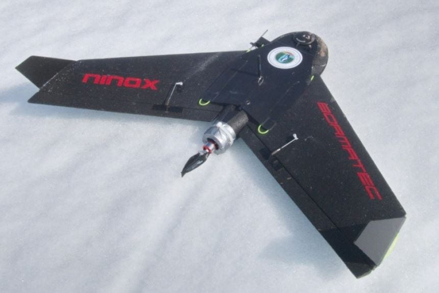
The battery‐powered fixed‐wing UAV BORMATEC Ninox after landing on a snowfield on King George Island.
The images obtained by the onboard camera during the flight were stitched to orthomosaics (UTM 21E/WGS84) for every potential breeding site. Orthomosaics were created using these geotagged images and the photogrammetric image processing software.
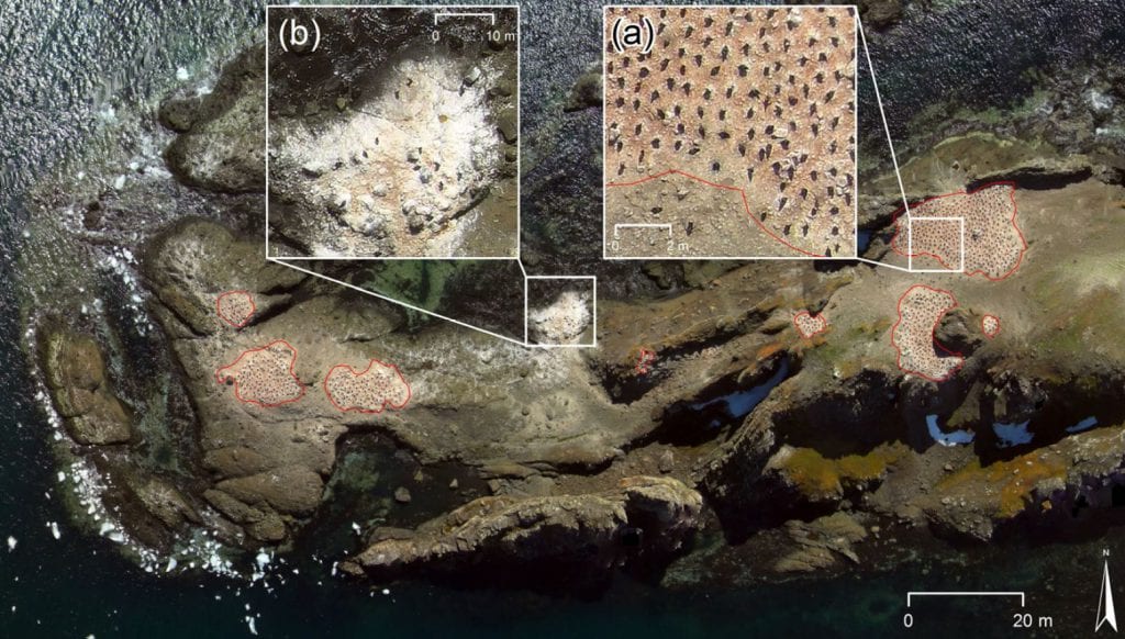
UAV orthomosaic of the chinstrap penguin (Pygoscelis antarcticus) colony at Cabo Cariz (Nelson Island): (a) showing the guano‐covered areas with occupied nests (red polygons) where individuals were counted, and (b) an area in the sublittoral zone close to the shoreline with no occupied nests where individuals were not counted.
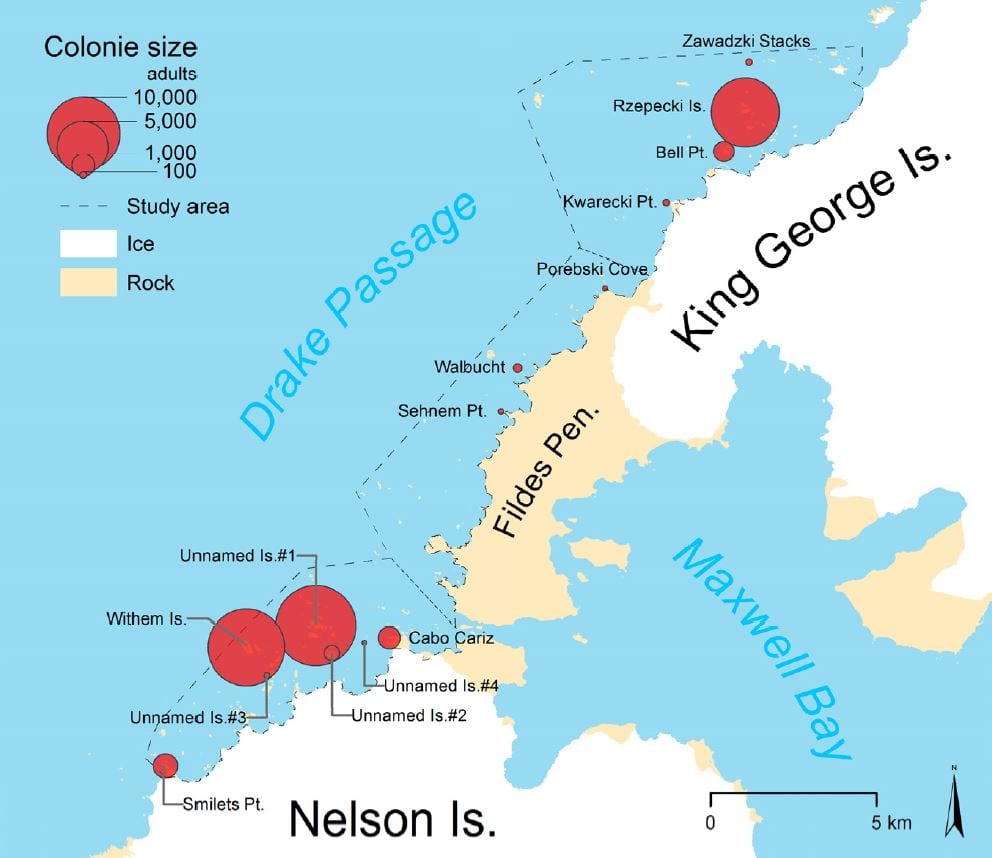
Size and location of chinstrap penguin colonies in the study area.
This study demonstrated the advantages of using a small and lightweight low‐cost fixed‐wing UAV with its low logistic demands and long flight range. Researchers conclude that the developed method efficiently performed a high‐quality survey of chinstrap penguin colonies in a difficult to access area. Using these UAVs instead of the widely used multicopters enables scientist in the Antarctic to map colonies in a radius of at least 10 km around the research stations. This could significantly increase the number of colonies that get monitored and thus help to increase the understanding of the changes in the Antarctic ecosystem.