Connect with us

Drone Below

  • Examples of UAV detection in outdoor tests. Examples of UAV detection in outdoor tests.

    AI

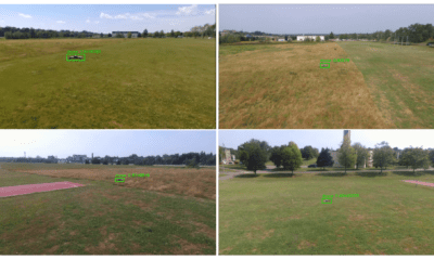
    Drones Chasing Drones Using Deep Learning and AI
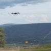
    By August 6, 2019

    Currently, the use of multiple UAVs in drone swarms is garnering huge interest from the research community, leading to the exploration of topics such as UAV cooperation, multi-drone autonomous navigation, etc. Researchers...

  • News

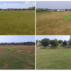
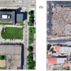
    UAE Using Drones and AI to Map Desert Landscape

    By August 6, 2019

    Drone technology is now assisting with census and mapping of wildlife and green cover in a unique UAE aerial drone project. The environment ministry of the Emirates is meticulously capturing the country’s...

  • UAF photo by Sean Tevebaugh The Skyfront Perimeter UAV taking off from the Alyeska trans-Alaska pipeline right of way near Fox for the first true beyond-visual-line-of-sight domestic flight, approved by the Federal Aviation Administration under the small UAS rule. The UAV flew 3.87 miles along the pipeline corridor. UAF photo by Sean Tevebaugh The Skyfront Perimeter UAV taking off from the Alyeska trans-Alaska pipeline right of way near Fox for the first true beyond-visual-line-of-sight domestic flight, approved by the Federal Aviation Administration under the small UAS rule. The UAV flew 3.87 miles along the pipeline corridor.

    News

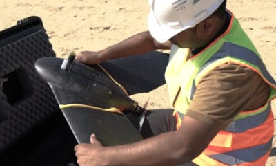
    Drone Flies 1st U.S. BVLOS Mission

    By August 6, 2019

    In a revolutionary step for beyond-visual-line-of-sight (BVLOS) drone flights the Federal Aviation Authority (FAA) in the US permitted the University of Alaska Fairbanks to successfully conduct the first (BVLOS) drone flight. FAA regulations till...

  • An illustrative example for service module. An illustrative example for service module.

    Drone Delivery

    Random Drone Fleet Deployment and Planning
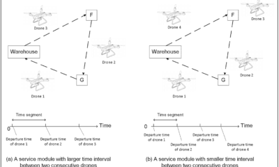
    By August 5, 2019

    Drone delivery is fast gaining popularity in the service and transportation industry. Amazon founder Jeff Bezos first announced that Amazon has developed a fleet of drones to deliver lightweight commercial products in...

  • Visual imagery of the case study locations: Marquette University (a) and University of Texas El Paso (UTEP) (b). Visual imagery of Marquette was captured from a drone on 11 August 2018. Visual imagery of UTEP was pulled from Google Maps on 13 March 2019. Visual imagery of the case study locations: Marquette University (a) and University of Texas El Paso (UTEP) (b). Visual imagery of Marquette was captured from a drone on 11 August 2018. Visual imagery of UTEP was pulled from Google Maps on 13 March 2019.

    News

    Using Drones to Evaluate Urban Land Surface Temperatures
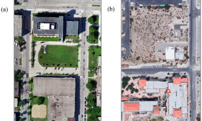
    By August 5, 2019

    Unmanned Aerial Vehicles (UAVs) or drones are now being utilized to help elucidate factors that cause land surface temperature (LST) variability in the urban environment at small spatial scales. Urban areas across...

More Posts

Back To Base (B2B)

Advertisement

Trending

Advertisement
To Top