News
Drone Used to Monitor Dark Zone of Greenland Ice Sheet
Drone Used to Monitor Dark Zone of Greenland Ice Sheet
A large continuous region of an ice sheet in Greenland known as the ‘Dark Zone’ is about 400 kilometers wide and stretches to around 100 kilometres up from the margin of the ice. This western flank of the ice sheet, an area of darkness, has in the past engendered much speculation and mystery with some experts likening the effect to water on top of the ice sheet – often imagined to be startling sapphire blue ponds, rivers and lakes. Now though, new research suggests the effect is created by impurities on the actual ice surface itself.
The research published in Nature Communications says the Dark Zone is covered in a finely distributed layer of dust, and black carbon, which provides nutrition for dark coloured algae which the scientists say is the the main cause of the darkening.
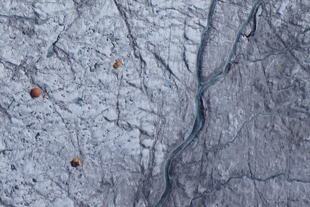
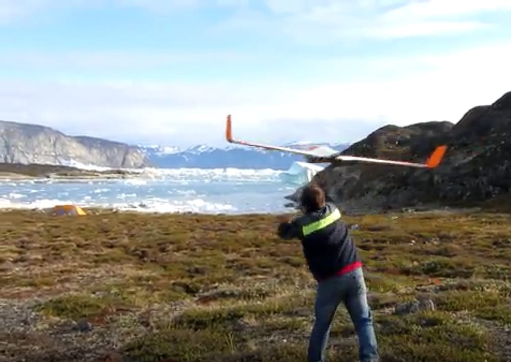
Drone image was captured on Aug. 5, 2014, and offers a view of the tents and scientific equipment in the Dark Snow Project. Dark ice, rich with impurities, was particularly visible east of the melt stream near the camp. Image Credit : Dark Snow Project. J. Ryan/ J.Box /A.Hubbard
Professor Alun Hubbard, the co-author of the study, from Aberystwyth University (CAGE) in Wales, says the Dark Zone is literally a dirty belt of the melting area or the ablation zone of the ice sheet; the darker this ablation zone is, the more of the sun’s energy it absorbs, and the faster the ice melts.
Albedo is a measure of the reflectance of the ice sheet and is the major factor governing how much incoming solar radiation is used to melt the ice and is the main positive feedback in Arctic climate change, bright white surfaces, such as snow or pure ice, reflect the sun’s energy, while dark surfaces absorb it.
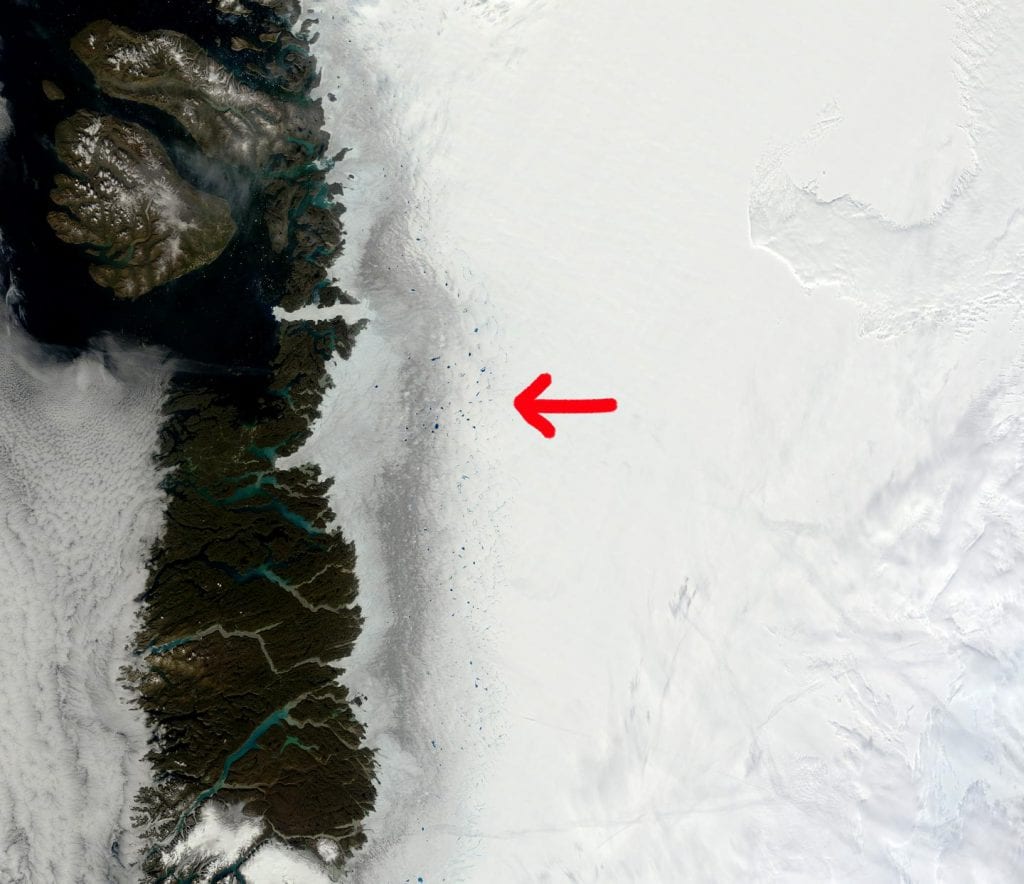
Satellite images of the dark zone of Greenland ice sheet clearly show the impure ice in remarkable contrast to the pristine snow. Satellites however miss out on details in the composition of the impurities. Credit MODIS/NASA
Hubbard says the fact that a large portion of the western flank of the Greenland ice sheet has become dark means that the melt is up to five times as much compared to a brilliant white snow surface.
A major player in this scenario appears to be the ice algae as just a slight increase of the atmospheric temperature and liquid water production seems to promote and trigger algae colonization across the ice surface.
Hubbard says the algae need nutrients and food, basically dust, organic carbon, and water and in summer, these are abundant and the algal bloom flourishes. As algae are dark in colour – they enhance the dark zone and a positive feedback effect is then established where the ice sheet absorbs even more solar radiation producing even more melt.
The Dark Zone of the Greenland ice sheet is a vast area and to date it has been observed by satellites such as MODIS which are an excellent tool for capturing the big picture across the entire Greenland ice sheet,but provide only broad images of what is happening on the ice surface.
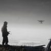
For this study however the scientists used relatively modest drones – or unmanned aerial vehicles (UAV) – to survey the darkened ice belt.
The drone cameras captured unprecedented detail of the Dark Zone, taking hundreds of images with pixel resolutions on the centimeter scale with an operating range of hundreds of kilometres. Hubbard says when comparing it to camera pixels, even the best satellites for the ice sheet imaging have resolution of tens of metres. This enabled the team to see in real detail what the dark zone is made up of.
The researchers say the UAV survey across the ablation zone of the ice sheet bridged the gap between people on the ground studying what’s under their feet in just one part of the ice sheet, and the satellite data that shows what’s going on across the entire ice sheet.
The UAV survey provided amazing detail, allowing the scientists to identify and characterize all the different surface types and impurities across the entire dark zone, rather than a small area.
The UAV images used in this study were collected by Johnny Ryan (Aberystwyth University; Brown University; University of California), Jason Box (GEUS) and Alun Hubbard (Aberystwyth University/CAGE) in the summer of 2014.
Reference: https://www.nature.com/articles/s41467-018-03353-2