AI
Drones and Sensors Used to Enhance Detection of Archaeological Cropmarks
Drones and Sensors Used to Enhance Detection of Archaeological Cropmarks
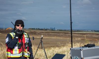
Drones were deployed to assist in archaeological exploration in Spain recently. The Department of Prehistory, Ancient History and Archaeology, ATHAEMHIS Group, Faculty of Geography and History, University of Salamanca; School of Land Surveying, Geodesy and Mapping Engineering, Polytechnic University of Madrid, Camino de la Arboleda and the Department of Geography and Spatial Management, Geoforest-IUCA Group and University of Zaragoza collaborated to carry out drone based experiments at the Roman Republican city of La Caridad (Teruel, Spain), for archaeological exploration of through multispectral and thermal aerial images to enhance detection of archaeological crop marks for the identification of buried archaeological remains.
A combination of in-house manufacturing and commercial products was used in this study. Two different drone systems were used: a Mikrokopter designed by Tecnitop SA (Zaragoza, Spain) and an eBee produced by SenseFly Company (Cheseaux-sur-Lausanne, Switzerland). Six drone sensors were tested and compared in terms of their ability to identify buried remains in archaeological settlements by means of visual recognition. Their sensors possessed varying spectral ranges and spatial resolutions. This experiment was aimed at testing the potential of this technology for archaeological benefits.
The Tecnikopter an 8-engined UAV with a folding carbon structure and a Mikrokopter v. 2.02 ME flight control board were used. This system integration is designed by Tecnitop SA together with the University of Zaragoza Department of Design and Manufacturing, enabled by the SME (Small and Medium Enterprise) Technology Transfer Program of the Aragonese Foundation for Research and Development.
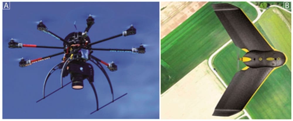
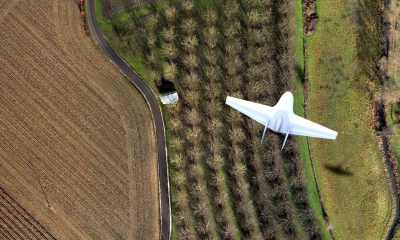
Drone systems: (A) The Tecnikopter (B) eBee.
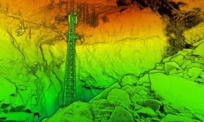
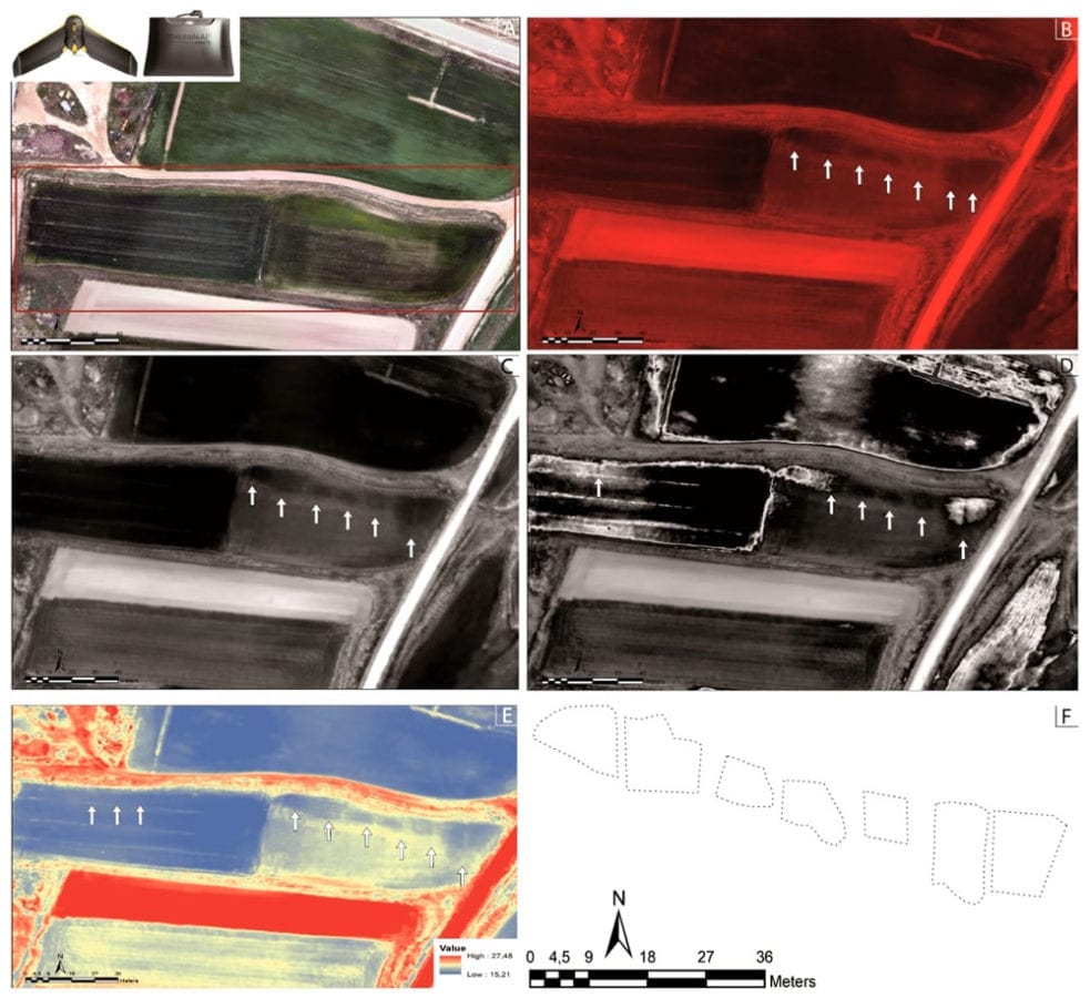
The project arose from the necessity to create a platform capable of integrating specific sensors, in this case photogrammetric and multispectral cameras. An area of 5 hectares was covered per flight approximately. A partially excavated site at the Republican Roman city of La Caridad (Teruel, Spain) was monitored. Flights with the Tecnikopter were performed using the Tetracam MiniMCA6 multispectral camera and with the commercial eBee, a multispectral camera (the MultiSpec 4C) and a thermal camera (the ThermoMap) as well. The method used for the comparison of the tools has been based on direct visual inspection, as in traditional aerial archaeology. The cereal crop fields chosen to facilitate experimentation with different tools were located in the suburban zone (outside of walls) of the old Roman city which grow the same cereal every year (wheat).
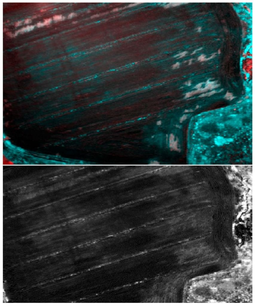
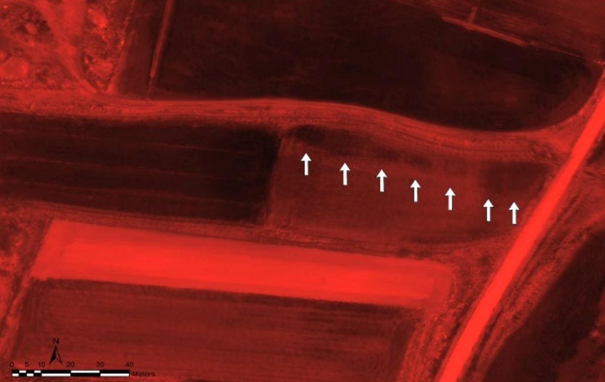
Archaeological structures not related to Roman houses (Area E in Figure 2): (1) False color composition of PCA of Tetracam, bands 123 with an equalize enhancement of the histogram; (2) NDVI with band 920 and an equalize enhancement of the histogram.
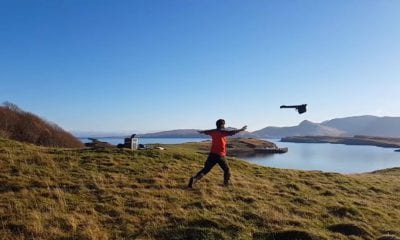
The eBee is a professional and a fully autonomous mapping drone manufactured by SenseFly Company which is capable of capturing high-resolution aerial photos and generating accurate orthomosaics. This flying wing is a very light UAV (700 g with the camera) and its wingspan is 96 cm. It is also equipped with an on-board artificial intelligence system, which analyzes data from an Inertial Measurement Unit (IMU) and an on-board GPS to optimize every aspect of its flight. A lithium polymer battery provides minimum 50 min of continuous operation. The flight is operated with the eMotion® software, which comes along with the eBee allows for the flight to be planned before the mission and also for interaction with the drone during the flight.
The commercial system combination of MultiSpec and ThermoMap facilitates the entire work process—both in data collection in the field and in the process of composition of the mosaics and subsequent image processing.
Demonstrations based on the method of direct visual inspection established that the most effective tool was the combination of eBee with the ThermoMap system. As evident from the results obtained, the archaeological remains are best visualized in the field when the crop has begun its senescent phase.
Consequently, the ideal solution emerged was to combine the available tools to achieve the best topographic results using one method, and remote sensing results using another. These new tools (drone plus different sensors) could become effective contributors to the modern archaeological praxis as a common and standardized procedure in all explorations prior to or could even replace archaeological excavation, especially at sites which are not threatened by looting and/or construction works.
Images via eBee
Conclusions
These trials affirm that the use of drones with multispectral or thermal cameras is a useful tool in the field of archaeology. With the in-house system (Tecnikopter and Tetracam), and the eBee and the Multispec 4C multispectral camera have made the process of data capture and post-processing faster.
This paper prepared as a synopsis of these trails shows that the use of drones with multispectral or thermal cameras is a useful tool in the field of archaeology and archaeological surveying. The use of these tools was recommended to become a common standardized procedure before starting an excavation. However, until now no comparison of data obtained with different drone systems and sensors, indicating which method obtained the best results, has been published. It must be noted however, that the character of archaeological features is so variable that it is not possible to establish a single technique or tool as universally successful.
Citation: Agudo, Paula Uribe and Pajas, Jorge Angás and Pérez-Cabello, Fernando and Redón, Jaime Vicente and Lebrón, Beatriz Ezquerra, “The Potential of Drones and Sensors to Enhance Detection of Archaeological Cropmarks: A Comparative Study Between Multi-Spectral and Thermal Imagery“, http://www.mdpi.com/2504-446X/2/3/29
| doi:10.3390/drones2030029