Technology
NASA Adopts NextNav’s 3D Geolocation Technology for Urban Drone Operations
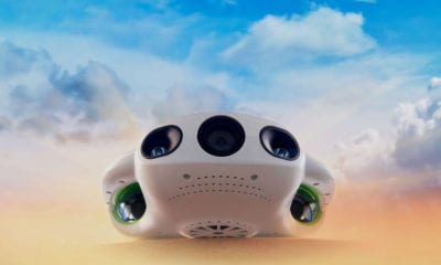
In looking for solutions to refining its (UAM) platform, a transportation management system for drone deliveries NASA has chosen geolocation leader NextNav’s Metropolitan Beacon System (MBS).
According to a press release, NextNav’s MBS is unique in its ability to facilitate drone missions where GPS signals aren’t reliable enough to locate a UAV’s horizontal and vertical location. This feature is vital for successful passenger drone or drone delivery operations to function as part of the space agency’s CERTAIN (City Environment for Range Testing of Autonomous Integrated Navigation) facilities at the Langley Research Center in Virginia.
“NextNav’s MBS system provides us with new tools for the development of navigation systems in environments where GPS has traditionally been challenged,” said Evan Dill, who works in NASA’s Safety-Critical Avionics Systems Branch.
While NextNav’s location services will be bolstered by GPS signals where available, the company’s primary focus keeping public safety in mind is ensuring a sort of backup in case one mode of localization should fail and generates the need to reliably know a drone’s location horizontally and vertically is critical to ensure safe operations in urban air traffic corridors.
“We are proud to work with NASA and integrate MBS into its urban drone operations,” said NextNav CEO and co-founder Ganesh Pattabiraman. “NASA’s acquisition of the MBS system is an exciting milestone for MBS technology and a great partnership with NASA to address the key challenges in urban drone navigation and make it possible to explore new opportunities in unmanned operations.”
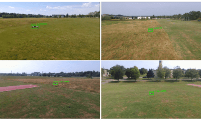
Further in its quest to find solutions to challenging tasks in GPS-deprived environments, NASA put a group of MIT students on the problem. The students developed a plan for a fleet of drones that can autonomously fly through a forest, communicate with one another and stitch together a 3D map of the environment—all sans GPS and without hitting trees.
To counter challenge of identifying trees without GPS the student team used onboard LiDAR to identify the trees and compute the configuration of the trees and use that as a unique signature of the place. For lack of Wi-Fi in a remote forest or job site the team decided adding a transmitter to the vehicles. As soon as the vehicles are at certain proximity to one another they detect and establish a communication link and collaborate.
The quadcopters used in the experiment have onboard laser-range for implementing SLAM to position the drones in space and scan the environment at the same times. Algorithms guide the drones so they map efficiently and avoid re-mapping already covered ground. One of the student’s immediate goals is to train the airborne system to spot missing hikers and send their coordinates to the ground station.
The FAA estimates that over 700,000 commercial drone missions by 2022 necessitating drone navigation solutions to be planned and tested in time.