DJI
Drones Used to Track Shark Movements Around Australia’s Heron Island
The study of the aquatic environment is highly complex in nature due to the abruptly changing environment in terms of flow of layers of water varying with depths, predators moving around prey and prey inviting predators from a far. Insight into how and why animals move within and across environments can be obtained by understanding the relationship between the environment and movement trajectories. There are certain tools, techniques and systems especially designed for aquatic study. However, each method has its own pros as well as cons.
Different methods offer different levels of accuracy and precision when it comes to tracking aquatic animals – the accuracy of tracking small, fast moving vertebrates. Most of the techniques currently under usage rarely allow direct continuous behavioral assessments or the recording of environmental interactions, especially for highly mobile species.
Acknowledging the limitations in modern systems currently being applied for marine study, the authors of a research article published in the MDPI journal Drones 2018 and titled,”Drone-Based High-Resolution Tracking of Aquatic Vertebrates“, trial a novel method of assessing small-scale movement patterns of marine vertebrates using an unmanned aerial vehicle that could complement longer-term tracking approaches.
Their approach is unlikely to have behavioral impacts on the marine life under study and provides high accuracy and high frequency location data while subsequently allowing quantitative trajectory analysis. Another merit of their approach with using Unmanned Aerial Vehicles is that tracking is relatively low cost compared to single-use acoustic and GPS tags.
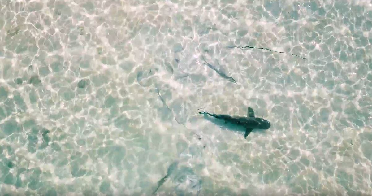
The authors studied their system implemented with UAVs by testing them as they studied the movement patterns of sharks at Heron Island, Great Barrier Reef, Australia.
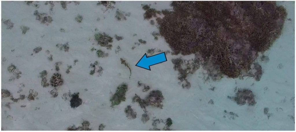
Aerial view from the unmanned aerial vehicle (UAV) while tracking movement and behaviour of an Epaulette shark at an altitude of ~2 m; a shark with an approximate length of 50 cm is indicated by the blue arrow.
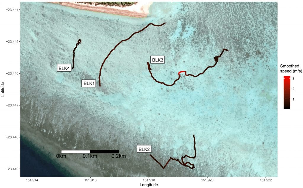
Locally-smoothed Blacktip Reef Shark (Carcharhinus melanopterus) tracks and movement speed recorded at Heron Island reef crest using a UAV. Satellite imagery courtesy of Google.
Setup and Equipment Used
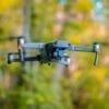
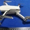
The drone chosen for the task was DJI Phantom 3 Professional, which is a conveniently available commercial drone that can be operated in GPS mode with the DJI GO app on any phone or tablet.
The researchers did not install their custom-selected camera on the drone. The built-in camera carried by the drone has an f/2.8 lens along with a 94 degree field of view. The camera is capable of recording 1080p footage at 30 frames per second. The researchers installed a polarized lens on the same camera to minimize disturbance from reflection.
Working
The drone was operated such that it would fly forming an “S” shaped pattern over Heron Island’s inner reef until it would detect a shark’s presence.
As soon as a shark was detected, the drone would immediately lower its altitude from 15 meters to as low as 2-3 meters so manually hover over the shark at a lower altitude.
The drone would then travel with the shark over the ocean, mimicking its movements in one projection of course while at the same time recording this movement with the built in GPS module of the drone as well as recording a 1080p 30 fps footage of the entire track session of the shark.
Once a shark was spotted, the UAV was used to track it until the shark was lost or until the battery of the drone fell to 30% capacity, enough to be able to safely return the drone to its base on Heron Island.
Potential Error(s) in Working
According to the authors of the study, the greatest source of measurement error associated with this method is likely to be pilot error. This would cause the UAV to deviate from its position above the tracked animal. In windy conditions, piloting skill becomes more important to produce accurate measurements.
Wind-induced error could be corrected by attempting to fly over a stationary point for 30 s before a track was commenced. The movement over this time could then be used to correct movement rates for any subsequent tracking data.
Results
The researchers and the staff performing the study were able to track fourteen sharks successfully for three to eleven minutes each including nine Epaulette sharks, four Blacktip Reef sharks, and one Lemon shark.
The purpose of this study and the mission for this newly developed technique that uses drones was successful extraction of accurate trajectory data that was in turn to be used for studying the different patterns of movement of different types of sharks.
As expected, the trajectories of individual sharks were highly variable, both within and between species, with some sharks having large numbers of pauses, and others swimming continuously during the tracks.
Trajectory analysis revealed that Epaulette sharks displayed sinusoidal movement patterns, while Blacktip Reef Sharks had more linear trajectories that were similar to those of a Lemon shark.
Citation: Drone-Based High-Resolution Tracking of Aquatic Vertebrates, Vincent Raoult, Louise Tosetto and Jane E. Williamson, Drones 2018, 2(4), 37; https://doi.org/10.33/drones2040037
http://www.mdpi.com/2504-446X/2/4/37