Conservation
Monitoring Tasmania’s Grasslands via Drone
The Australian state of Tasmania is a region that was once populated by expanses of native grasslands and open woodlands. However, the communities have seen a significant decline since the European colonization, which is how native vegetation was replaced by traditional European crop and forage specs.
All of this makes this region great for ecology and biodiversity research – specifically the native grassland community which has been steadily declining. The aim of a recent study is to classify the lowland native grassland communities in this region by using unmanned Aircraft System (UAS) imagery.
Using 20 Band Hyperspectral Snapshot PhotonFocus Sensor
The researchers of this paper, titled ‘Classification of Lowland Native Grassland Communities Using Hyperspectral Unmanned Aircraft System (UAS) Imagery in the Tasmanian Midlands’, used 20 band hyperspectral snapshot PhotonFocus sensor that was mounted on an unmanned aerial vehicle, with a spectral range of 600 to 875 nanometers.
“Four vegetation classes were identified for analysis including Themeda triandra grassland, Wilsonia rotundifolia, Danthonia/Poa grassland, and Acacia dealbata. In addition to the hyperspectral UAS dataset, a Digital Surface Model (DSM) was derived using a structure-from-motion (SfM). Classification was undertaken using an object-based Random Forest (RF) classification model,” the abstract of their paper notes.
The three authors, Bethany Melville, Arko Lucieer and Jagannath Aryal, were confident that the application of such unmanned aircraft systems (UAS) for environmental remote sensing applications has become increasingly prevalent over the past few years. Moreover, they think that the ability of UAS to provide ultra-high spatial resolution datasets at relatively low costs makes them attractive for many researchers in the field. In grassland monitoring and mapping, UAS are very attractive mostly because of their ability to collect spatially detailed datasets on demand.
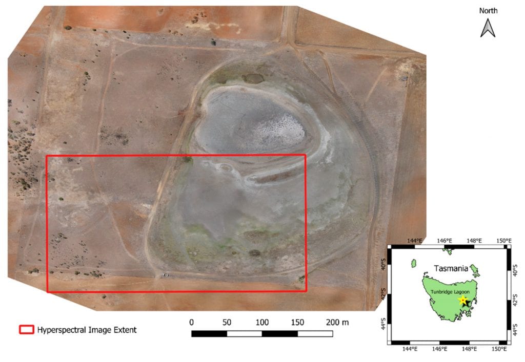
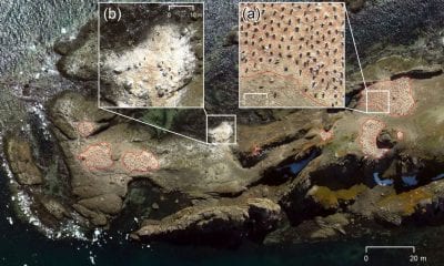
Overview of Tunbridge Township Lagoon showing extent of the lake, and distribution of vegetation communities. The extent flown by the hyperspectral sensor within the large site is shown in red.
UAS as the Principle Platform in Grassland Research
There have been several studies that have employed UAS as the principle platform in grassland research. However, the majority of them using UAS within the realm of ecological research have focused on the use of ultra-high spatial resolution datasets collected using broadband multispectral sensors or RGB cameras mostly because of their low cost.
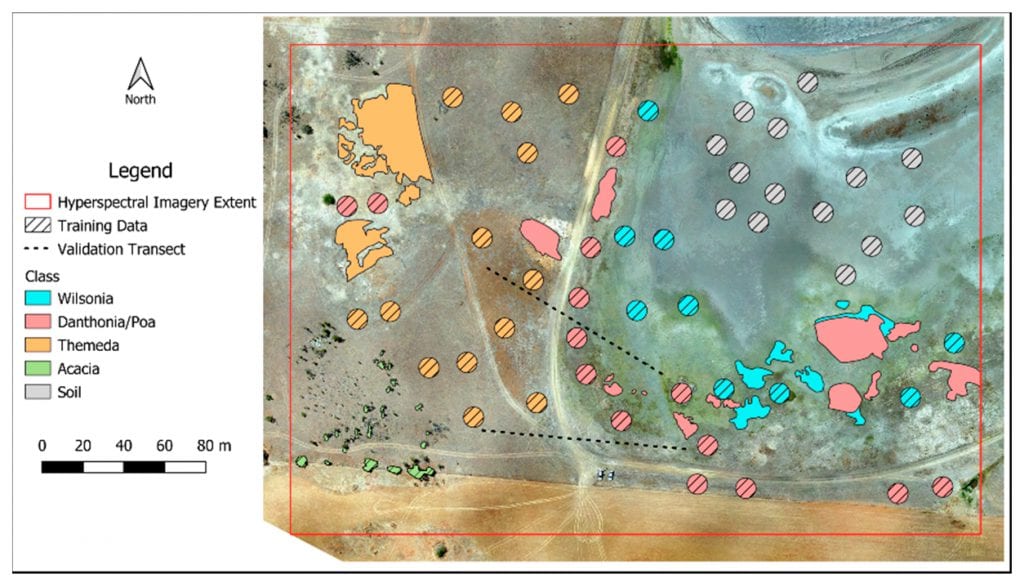
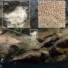
Distribution of training and validation points throughout the study site. Hashed areas indicate data used for training, while un-hashed polygons were used for validation.
As they showed, their study differs a lot from the studies done so far, stating the following:
“The development of frame-based and snapshot hyperspectral cameras, however, eliminates the need for complicated geometric processing, and makes the collection of hyperspectral datasets from UAS much more feasible. The use of such sensors has enormous potential for ecological vegetation mapping and monitoring due to the high degree of spectral information captured. This study aims to show the potential of a frame-based hyperspectral system for the vegetation community mapping in a highly heterogeneous grassland environment.”
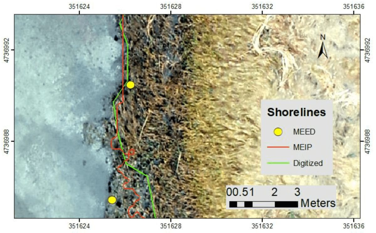
After outlining all of the technology that they used in the study, the authors came with results which are set in figures, numbers and thermal maps. Basically, they have divided the parts where the soil and grassland types differ. Thanks to their digitized accuracy, they calculated the percentage of all soil types and correctly classified them in tables.
The Accuracies & Inaccuracies: Final Results
In the final part, they noted that the RF training model and the accuracies obtained are much higher than the accuracy obtained for any of the final classification results. In other words, their research measured a high importance for the two topographic variables.
However, there were some inaccuracies as well:
“The primary source of inaccuracy in the classification results was confusion between the Danthonia and Wilsonia classes. The confusion in this case was only in one direction, in that a large proportion of the Danthonia class was erroneously classified as Wilsonia, while there was very little misclassification of Wilsonia as Danthonia.”
To sum things up, the authors of this paper concluded that their work shows that discrimination between similar vegetation communities can be successful using hyperspectral, frame-based UAS mounted sensors and a spectral range that is quite narrow, with bands only covering the red and near-infrared portions of the spectrum from 600 to 875 nm.
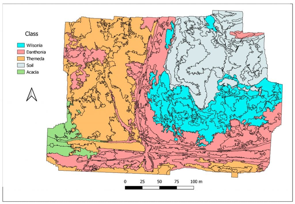
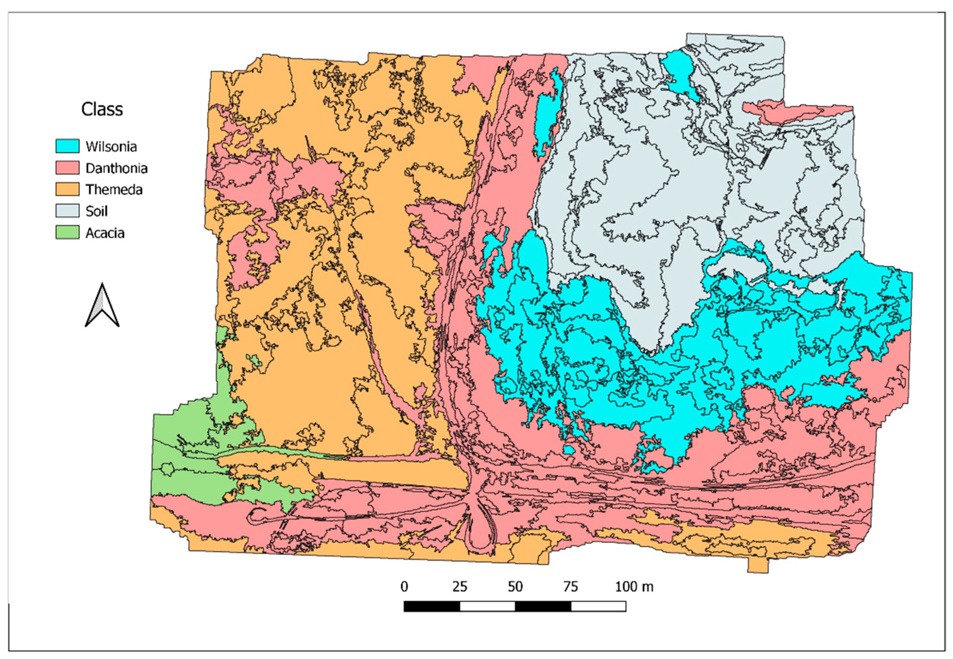
Random Forest classification results for all community classes. General class delineation is good. However, there is a significant omission and commission of the Acacia class, and some observable confusion between the Wilsonia and Danthonia classes.
Conclusion
As they noted, the findings of their study indicate that “high spectral resolution UAS datasets can provide detailed community discrimination at a fine spatial scale, and show great potential for community and species level mapping” and that the higher classification accuracies obtained for the transect validations indicate that accurate assessment of community gradients requires “the collection of high spatial frequency field observations over a large area.”
Citation: Classification of Lowland Native Grassland Communities Using Hyperspectral Unmanned Aircraft System (UAS) Imagery in the Tasmanian Midlands
Bethany Melville, Arko Lucieer and Jagannath Aryal, Drones 2019, 3(1), 5; https://doi.org/10.3390/drones3010005 (registering DOI) – https://www.mdpi.com/2504-446X/3/1/5