News
Drones Used to Improve Crash Site Investigations
In a collaborative effort the Purdue University and the Tippecanoe County Sheriff’s Office have conducted drone trials in an attempt to test reduced reaction time of first responders at crash sites, especially those on the interstate which lead to closures and huge traffic jams.
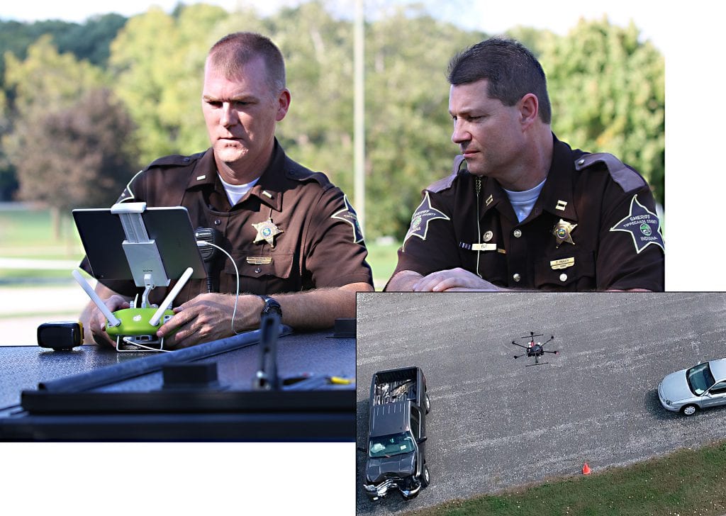
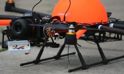
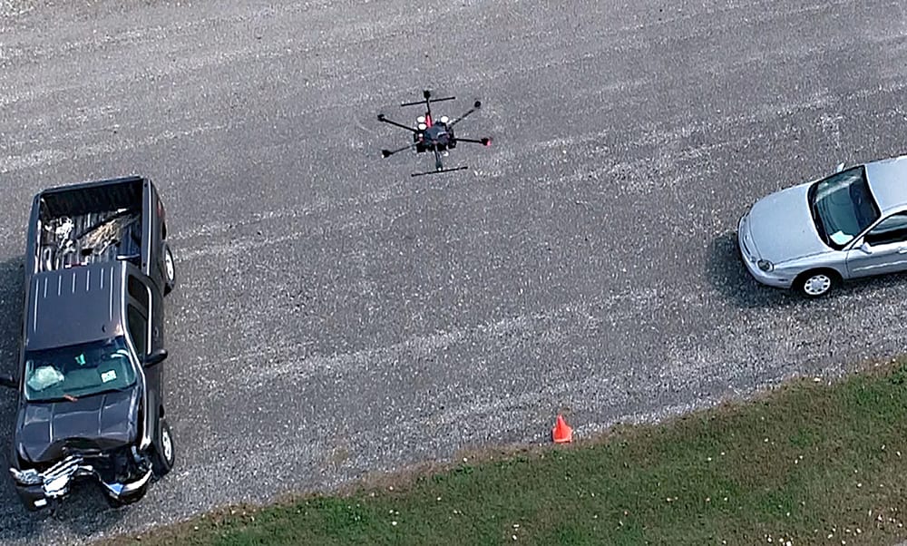
Capt. Rob. Hainje and Capt. Terry Ruley of the Tippecanoe County Sheriff’s Office test drone technology for use at vehicular crash sites. The office used the technology to map vehicular crash scenes 20 times in 2018. (John Bullock and Erin Easterling/Purdue University)
An update from Research Foundation News on Purdue University web site release states that Darcy Bullock, the the Lyles Family Professor of Civil Engineering and Joint Transportation Research Program director at Purdue University and John Bullock, a sophomore in the School of Mechanical Engineering and research assistant on the project, worked with local public safety colleagues to develop field procedures and post processing of images to create orthorectified images that clearly illustrate the position of vehicles, infrastructure and general terrain adjacent to the crash site. This reduced the reaction time of first responders drastically.
While Conventional mapping a severe or fatal crash can take two to three hours depending on the severity of the accident, Ayman Habib, Purdue’s Thomas A. Page Professor of Civil Engineering says, “Our procedure for data collection using a drone can map a scene in five to eight minutes, allowing public safety officers to open the roads much quicker after an accident.” Habib developed the photogrammetric procedures and envisions even more uses for the technology. The drones are programmed to use a grid-type path and record about 100 photos in two-second intervals. This post processed data is used to develop an accurate scale map that helps create a 3D print of the scene.
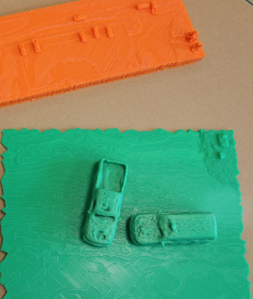
3D prints of accident scenes can help law enforcement and first responders better study and document vehicular crash scenes. (Erin Easterling/Purdue University)
It is one of the most vulnerable times for “secondary accidents,” which often can be worse than an original source of the slowdown, according to the U.S. Department of Transportation’s Federal Highway Administration. “It’s the people at the back of the queue where you have traffic stopped who are most vulnerable and an approaching inattentive driver doesn’t recognize that traffic is stopped or moving very slowly until it is too late,” says Bullock.
Capt. Rob. Hainje and Capt. Terry Ruley of the Tippecanoe County Sheriff’s Office tested drone technology for use at vehicular crash sites. In fact the Office has already used drones to map crash scenes 20 times in 2018 and another 15 times in the same year to support specialty law enforcement teams throughout Tippecanoe County and in neighbouring counties and jurisdictions.
“Overall, it can cut 60 percent off the down time for traffic flow following a crash,” said Hainje adding, “the collaboration with Purdue faculty and students has been tremendously effective in helping our law enforcement, first responders and special teams. The drone technology with the thermal imaging capability helps with all types of emergencies such as search and rescue, aerial support over water for diver teams or in wooded areas and for fugitive apprehension.”
The technology is not only faster than traditional approach but can also provide high-quality maps, imagery, and models for post-crash investigation by engineers and public safety officials. It also has several civil engineering applications beyond crash scene mapping like being used for material estimation in construction projects.