News
Monitoring Large and Complex Wildlife Aggregations with Drones
The recent advancements in drone technology have led us to believe that these small units can be used for monitoring, filming, managing wildlife problems and doing a plethora of other activities, generalizing their framework for their applications to complex wildlife aggregations (which is still lacking).
This motivated the authors Mitchell Lyons, Kate Brandis, Nick Murray, John Wilshire, Justin McCann, Richard Kingsford and Corey Callaghan of the School of Biological, Earth and Environmental Sciences, UNSW Australia, to present a generalized semi-automated approach where machine learning is in the focus, mapping targets of interest in drone imagery supported by predictive modelling for estimating wildlife aggregation populations.
The Mapping And Modeling Approach Applicable To Different Colonies
An important aspect of the paper is the mapping and modeling approach which was applicable to all four colonies of drones without modifications, effectively dealing with variations in terms of nest sizes, shapes, colours and density of the wildlife segments. With this, the approach proved itself as a significant improvement for monitoring large and complex aggregations of wildlife – and with that offering an innovative solution for monitoring large and complex aggregations where ground counts are costly, difficult and almost impossible.
The general framework which the authors propose requires minimal technical ability and is fully open-source. It aims to manually count targets of interest (individual animals, breeding pairs and nests) from aerial images, regardless of their capture platform.
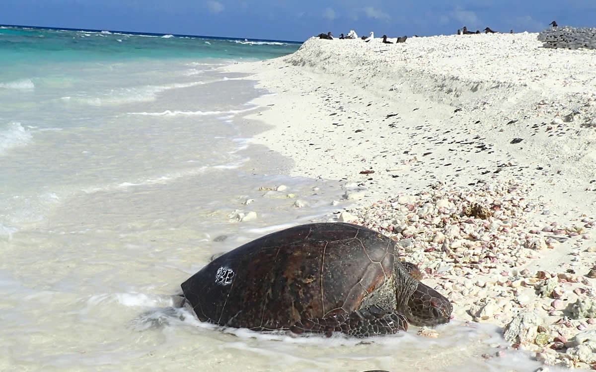
“In this paper, we develop a semi automated framework for monitoring large complex wildlife aggregations using drone acquired imagery. We use the case study of colonial waterbird breeding colonies because they present the key challenges currently inhibiting uptake of drone-based methods. The colonies cover large spatial extents and can have range of density of animals across these extents, there are many thousands of highly mobile individuals that cannot be contained to single drone images,” the authors suggest.
Flight Planning, Image Acquisition And Processing With Different Materials And Methods
They also detail flight planning, image acquisition and processing, manual and automated methods for mapping and accurately counting nests. Software-wise, they include the Google Earth Engine and R code required for their analysis along with a web-app to explore drone data, intermediate machine learning predictor and nest map layers.
When it comes to the materials and methods used, the primary motivation of the authors was mapping and counting nests for breeding colonial waterbirds with wide applicability. This methodology worked with different colonies and was made transferable across different environments and applications, requiring limited technical modification or ability.
The authors used a DJI Phantom 3 Professional quadcopter with the stock single sensor red/green/blue (RGB) camera, colonies were within large flooded extents so multi-rotor drones were the only option with no landing area for fixed wing drones. The imagery was processed using the commercial software Pix4DMapper which uses a photogrammetry technique called ‘structure from motion’ to identify points in overlapping images, ultimately generating a 3D point cloud reconstruction of the landscape.
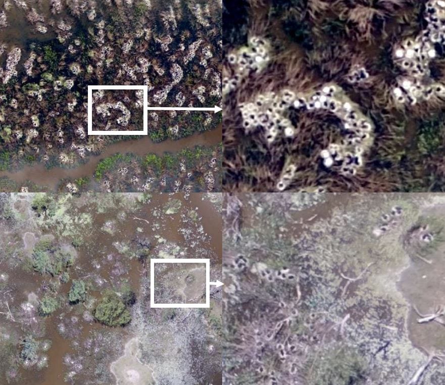
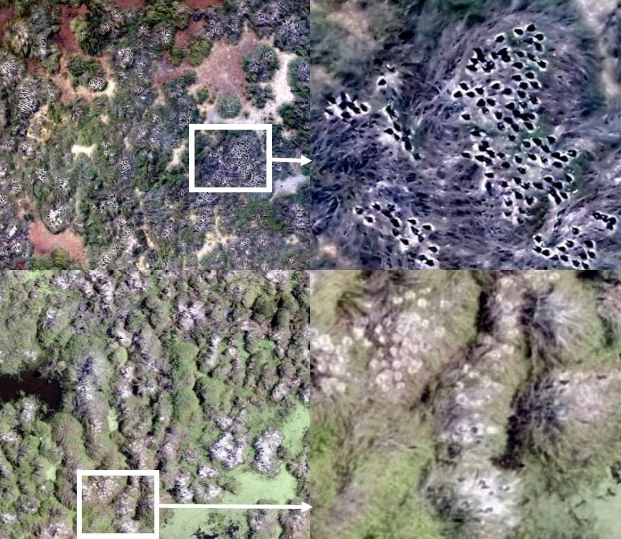
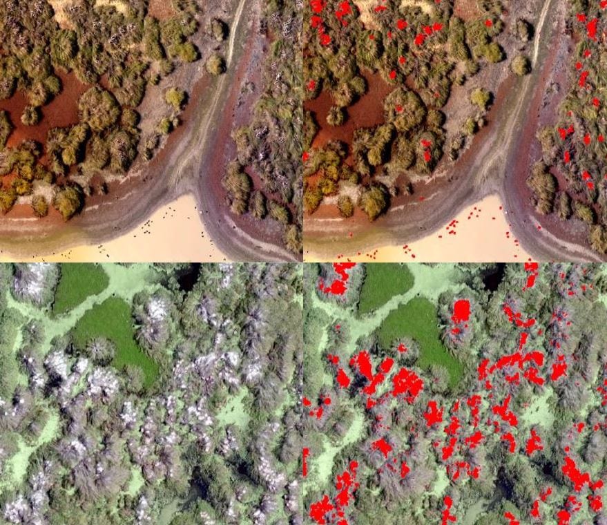
Example drone imagery showing the variation in nest types and environments across four breeding colonial waterbird colonies. Images from top row to bottom row are from the following colonies: Merrimajeel, Zoo Paddock, Eulimbah and Block Bank
A Semi-Automated Approach That Includes Machine Learning Mapping
With this, the authors propose a semi-automated approach for nest counting. As they describe it, the approach is modular and adaptable to variable target properties – as well as scalable to large spatial extents, applicable to multiple colonies.
Subsequently, the authors also applied a supervised machine learning approach that maps nests at each colony, defining them as any material or bird that constitutes of a nest or a nest clump based on their experience in the field.
The training data set was compiled by extracting the pixel values for each image metric layer within a 10 cm buffer, around each training nest and non-nest point so that the random forest classifier was a binary nest and non-nest classification.
Results & Conclusion
The results of this survey showed a massive potential for uptake of semi-automated methods as well as huge transferability across environments and spatial scales which prevents widespread adoption of semi and fully automated methods in wildlife monitoring.
With major improvements in data collection, interpretation and understanding, the authors provided insights which include cost savings and potentially improved accuracy. In this field, applications will continue to grow assisted by development of similar semi-automated methods such as the one presented in this paper.
Citation: Lyons, M., Brandis, K., Murray, N., Wilshire, J., McCann, J., Kingsford, R., & Callaghan, C. (2019, January 2). Monitoring large and complex wildlife aggregations with drones. https://doi.org/10.32942/osf.io/w247h