AI
Drone and AI Used for Solar Inspection
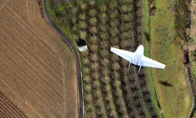
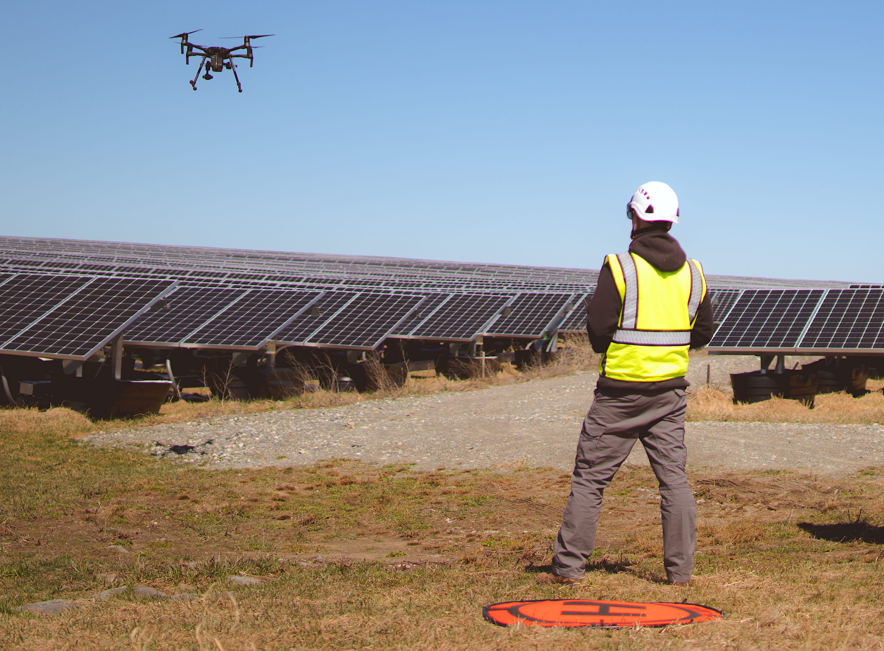
Maintenance of solar farms is a huge challenge for the solar industry. Conventional techniques involve running electrical tests on random sections of solar cells in order to identify problems. Drones equipped with thermal cameras are being used for some time now and have improved the speed of data collection.
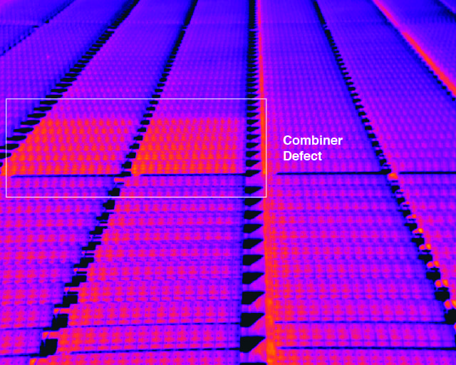
A bigger challenge lies in drone data analysis to interpret a never-ending flow of unstructured data. Raptor Maps a start up by ex-MIT students has the solution. According to MIT news the drone start up which uses software analyzes imagery from drones and diagnoses problems down to the level of individual cells. The system can also estimate the costs associated with each problem it finds, allowing technicians to prioritize their work and owners to decide what’s worth fixing.
“We can enable technicians to cover 10 times the territory and pinpoint the most optimal use of their skill set on any given day,” Raptor Maps co-founder and CEO Nikhil Vadhavkar says.
Raptor Maps was founded by Eddie Obropta ’13 SM ’15, Forrest Meyen SM ’13 PhD ’17, and Vadhavkar, who was a PhD candidate at MIT between 2011 and 2016, (Meyen left the company in 2016).. The founders decided to create a drone start up focused on the agriculture industry initially. The plan was to build drones equipped with high-definition thermal cameras to gather data, and then create a machine-learning system to gain insights on crops as they grew. The founders received guidance from MIT’s Venture Mentoring Service and the Martin Trust Center. In the spring of 2015, Raptor Maps won the MIT $100K Launch competition and began working with the owners of two large farms.
In 2017, after making their software publicly available Raptor Maps discovered that most of its customers system were applying the system work on thermal images of solar farms instead of real farms.
“Solar is similar to farming: It’s out in the open, 2-D, and its spread over a large area,” Obropta says. “And when you see [an anomaly] in thermal images on solar, it usually means an electrical issue or a mechanical issue — you don’t have to guess as much as in agriculture. So we decided the best use case was solar. And with a big push for clean energy and renewables, that aligned really well with what we wanted to do as a team.”
Since deciding to focus on solar exclusively around the beginning of 2018, Raptor Maps has found success in the industry by releasing its standards for data collection and letting customers — or the many drone operators the company partners with — use off-the-shelf hardware to gather the data themselves. Then the data is submitted to the company and the system creates a detailed map of each solar farm and pinpoints any problems it finds.
“We run analytics so we can tell you, ‘this is how many solar panels have this type of issue; this is how much the power is being affected,’” Vadhavkar says, adding “And we can put an estimate on how many dollars each issue costs.”
Raptor Maps processed the data of 1 percent of the world’s solar energy in 2018, amounting to the energy generated by millions of panels around the world.