
Brands
DJI Terra – Capture, Analyze and Visualize
DJI, the world’s leader in civilian drones and aerial imaging technology, today introduced DJI Terra has announced its new software tool that transforms drone data into digital 3D models and maps for easy analysis and decision making. DJI Terra enables visualization and analysis of aerial images for a wide variety of applications across the public safety, construction, infrastructure, agriculture and film industry businesses and organizations using DJI drone technology.
Sunny Liao, Director of Enterprise at DJI said, “As the leader in the commercial drone industry, DJI continues to develop accessible and easy-to-use hardware and software solutions that help organizations transform their operations with drone technology and gain a competitive advantage in their industries,” adding, “As an all-in-one mapping and modelling solution, DJI Terra makes it simple and efficient to extract value from drone data, generating conclusions and recommendations across multiple use cases from crash reconstructions to critical infrastructure inspections as well as agriculture field mapping and construction site modelling.”
Automatic Flight Planning and Data Capture
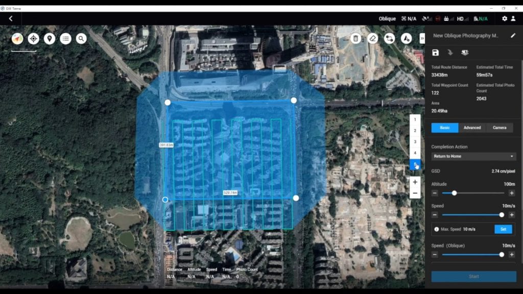
Equipped with several easy-to-use options based on the area or objects they’d like to capture and the type of map or 3D model they’d like to create DJI Terra helps commercial drone pilots quickly plan automated flights. It features three mission planning types:
Area – DJI Terra automatically generates efficient flight path options based on the area selected capturing a specific area quickly and easily by drawing a custom polygonal flight zone on a map.
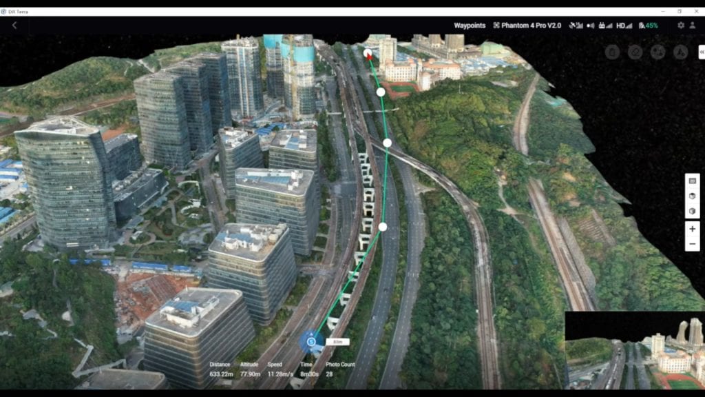
Waypoint – Creation of dynamic custom flight paths through an area or around objects using waypoints and adjustable parameters like aircraft altitude, speed, heading, gimbal pitch and angle. The 3D Flight Visualization feature enables the design and simulation of missions on existing 3D models for more detailed and complex missions.
Oblique – Capturing a rich data set by automatically flying the same route multiple times. Each flight automatically adjusts the angle of the camera to capture new details, giving an extra crisp 3D model of the object or asset from multiple angles.
Real-time Mapping and Detailed 3D Models
DJI Terra allows drone pilots to quickly generate 2D orthomosaic maps as the drone flies thanks to its real-time mapping capabilities, ideal for time-sensitive missions where situational awareness is critical and decisions need to be made in minutes. DJI Terra’s fast processing capability also creates sharp and realistic representations of any environment through detailed 2D orthomosaics and 3D model reconstructions used for industrial applications like reconstructing vehicle crashes, tracking progress on construction projects or conducting large-scale critical infrastructure inspections on bridges and roadways.
Easy Data Analysis
Additionally, DJI Terra enables data analysis and generates instant insights with easy-to-use analysis tools that provide a variety of measurements including linear distance, surface area and volumetric estimations. Annotation labels can be edited and shared for improved team communication and reporting throughout ongoing projects. DJI Terra’s photo inspection tool lets users closely examine every photo used to create the model so they can pinpoint and highlight critical elements.
Availability
DJI Terra is available today for purchase through authorized DJI Enterprise resellers worldwide and is compatible with Windows PCs and all current DJI Phantom 4 Series drones.