
All posts tagged "Mapping"
-

News
DroneDeploy Releases Intelligent Cloud Photogrammetry
August 22, 2018DroneDeploy, a drone software platform with the largest drone data repository in the world, today announced...
-
News
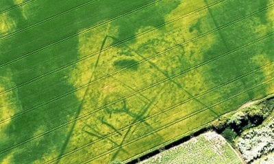
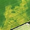
Seen from the air, the dry summer reveals an ancient harvest of archaeological finds
August 18, 2018For an aerial archaeologist 2018 has been a bumper year. The long, hot summer has revealed...
-
News
Saving Time and Money Mapping Contaminated Houses with Drones
August 7, 20183D scanning and virtual reality increase the quality of environmental monitoring and allows businesses to create...
-
LiDAR
Geomesure Bring Microdrones mdSolutions to France
July 24, 2018Geomesure, the official distributor of Trimble topographical equipment in the South and West of France, has...
-
AI
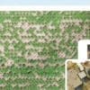
Drones in Precision Agriculture
July 19, 2018As the development of programming and artificial intelligence expands their applications, so do the means to...


Back To Base (B2B)
