News
Drones Help Discover 50 Nazca New Lines
Drones Help Discover 50 Nazca New Lines
Peruvian archaeologists have discovered in excess of fifty new geoglyphs or ‘’ground drawings’, etched into the Nazca desert of southern Peru, a high arid desert plateau between the towns of Nazca and Palpa, 400 kms south of Lima.
These fascinating ‘Nazca lines’ are believed to have been created more than a millennium ago, and more than a thousand of these geoglyphs meander across the sandy soil of Nazca province; they are thought to possibly be the remains of mysterious ritual practices on the part of the Nazca people and an ancient prehistoric use of engineering techniques to bring underground water to the surface for irrigation purposes.
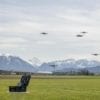
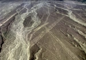
By using drones, Peruvian archaeologists have discovered more than 50 new examples of these mysterious desert monuments in Palpa province. The lines are finely traced onto the earth’s surface and hard to recognise with the human eye yet visible when captured in low altitude by a drone camera; the drones have given the archaeologists hitherto unseen detail of the geoglyphs.
While some of the newly discovered lines appear to belong to the Nazca culture, powerful in the area from 200 to 700 A.D. the archaeologists suspect that the earlier Paracas and Topará cultures were responsible for many of the newfound carved images between 500 B.C. and 200 A.D.
Most of the famous Nazca lines are only visible from overhead whereas the older Paracas geoglyphs were etched on hillsides, making them visible to villages below.
The two cultures also differ in their choice of artistic subjects – the Nazca lines commonly consist of lines or polygons, while many of the newfound Paracas figures depict human figures – usually warriors.
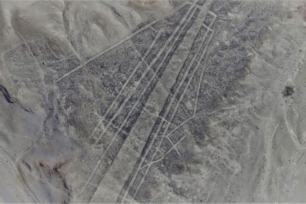
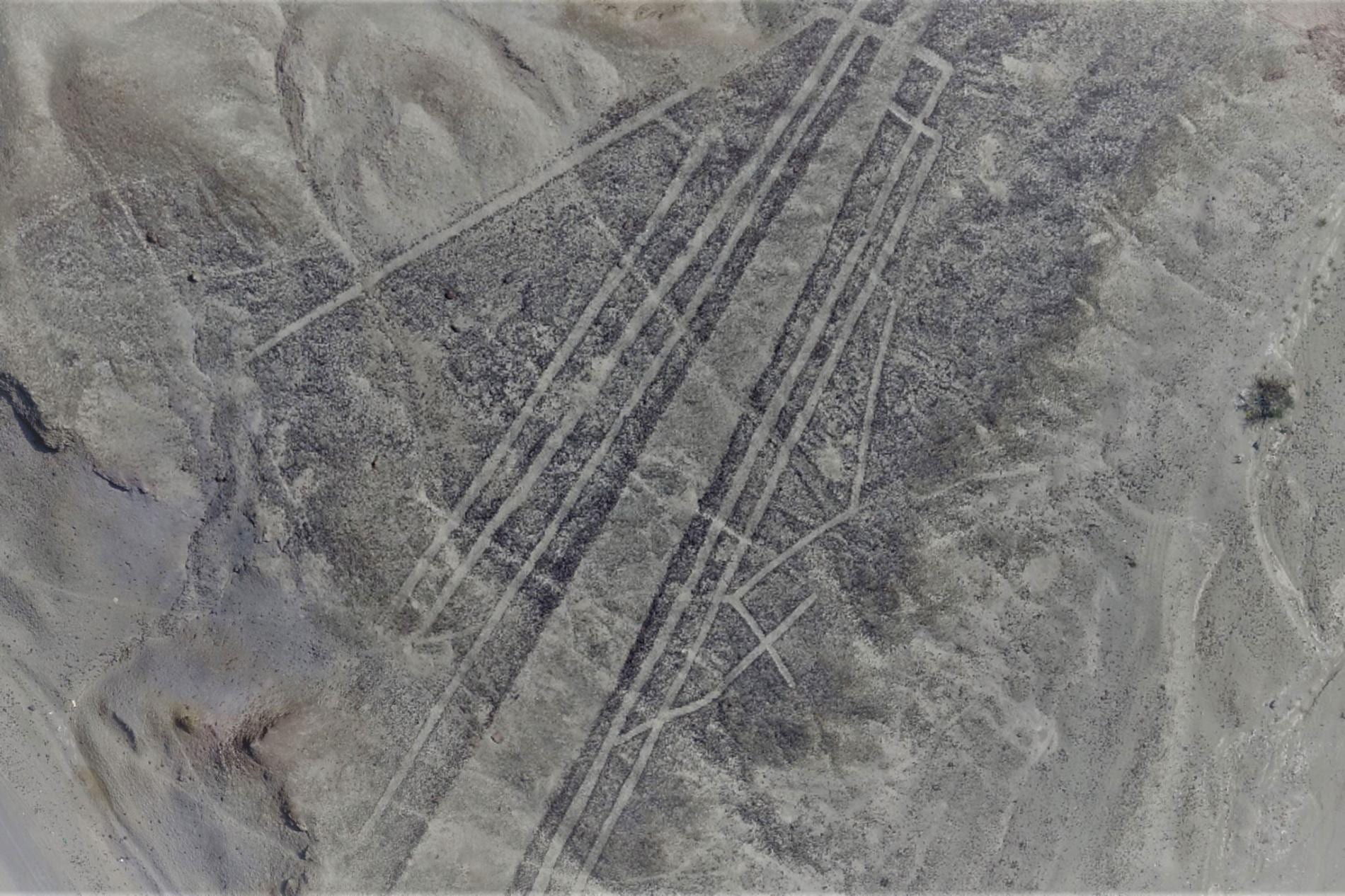
Image Credit: Luis Jaime Castillo, Palpa Nasca Project
Peruvian archaeologist Luis Jaime Castillo Butters, one of the team who discovered the new geoglyph, says the new ones could originally be spotted from a certain distance, so people had seen them, but over time, they were completely erased.
The information captured by the drones of the new geoglyphs has provided crucial data on the Paracas culture, as well as the mysterious Topará culture, which marked the transition between the Paracas and the Nazca.
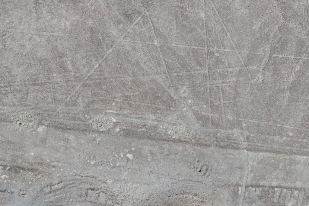
Image Credit: Luis Jaime Castillo, Palpa Nasca Project
It seems that centuries before the famous Nazca lines were etched out, people in the region were already experimenting with making enormous geoglyphs.
Peruvian Ministry of Culture archaeologist Johny Isla, the Nazca lines’ chief restorer and protector says this shows that a tradition already existed over a thousand years before the famous geoglyphs of the Nazca culture, and this leads to new hypotheses about its function and meaning.
It was threats to the already known Nazca lines that prompted this later discovery.
In December 2014, the environmentalist group Greenpeace staged a protest near the famous Nazca “hummingbird,” and in so doing, damaged the area. As a result of the ensuing uproar, Peru received a grant from the U.S. to help hire Isla and his restoration team.
The task was not an easy one, with little reference on hand other than vague maps. Of the estimated 100,000 archaeological sites in Peru, Isla’s colleague Professor Castillo, from the Pontifical Catholic University, says only about 5,000 have been properly documented on the ground and even fewer have been mapped from the air.
Professor Castillo, Peru’s former Vice-minister of Cultural Heritage, has always believed in the use of drones and other aerial mapping techniques to catalog archaeological sites.
Isla and Castillo now have much more data to work with, and are indebted to National Geographic Explorer and “space archaeologist” Sarah Parcak.
Parcak founded the GlobalXplorer initiative after winning the TED Prize in 2016; the project trains citizen scientists to analyze satellite imagery for archaeological sites and signs of looting.
Parcak, an archaeologist at the University of Alabama at Birmingham says Peru’ definitely fit the bill when it came to a country that everyone in the world would know is important, where the Ministry of Culture would be open to new technology and where most of the sites were out in the open and fairly easy to detect.’
The platform’s first project invited volunteers to look at satellite photos of Peru.
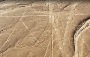
This newly discovered Nazca line feature, captured by a drone, consists of several straight lines with no discernible pattern which were likely made at different times and for different purposes.
The GlobalXplorer volunteers flagged targets in the satellite data that were potential archaeological sites or instances of looting, Parcak then passed on the target locations to the Peruvian archaeologists.
Castillo and three of his students with support from the Sustainable Preservation Initiative,then began a ground searching expedition funded by the National Geographic Society.
Initially when Castillo’s team visited Nazca and Palpa provinces in December 2017, they found little evidence of fresh looting at the GlobalXplorer candidate targets. What they did find however was decades-old looting sites and encroachment – a result of the region’s booming illegal gold mines.
After photographing the sites from overhead with drones, the researchers unexpectedly discovered that the high-resolution images contained suggestions of dozens of ancient geoglyphs, carved into the desert crust.
Castillo says the ongoing encroachment is akin to “land trafficking” and a’ sophisticated effort within Peru to forge deeds and build illegal housing by the acre, erasing the country’s cultural heritage in the process’.
He believes the fight is with an ‘army of lawyers’ rather than ‘a looter with his shovel, running away when you blow a whistle’, and documenting the sites, geo-referencing—is the’ best protection we can give the sites.’