Back to Base (B2B)
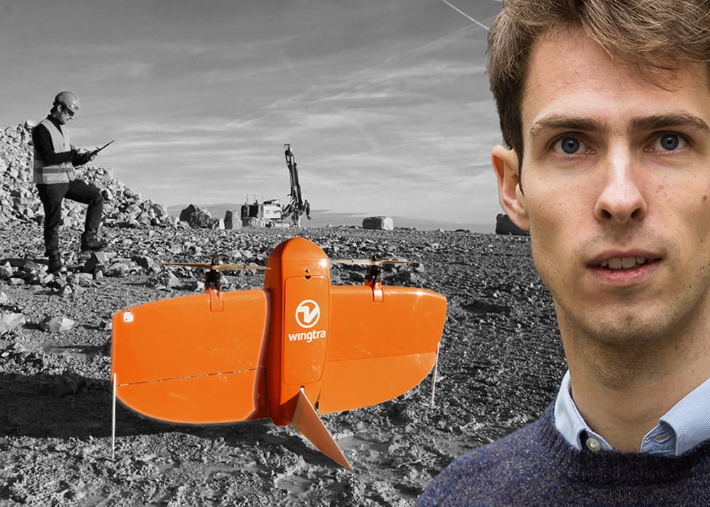
Aerial Mapping with WingtraOne Drone and Maximilian Boosfeld, Co-Founder, Wingtra
Swiss UAV manufacturer Wingtra, develop, produce and commercialize drones that combine the ease of use of agile multi-copters with the long range of high endurance fixed-wing aircraft. Based in the vibrant city of Zürich, Wingtra has grown to become an international company with distribution partners in 5 continents, 1,000+ customer flights and the very first VTOL drone to be equipped with professional aerial photography sensors. Its ever growing multinational team is an eclectic blend of young entrepreneurs, brilliant minded software developers and engineers, service-oriented sales and dedicated technical support, who share a common vision of what the future of unmanned aerial robots should look like. Their Chief Operating Office and co-founder, Maximilian Boosfeld, took some time out of his busy schedule to answer some questions on the company and its latest product offering, WingtraOne.
Hi Maximilian, can you tell our readers how and why you and your partners started Wingtra?
The four founders – Basil Weibel, Sebastian Verling, Elias Kleimann and I shared an idea of making a global positive impact. We envisioned making better decisions and minimizing transaction costs in trade by directly connecting the buyer and seller.

Wingtra Founders, Maximilian Boosfeld, Basil Weibel, Elias Kleimann from left to right
At that moment, Basil, our current CEO, and Sebastian, now senior software engineer, were working on a research project at Prof. Dr. Roland Siegwart’s Autonomous Systems Lab, at ETH Zurich in Switzerland. The project was called Pacflyer – a new generation drone built for parcel delivery. Their research inspired us to make the Pacflyer become reality.
We were a really ambitious team – Pacflyer had to carry the most valuable goods on Earth, and doesn’t aerial information have the best ratio of value per weight?
Today, I see us progressing towards that early goal! Now our drone WingtraOne collects thousands of gigabytes of aerial data when used by mapping professionals in applications that range from surveying and mining to wildlife monitoring.
What makes your WingtraOne UAV different than other VTOL products on the market?
WingtraOne is the first VTOL drone to be equipped with professional photogrammetry sensors. I also feel confident enough to say that currently we are the largest commercial VTOL player in surveying, construction and precision agriculture industries.
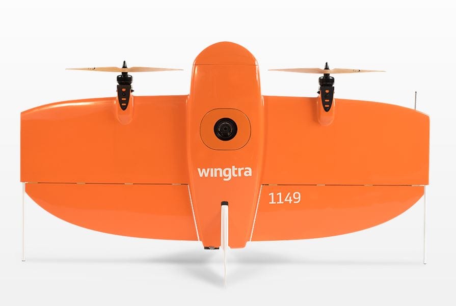
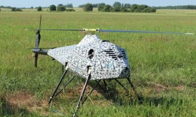
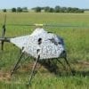
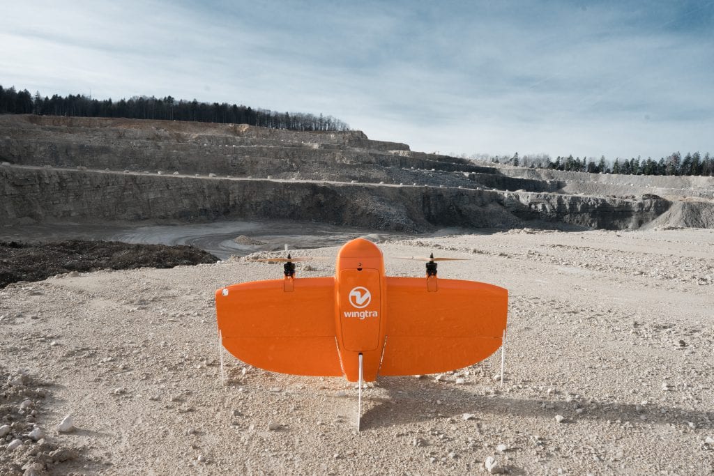
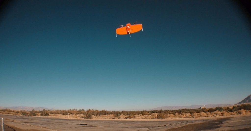
WingtraOne
WingtraOne has been on the market for more than a year now and we have a fast growing global presence with partners across all continents (well, except Antarctica).
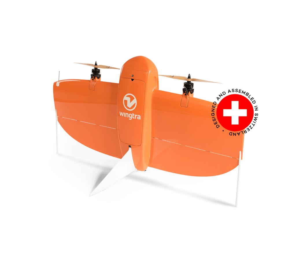
From the design perspective, we tried to simplify our drone as much as possible. WingtraOne has as few moving parts as possible, which limits the room for hardware error, making WingtraOne more robust, more reliable and easier to maintain.
-

- WingtraOne
-
- WingtraOne before the mission

-
- WingtraOne
-
- WingtraOne before the take-off
-
- WingtraOne
-
- WingtraOne
-
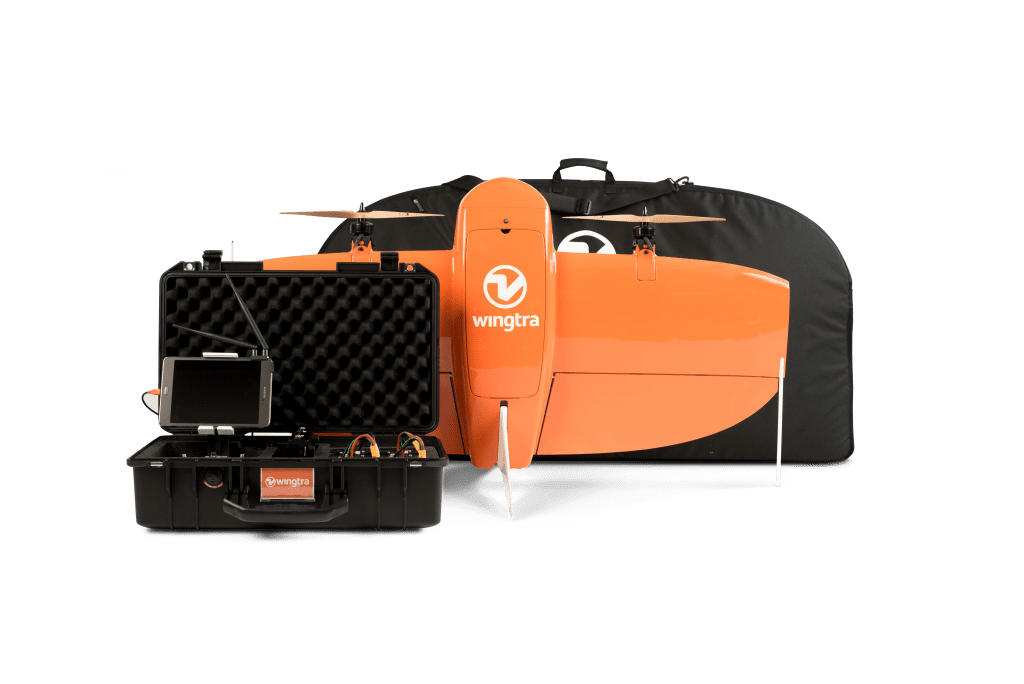
- WingtraOne bundle
-
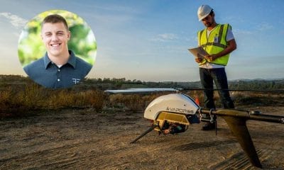
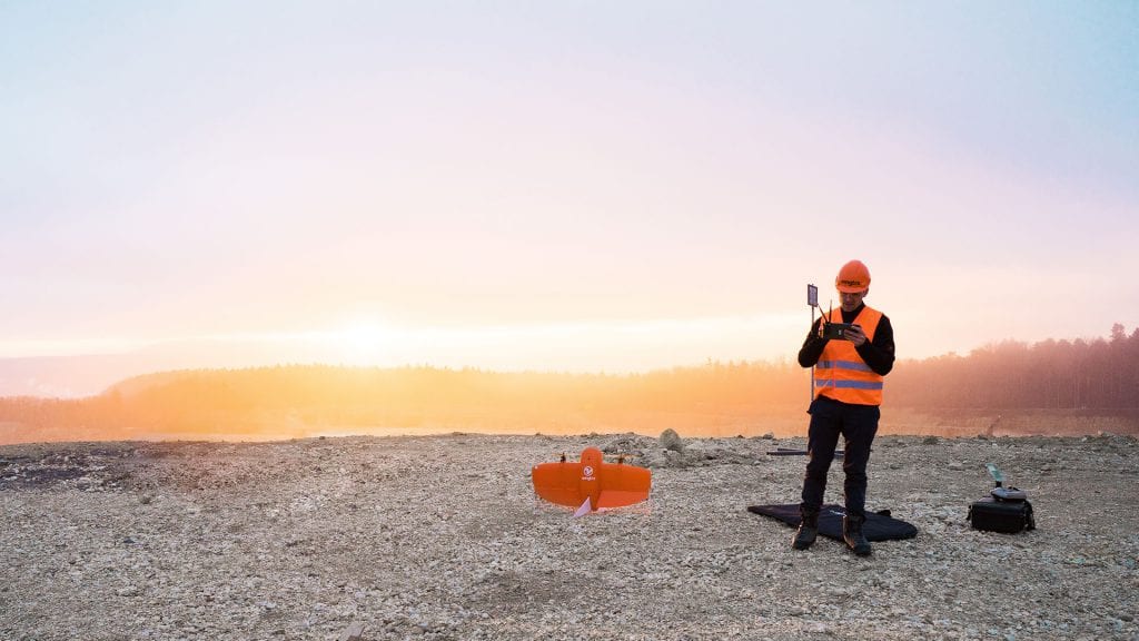
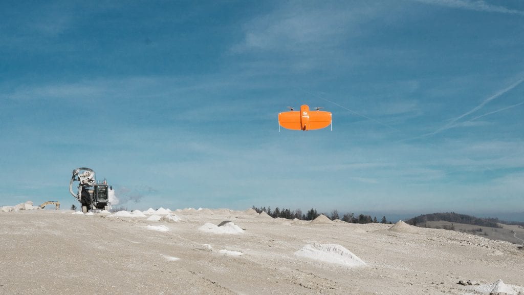
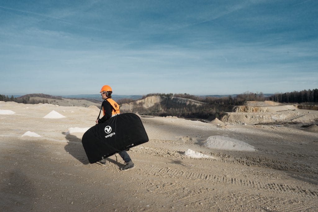
- WingtraOne is used by surveying and mapping professionals to collect aerial data
With a weight of 3.7 kgs and 55 minutes of flight time for a twin rotor VTOL fixed-wing drone, how difficult was it to achieve this performance and what were the challenges your team faced when developing WingtraOne?
Actually, there is an interesting story behind our idea. We invested quite some time in basic research, but the moment when it all kind of fell together happened totally unexpectedly.
Whilst performing an internet search, we stumbled upon a Danish psychologist whose hobby was to build model aircraft, which he referred to as soaring wings. We invited this guy to visit us in Zurich and do a little workshop. We really did not expect to define our future path during that workshop, we had hoped to simply gather some ideas and have an interesting time! Miraculously, the single wing idea made so much sense, that the very same night we actually came up with a design very close to our current WingtraOne design, which also pretty much defined our future technological decisions.
-
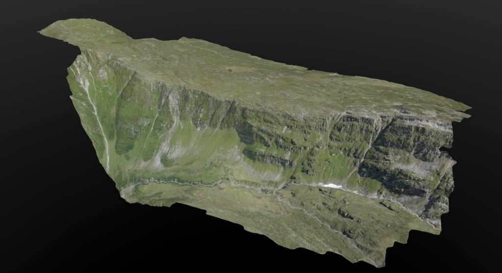
- 3D model of a valley in the Swiss Alps
-
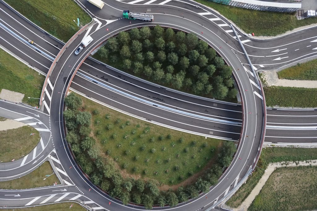
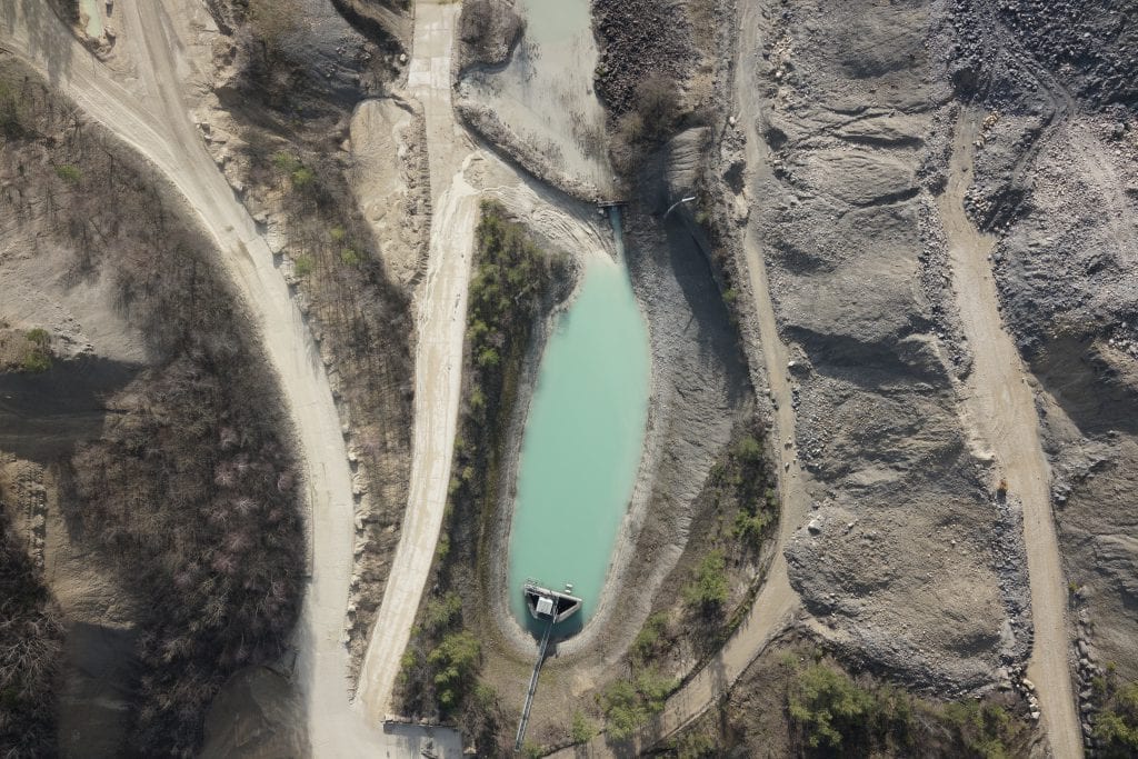
- A single shot of a WingtraOne. Orthomosaic maps are made out of hundreds and thousands of these images
-
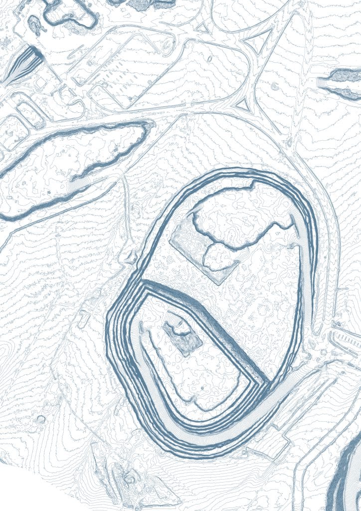
- Contourlines of an orthomosaic map by WingtraOne
-
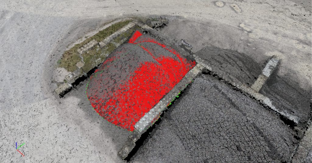
- Stockpile volume calculations, data gathered by WingtraOne
-
- While flying WingtraOne collects aerial data in a form of single images. Later these images are post processed to orthomosaic maps and 3D models
-
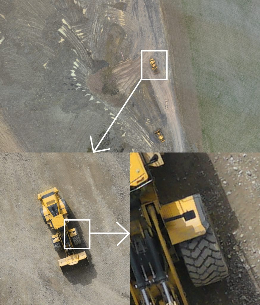
- WingtraOne can achieve a resolution of 0.97 cm
-
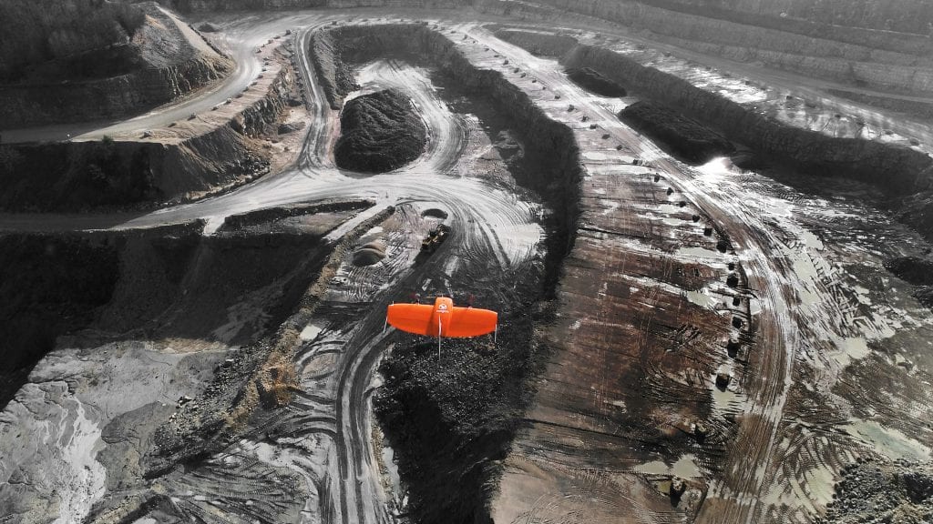
- WingtraOne in a cruise mode
Surveying up to 1 cm of accuracy is quite amazing, how do you achieve this?
The answer is the combination of VTOL (vertical take-off and landing) and the latest PPK technology.
VTOL combines the best of both worlds: multirotors and fixed-wings. Vertical take-off and landing means hands-free operation and a smoother ride for the on-board sensors. Secondly, efficient flying in fixed-wing mode means far greater coverage than any comparable multirotor.
Post-Processed Kinematics — PPK — allows the WingtraOne to reach new level of accuracy. PPK computes ultra-precise geolocations for each image by combining the GNSS data with correction data from a nearby reference receiver.
WingtraOne’s high payload capacity makes it possible to integrate the highest quality sensors: the Sony RX1RII and state-of-the-art PPK system leading to an RMS error of 1.3 cm (0.5 in) horizontally and 2.3 cm (0.9 in) vertically without any ground control points, and that is a significant leap forward in efficient aerial mapping, saving hours on the field.
How does Post Process Kinematics (PPK) compare with Real-Time Kinematic (RTK)?
We chose PPK solution after investigating both RTK and PPK. Bottom line that we’ve reached: PPK is more reliable. RTK provides real-time geotagging feedback, which means that the connection can be easily interrupted and suspended. Base station link losses are quite likely with RTK solution.
PPK does not necessarily even need a base station. The technology corrects geo-location of aerial imagery by comparing it with in-flight measurements as well as post-flight measurements. So in the end we chose PPK as a more robust technology in terms of reliable data corrections.
What is WingtraOne’s airframe made of?
WingtraOne’s airframe is made of robust and light weight glass-fiber composite material. By the way, the same material is used in Formula 1 vehicles.
Have you used 3D printing technology or advance materials to develop this drone?
Indeed the usage of advanced 3D printing technology allowed us to greatly increase the development speed during prototype development and testing. Critical parts were first manufactured using this additive manufacturing technology to test the functionality at an early stage.
On top of that the final product comprises titanium gear servos as well as rare earth magnets in our ultra-high performance motors.
What features or improvements on performance / accuracy might be in the pipeline for future models?
As we’ve just launched WingtraOne PPK, we’re still pretty much exploiting the momentum of the new product. There are still plenty of things to do, e.g. we shipped the first PPK drones just recently. So let’s say that at the moment we are concentrating on the current launch.
Of course we are thinking of possible improvements like WingtraOne PPK options with different cameras or flight planning app available in multiple languages. But our true “religion” is listening to the customer. In other words, now when the aspired PPK version is out there in the market, we will talk to our customers and distributors and depending on the demand we will define the next big steps.
As per your partner work portfolio, you worked with a Uranium mine, what challenges arose and how did you overcome them, what did Wingtra help that client achieve?
Our customer Strydom & Associates had to deal with extra tight deadlines, harsh weather conditions and the biggest Uranium mine in Africa – Husab in the Namib Desert. With WingtraOne, the surveyors were actually able to successfully conduct the required volumetric measurement over a 15 km2 open pit mine in a single day.
At the end of the day, Strydom & Associates met their deadline and managed to compile a most needed data-set over one of the harshest environments there is (extreme desert winds and heat). The WingtraOne was a reliable choice that helped the surveying team conduct and complete their end of the year survey of the mine.
Actually you will be able to read more about the details of the Namibia case in May-June issue of Geoconnexion magazine, so stay tuned.
Bird surveying, land surveying, wind farm site analysis, wildlife search, apart from these what other exciting fields have your drones be used in an innovative manner?
Our most recent and really exciting use case is Dugong monitoring project in Australia. There, scientists from Murdoch University use WingtraOne from a boat to fly over the Dugong inhabited areas in the ocean and for population count research. They have developed machine learning techniques that help them spot Dugongs in the pictures taken by the drone, count the animals and ultimately predict the behavioral and migration patterns of these creatures.
There, the VTOL aspect of the WingtraOne is crucial to the research. Without it, the scientist actually admitted that they wouldn’t be able to do the research as it is impossible to operate a fixed wing from a boat – there is not enough space to land, and multi-rotors are not powerful enough to fly over large ocean areas.
The project is still in progress and we promise there will be more information available at a later stage. Some of the other use cases to mention would be plant health monitoring in vineyards or volumetric gravel calculations of quarries.
What are your thoughts on the changing UAV /drone regulations worldwide, and what are your expectations on how these changes will affect your business?
I believe that the latest developments in regulations mainly have had a positive effect on our business. Rules are converging and this helps our professional customers to reduce uncertainty in planning. Especially the FAA 107 framework and LAANC seem to work well and are tailored for commercial drone user.
In general I see a lot of regulations in a way respecting the enormous potential of commercial drone use for the economy while still making flying safer.
The other hot topic in drone regulations – privacy – applies much more to recreational drones and their operators and is hardly an issue in the professional surveying segment.
Any plans for package delivery?
Could be on the cards
Can you tell us how the WingtraOne can be used in crop monitoring?
For one, WingtraOne can be equipped with multi-spectral and thermal cameras such as the Micasense Rededge and Flir Duo Pro. By inspecting the aerial imagery and maps created with this data, farmers can detect issues in their crop early, e.g. identifying pests, disease and weeds or obtaining data on soil fertility. Inspection with WingtraOne helps to optimize pesticide usage, or refine fertilization practices.
With RGB cameras and today’s advance photogrammetry software, different types of maps can be created with RGB images, e.g. NDVI (Normalised Difference Vegetation Index calculation). Farmers can use the collected data to determine population and spacing issues, measure irrigation and estimate and maximize crop yield by identify areas with larger irrigation needs.
When a customer purchases your drone, what training and service do you provide?
The WingtraOne drone and our custom made flight planning app WingtraPilot is designed to be used intuitively and with minimal training. We also have an online manual and easily accessible interactive videos to guide the operation of the drone as independently as possible.
We have an extensive knowledge base and a dedicated support team across different time zones that are always ready to help. If requested, we do provide customers additional training as a service.
How do you envision Wingtra’s future?
The Wingtra team expects the WingtraOne to become the most desired drone in high precision surveying and mapping applications and not only that: Drones have already made aerial data far more accessible than ever, even in extremely complicated or hazardous conditions.
Besides surveying, our drones are already being used in other exciting applications like endangered species monitoring, construction in difficult to reach areas or mining in severe conditions. In these particular cases, drone use greatly reduces the risk for workers as they dramatically shorten the time required in the field and help predict risks such as landslides. Thus we believe that in the future, the growing range of applications will not only help to increase work efficiency but will also save lives of people and animals.
What other companies in your space excite or inspire you?
In general, I love the pace of the emerging drone ecosystem. So many great teams and ideas are developed everyday at the blink of an eye. Even better to see that quite a few make it to market successfully.
During our journey, we have greatly benefited from open source thinking and institutions like Dronecode that we adopt and build upon to provide highly tested and safe software with great functionality for our customers. Lorenz Meier, the architect of the open source software stack just founded his company Auterion with former 3DR key person Kevin Sartori. I am looking forward to continuing working closely with them on new business opportunities.
Anything else you’d like to add?
Yes, definitely. Please find more information about Wingtra and our daily routines on wingtra.com and our social media profiles.
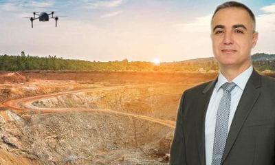
About Maximilian Boosfeld
 Maximilian is co-founder and the head of operations at Wingtra, the professional drone company manufacturing high precision VTOL (vertical take-off and landing) drones that collect survey-grade aerial data. From the very start Maximilian helped Wingtra to become an international company with distribution partners across the globe and a very first VTOL drone to be equipped with professional aerial photography sensors. Prior to Wingtra, Maximilian was studying Mechanical Engineering at ETH Zurich, and in parallel running his very first successful company — open-air cafe ‘Kleine Freiheit’.