Conservation
Wildfire in Jack Pine Forests: How Drones and Satellites Can Help Recovery
Nowadays, Jack pine (Pinus banksiana) forests are unique ecosystems that are controlled by wildfire. Therefore, understanding the process of re-vegetation after wildfire is very important for sustainable forest management, mostly because these forests provide economic resources and are home to specialized species.
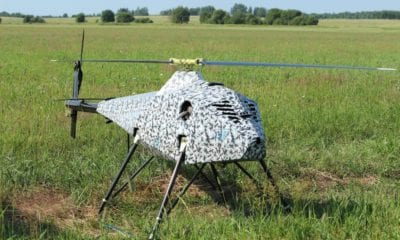
The individual detection of jack pines after fire events is therefore crucial – providing information about the environment’s recovery. In times when traditional (manned) and satellite aerial sensors lack certain flexibility and spatial resolution that is needed for identifying jack pines in early post-fire analysis, drones come in as a perfect solution for object-based image analysis for jack pine identification in regions that have been burned.
Post-Fire Remote Sensing Applications for Drones
A group of authors have focused on this form of post-fire remote sensing applications, aiming to provide timely spatial and spectral information regarding forest structure, composition as well as vigor during regeneration. The research is published in Drones 2018 and titled, UAS-GEOBIA Approach to Sapling Identification in Jack Pine Barrens after Fire.
As the introduction of their paper reads:
“Unmanned aerial systems provide an excellent alternative to satellite imagery, providing higher spatial resolution and temporal frequency at a much more cost-effective rate than manned aircraft and satellite sensors [2,5]. Limitations to their use include small payload capacity, limited battery life, and a lack of professional standards for their use. There is a critical need to establish standard protocols to produce reproducible, repeatable workflows. Individual tree detection (IDT) is one application of UAS that is imperative for forest management.”
There are several methods which exist for ITD using remotely sensed data. Many of them use 3D data, like the Light Detection and Ranging (LiDAR) systems. However, the new methods of generating structural data involve Structure from Motion (SfM) and the use of UAS imagery to generate SfM multi-view stereo (MVS) as a widely recognized low-cost method for generating both orthomosaics and digital surface models (DSMs).
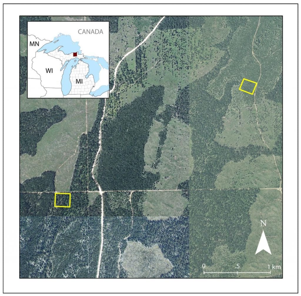
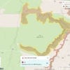
Duck Lake study area in UP of Michigan, USA. The NAIP image was acquired in 2008, prior to the fire. Plot A is on the eastern edge while Plot B is in the southwestern corner of this image.
Motivated by technology as well as broader ecological and management objectives, the paper focuses on jack pine ecosystems as influenced by fire.
According to the authors, “there is still limited understanding of how UAS data are acquired, processed, and used. The aim of this research is to understand the spectral and seasonal requirements necessary for ITD of jack pine (Pinus banksiana) saplings in a post-fire environment through the use of multispectral imagery. We evaluate which spectral band combinations provide the best accuracy in the detection of jack pine saplings and which period in the vegetation growing season is the most suitable to properly identify jack pine saplings.”
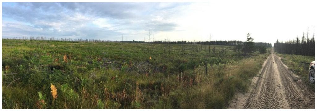
Current landscape highlighting the devastation to the jack pine forest and the vegetation recovery as of summer 2017.
The Methods and Materials Used in the Surveys
When it comes to the actual methods that the researchers used, they took an area north of Newberry, Michigan (US) which is managed by the Michigan Department of Natural Resources (MDNR) and is categorized as having a humid continental climate with a vegetation that includes a mixture of coniferous and deciduous tree species including jack pine, white spruce, balsam fir and others.
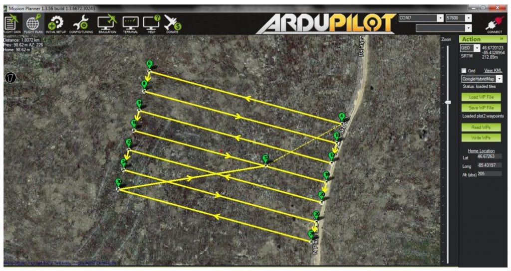
Example of data collection flight path. For scale, flight covers a one-hectare plot.
After image collection using a 3DR IRIS quadcopter UAS platform, the authors effectively monitored the forest and classified the different trees and areas in it, mostly through the following steps:
- Image Processing
- OBIA Classification
- Identity Accuracy
- Edge Similarity
After seeing the results, the general conclusion is that the inclusion of the RE had little positive impact on the classification accuracy – and was mostly beneficial when added with NIR data.
“The results also suggest that seasonality has important implications for detectability of saplings. Seasonal changes in evergreen species are not as easily detected using greenness indices like deciduous vegetation, but instead are better traced using Light Use Efficiency (LUE),” the authors conclude.
From this, they have developed a number of individual tree detection methods but standardized application of these methods to the problem of tree identification, however, has not been achieved.
Conclusion and Final Thoughts
The study, in general, uses three-dimensional data for adult crown detection. As the authors claimed:
“This study, like others utilize these three-dimensional data for adult crown detection, and do not consider the applicability to small crowns like those found on saplings. One study by considered young 4-year old eucalyptus trees achieved 98% accuracy when applying SfM with UAS data. However, eucalyptus tends to be a faster growing species than jack pine, despite jack pine being the fastest growing conifer. Jack pine seedlings grow slowly during their first three to four years and then speed up around age five. Saplings in the study area ranged in height from one to five feet. We did not locate studies using these methods on such small trees.”
From this, the general conclusion is that monitoring the effects of wildfire is an important aspect of the management of jack pine ecosystems. Since satellite and aerial-based imaging systems are not able to provide data at spatial resolutions, jack pines are best monitored with multispectral UAS imagery in combination with GEOBIA resolution.
The research altogether has shown that optimal accuracies for these cases are obtained using late-summer imagery consisting of NIR and R spectral data.
Citation: “UAS-GEOBIA Approach to Sapling Identification in Jack Pine Barrens after Fire”, Raechel A. White, Michael Bomber, Joseph P. Hupy and Ashton Shortridge – Drones 2018, 2(4), 40; Doi:10.3390/drones2040040, https://www.mdpi.com/2504-446X/2/4/40/htm