
All posts tagged "MDPI"
-

Construction & Mining
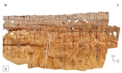
Drone Mapping of Mississippi Quarry
July 19, 2019Unmanned Aerial Vehicle (UAV) or drone technology is becoming more and more valuable in geologic investigations...
-
News
Analysis of Orthomosaics Derived from Drone Imagery
June 5, 2019The advancements in drone technology has revolutionized the production of aerial imagery. Using a drone equipped...
-
News
DOWSE, A DrOne Water Sampling SystEm
May 29, 2019Testing water samples from large water bodies at regular intervals is an imperative yet sometimes tedious...
-
Conservation
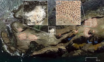
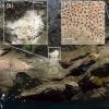
Drones Used to Map Antarctic Penguins
April 24, 2019A team of researchers undertook an unmanned aerial vehicle (UAV) survey with the aim of ascertaining...
-
News
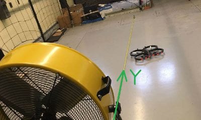
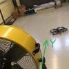
Researchers Look at VTOL UAVs & Wind Estimation Using a Learning-Based Model
April 3, 2019Vertical take-off and landing (VTOL) UAVs are gaining popularity day by day- used in spectra of...


Back To Base (B2B)
