Brands
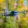
Meet the Phantom 4 RTK, DJI’s Phantom Drone Revamped
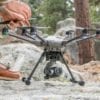
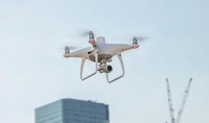
Specialised drones have made the task of surveying construction sites easier and cheaper. Now, DJI the leading giant in drone tech is offering a new Phantom 4 RTK drone to its customers. The drone is basically a redeveloped Phantom 4 with improved technology designed specifically for professionals. The original Phantom 4, widely seen as a game changer in the UAV industry, was first released back in March 2016.
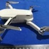
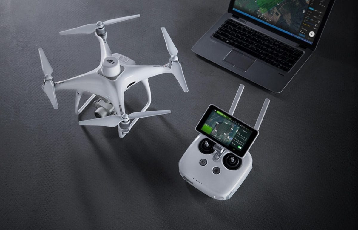
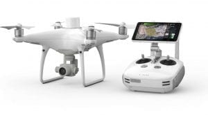
DJI says the new cutting edge features of the 4 RTK, like its new RTK module, 1”CMOS Sensor and the GS RTK App, will revolutionise surveying in the construction industry. The new Phantom 4 RTK series specific characteristics include -1cm+1ppm RTK Horizontal Positioning Accuracy, 1.5cm+1ppm RTK Vertical Positioning Accuracy and Absolute Horizontal Accuracy of photographic models (5 cm when flying at 100 metre height).
STRABAG, a European a technology group for construction services headquartered in Vienna, has been using drones for their surveying and is vouching for the Phantom 4 RTK. Thomas Groeninger head of business unit digital object survey and UAV at STRABAG says, “the Phantom 4 being flexible and compact provides centimetre-accurate data resulting in requirement of fewer ground control points and is another step forward in using drones for construction surveys.”
Centimetre Level Positioning System
A new RTK module is integrated directly into the Phantom 4 RTK, providing real-time, centimetre-level positioning data for improved absolute accuracy on image metadata. Beneath lays the RTK receiver, a GNSS module, to ensure flight stability in signal-poor regions such as dense cities. The Phantom 4 RTK has optimized flight safety while ensuring the most precise data is captured for complex surveying, mapping and inspection workflows by combining both modules.
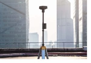
The Phantom 4 RTK can be to fitted any workflow, with the ability to connect this positioning system to the D-RTK 2 Mobile Station, NTRIP (Network Transport of RTCM via Internet Protocol) using a 4G dongle or WiFi hotspot, or store the satellite observation data to be used for Post Processed Kinematics (PPK).

Gather Accurate Data with TimeSync
The new TimeSync system was created to continually align the flight controller, camera and RTK module. Additionally, TimeSync ensures each photo uses the most accurate metadata and fixes the positioning data to the center of the CMOS – optimizing the results from photogrammetric methods and letting the image achieve centimeter-level positioning data. The Phantom 4 RTK missions form an accurate surveying solution being supported with the D-RTK 2 Mobile Station that provides real-time differential data to the drone. The Mobile Station’s rugged design and OcuSync 2.0 transmission system ensures availability of centimetre-level accurate data from the Phantom 4 RTK in any condition.
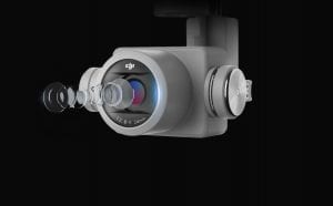
Precise Imaging System
The 20 megapixel 1”CMOS sensor captures the best image data. The Phantom 4 RTK can move while taking pictures without the risk of rolling shutter blur and the high resolution makes it achieve a GSD of 2.74 cm at 100 meters flight altitude.
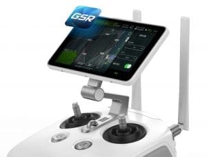
Purpose-Built Flight Planning Application
The newly incorporated GS RTK app allows pilots to intelligently control their Phantom 4 RTK, with two planning modes – Photogrammetry and Waypoint Flight juxtaposed with the traditional flight mode. The planning modes let pilots select the drone’s flight path while adjusting overlap rate, altitude, speed, camera parameters and more, offering an automated mapping or inspection workflow.
The GS RTK app has a range of features built for specific mapping or inspection workflows. The app implements direct loading of KML area files for in-office flight planning and has a new shutter priority mode to keep exposure consistent across all photos and a strong wind alarm to warn pilots of adverse conditions.
Mobile SDK Supported
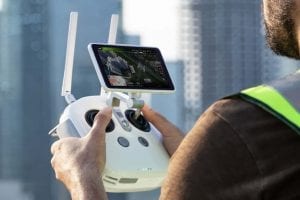
The Phantom 4 RTK is compatible with the DJI Mobile SDK, opening up its functions to automation and customization through a mobile device. Users can enjoy stable and reliable HD image and video transmission at distances of up to 7 km, great for mapping larger sites.
If the area being surveyed is too vast The Phantom 4 RTK to map on a single battery charge the Phantom 4 RTK will automatically resume the mission at the same point. It is also equipped with an intelligent flight battery charging hub. With a built-in flight planning app (GS RTK) and an easy method to collect RTK data (RTK Network or D-RTK 2 Mobile Station), pilots have a full solution for any surveying, mapping or inspection workflow – right out of the box.
The Phantom 4 RTK’s visionary Intelligence and elevated Accuracy make for the ideal upgrade for users next mapping mission using DJI’s most compact and accurate low altitude mapping solution.