Conservation
Drones Being Used to Monitor Sacred and Culturally Significant Sites
There is absolutely no doubt that the use of drones nowadays is massive. In one of the most recent scenarios, Jesse Thompson of ABC Radio Darwin has reported on how drones are being used for monitoring sacred areas as well as culturally significant sites which lack accessible terrain and are usually located in isolated areas.
Thanks to the recent development of drones and especially drone pilot training, this concept proves that one day, drones can document and archive the culturally significant information obtained from these areas and sites.
The Technology’s Capacity to Map Hard-to-Reach Areas
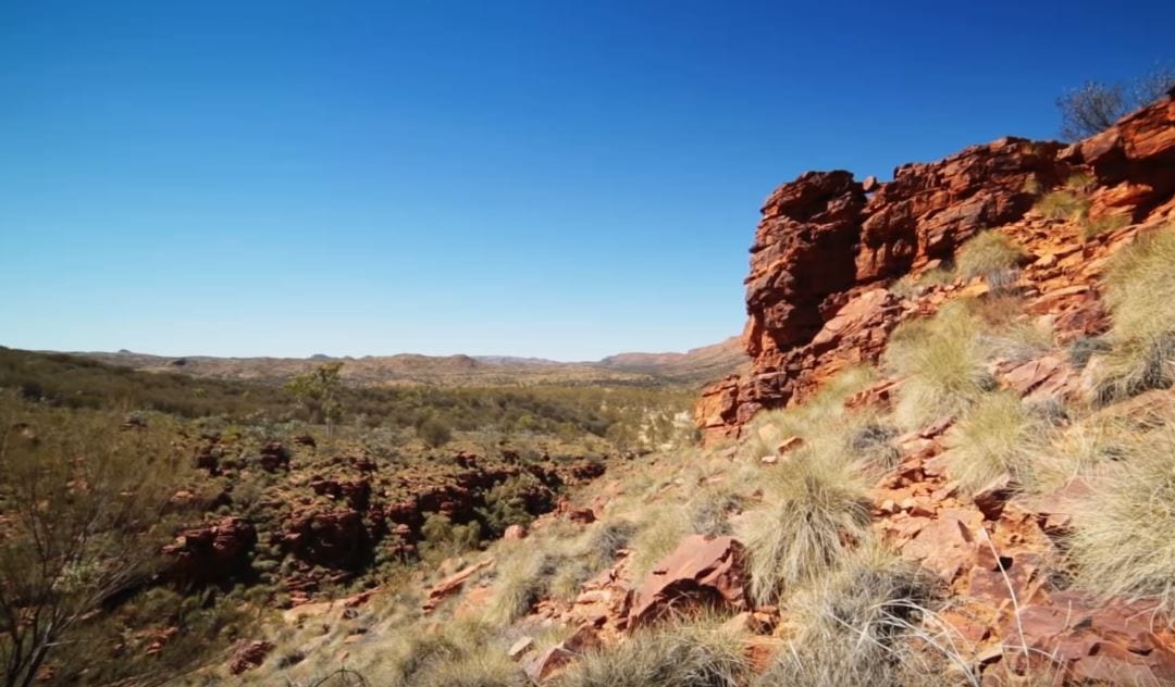
It all began with a training as part of the 2018 Western and Northern Australian Languages Alliance (WANALA) forum where this technology was initially coined, along with its massive potential for mapping areas and sites that are difficult to access.
As the Corporation chief executive, Karan Hayward, stated during the forum:
“You can GPS items that are sacred that you haven’t been able to do before, because to walk in there, you’ve got to go through massive amounts of bushland.
One drone pilot named Lianna Brown, who is a Gurindji interpreter who now lives in Katherine confirmed the potential opportunities for this project, stating:
“Because you’re watching it on the iPad, I think it’s a pretty incredible way of recording those countries and sacred areas and having them archived.”
Meanwhile, Ms. Brown has found it difficult to return to the Kalkarindji areas because of the abundance of harsh and remote terrain in the isolated area south-west of Katherine. Because of this, she sees the project as potentially life-saving for both the people and the areas in need of monitoring.
The training included participants who were ferried to the magnetic termite mounds of the Litchfield National Park, surveilling the sites from a height of 30 meters and above. With this, they also experimented by practicing the height, depth and the movement of the drone and the panoramas in that specific area.
As one of the members stated:
“Every single one of our students, they all come from a different area and country from Australia, and they all said that our old people had that vision; we had that vision before we even heard about drones. So we were fascinated with how did our old people, how did they see what this drone is showing us?”
A Potential to Save Indigenous Languages
Aside from the sites and areas monitored, the forum brought together representatives of 15 different organizations, all involved in the preservation and transmission of languages. The forum was a vital meeting place to discuss the preservation on languages as well.
Among the conclusions was the one pointing to the “worst scenario” of languages becoming non-existent, according to the contributors. The summed up results were adding up to the fact that “if there are no languages, there is no law, no culture and therefore, no land.”