Brands
DJI Partners with Response Agencies Following California’s Deadliest Wildfire
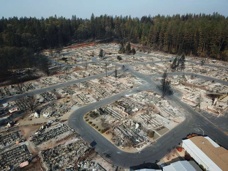
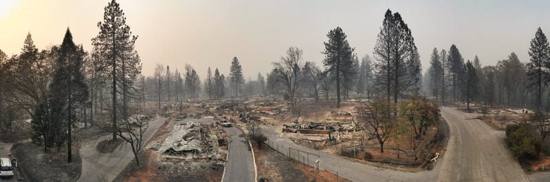
What was once a community with over 27,000 residents is now a burned area in which thousands of people have lost their homes and nearly 100 of them lost their lives. We are talking about the towns of Paradise and Magalia in Northern California, both affected by a wildfire named “Camp Fire” in November 2018.
Over two days, a legion of drones began recording images of the devastation below. Set up by DJI in collaboration with 16 first response agencies and disaster response and damage assessment teams, the aim of this mission was to collect as many images and data as possible in efforts to help and rebuild the community.
Collecting More Than 70,000 Images Over 17,000 Acres
By the time the tests were done, they had collected more than 70,000 images over 17,000 acres which resulted in 1.4 trillion pixels of data. The drones firstly determined the condition of the burned homes in order to expedite the insurance claims. However, the footage was also found helpful for the preparation of recovery crews, demolition crews, city planners, scientists and researchers who were all in need of a better understanding of the situation.
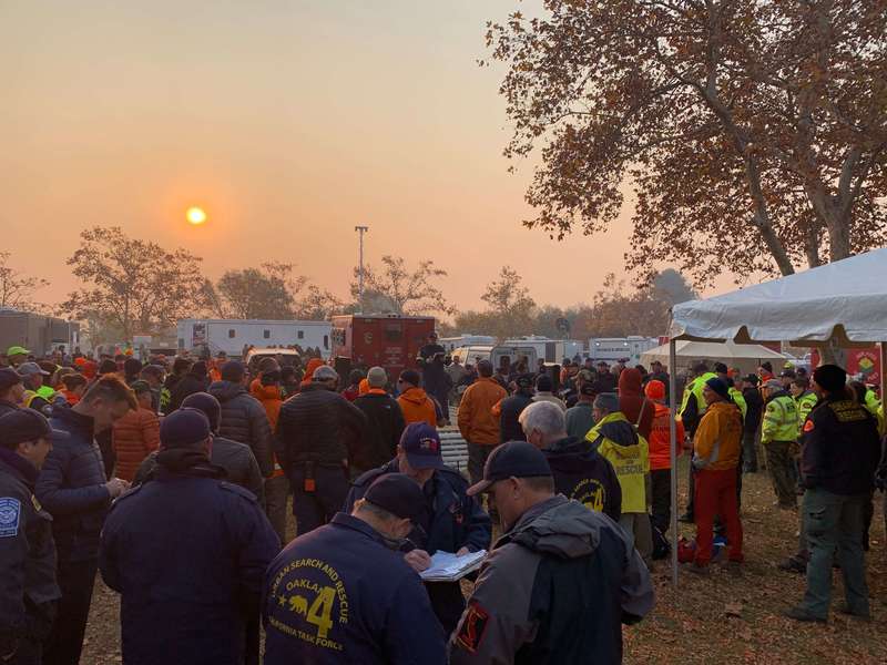
This is one of the biggest drone responses in history, especially when disaster scenes are concerned. The 16 UAV teams were led by the Sheriff’s Office of Alameda County, as well as the Contra Costa County Sheriff’s Office and the Menlo Park Fire Protection District as the teams with the most units.
An AI-Based App Showed The Real-time Status Of The California Homes
The San Francisco Police was also involved, overseeing airspace mitigation in over 160 360-degrees and interactive panoramas created with the help of Hangar, as well as geo-referenced video which monitored the devastating scenes. The entire data set was processed in record times.
Geo-referenced as well as stitched into a map format, the photos and videos made it possible for residents to check the status of their homes with an interactive and AI-based (Artificial Intelligence) app. As one of the authorities said:
“We’re hoping that one, it will help people understand the devastation that we’re dealing with, understand the very difficult task that we have,” said Butte County Sheriff Kory Honea. “We’re hoping it’ll provide them information that will help them get their insurance claims started.”
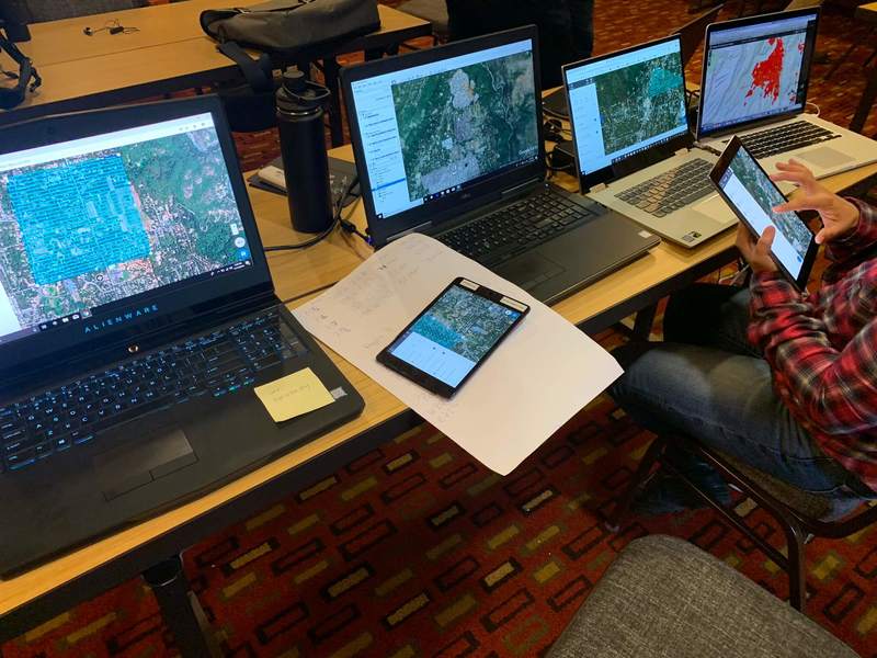
Sending The Data Back To The Processing Center For Proper Evaluation
The large amount of data was quickly sent back daily to the data process service DroneDeploy, which is a DJI software solution partner based in San Francisco. The main aim of this was to create a detailed, interactive map within 24 hours upon receiving the drone images and data.
From the drone platform standardization to evaluating the specific power needs and working with data management, DJI along with the 16 teams on the mission proved that drones can be of groundbreaking importance when surveilling disaster zones.