Construction & Mining
SPH Engineering Announces True Terrain Following for Drone Surveys and Inspections
Drone or Unmanned Aerial Vehicle technology (UAV) often face the issue of how to follow terrain without compromising effectiveness and precision. In a new press release SPH Engineering has declared having found the answer by developing a new solution for UAVs that allows for accurate terrain following without the need to rely on map data.
With the help of a proprietary UgCS data logger and a laser altimeter, SPH Engineering has a new integration solution especially significant for inspections, mining, engineering, agriculture and environmental industries where ground penetrating radars or analyzers are used or where being able to fly over objects at a particular height is crucially important for other reasons.
Earlier, digital elevation model (DEM) data was essential for pursuing such tasks; however wasn’t found sufficiently accurate. For example, if a drone with ground-penetrating radar needs to be flown at a height of one meter, but the precision of the available data is three meters then this data is redundant.
While LiDARs nowadays can create extremely accurate terrain maps by providing a precision level of up to one centimetre, this would mean including too many waypoints for drone mission planning. As the waypoints need to be loaded onto the drone in batches of no more than 99 at a time, following a LiDAR-mapped area of terrain with the necessary precision would involve flying over the area time and time again.
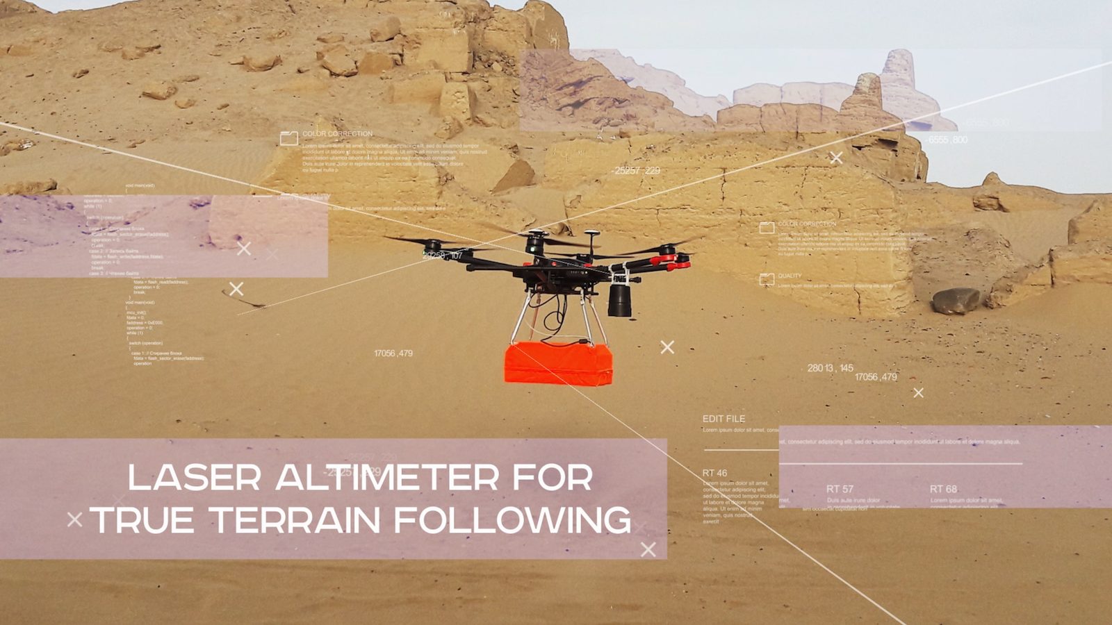
SPH Engineering has solved both of these issues by gathering and using terrain data on the go. The laser altimeter gathers an uninterrupted data flow by measuring the flight time of a short flash of infrared laser light as it bounces back off the surface of the terrain, while the UgCS data logger adjusts the drone flight height accordingly. As it uses actual and not pre-existing data, the mode is called True Terrain Following.
All these features put together with the UgCS software allow for hassle-free drone mission planning with immaculate and uncompromised flight height precision. True Terrain Following mode requires no more than two waypoints on each survey line, thus sparing the user from unnecessary interruptions to missions without crowding the mission with too many waypoints. The operator simply sets the desired flight height and speed and activates the True Terrain Following mode. The rest of the work is done automatically. In addition to mining, engineering, and archaeology, this new solution is useful in situations where GPRs are not used, but flying over objects or following the surface at a particular height is required for other reasons. This could include spraying plants in agriculture and many other situations where accuracy is a priority.
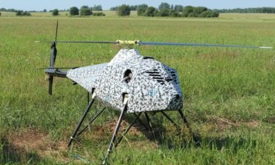
True Terrain Following available for professional drone surveys and inspections and the function is currently available for DJI M600/M600 Pro drones and can also be used with custom drones based on DJI A3 autopilot. More details are available at industrial.ugcs.com/ttf.
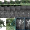
Videos of GPR-drone integrated system with Laser Altimeter which can be viewed below.
One of the videos features SPH’s Ground Penetrating Radar (GPR)+drone integrated system used for archaeological investigation of Inca ruins: The system integrates a Ground Penetrating Radar (GPR) and a drone equipped with a laser altimeter, allowing the drone to fly in the True Terrain Following mode which allows the drone to accurately follow the terrain during the flight, based on data received from the laser altimeter. True Terrain Following enables the drone to fly at low altitudes (about 2-3 meters) without a need to import precise Digital Elevation Model (DEM) height-map into UgCS. The GPR+ drone integrated system guarantees the delivery of accurate survey results is safer for personnel and is more time-efficient.
SPH Engineering’s industrial drone-based integration solutions include software and data logger integration with methane detectors, laser altimeters, metal detectors and Ground Penetrating Radars for a wide range of industrial applications. Its UgCS software provides a complete toolset for safe and efficient UAV land surveying and industrial inspections, including custom elevation data importing, Photogrammetry and Geotagging tools, LIDAR, Magnetometer and GPR linear and aerial survey planning tools with terrain-following mode.