Conservation
VTOL Drone WingtraOne Monitoring Endangered Dugong, Cuts Risk, Cost and Time
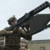
WingtraOne from THE Swiss UAV manufacturer Wingtra, is the first VTOL drone to be equipped with professional photogrammetry sensors. With a weight of 3.7 kgs and 55 minutes of flight time for a twin rotor VTOL fixed-wing drone and a combination of VTOL (vertical take-off and landing) and the latest PPK technology, the WingtraOne is unique in several attributes.
Swiss UAV manufacturer Wingtra, based in the vibrant city of Zürich develops and produces drones that combine the ease of use of agile multi-copters with the long range of high endurance fixed-wing aircraft.
Their Chief Operating Office and co-founder, Maximilian Boosfeld, explained to us in a recent interview how the WingtraOne collects thousands of gigabytes of aerial data when used by mapping professionals in applications that range from surveying and mining to wildlife monitoring.
WingtraOne’s high payload capacity enables the integration of the highest quality sensors: the Sony RX1RII and state-of-the-art PPK system with an RMS error of 1.3 cm (0.5 in) horizontally and 2.3 cm (0.9 in) vertically without any ground control points. PPK computes ultra-precise geolocations for each image by combining the GNSS data with correction data from a nearby reference receiver. WingtraOne’s airframe has minimal moving parts and is composed of robust and light weight glass-fiber composite material, making it robust, reliable and easier to maintain.
WingtraOne’s features were put to test when a customer Strydom & Associates had to deal with extra tight deadlines, harsh weather conditions in the biggest Uranium mine in Africa – Husab in the Namib Desert. Assisted by WingtraOne, the surveyors successfully conducted the required volumetric measurement over a 15 km2 open pit mine in a single day.
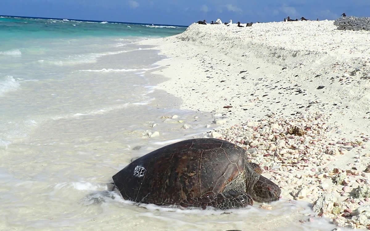
Now in a new and exciting use case Wingtra reports on a Dugong monitoring project in Australia. The Dugongs of the Western Australia Pilbara region are considered endangered according to state listings and are now being studied by researchers Murdoch University, using drones. On a three week trip by postDoc research fellow Dr Christophe Cleguer and team two different types of drones were used to survey the local dugong population – a DJI Phantom Proquadcopter and a WingtraOne fixed wing VTOL drone.
Scientists used WingtraOne from a boat to fly over the Dugong inhabited areas in the ocean and for population count research. They spotted Dugongs in the pictures taken by the drone, counted the animals and predicted theDudong’s behavioural and migration patterns.
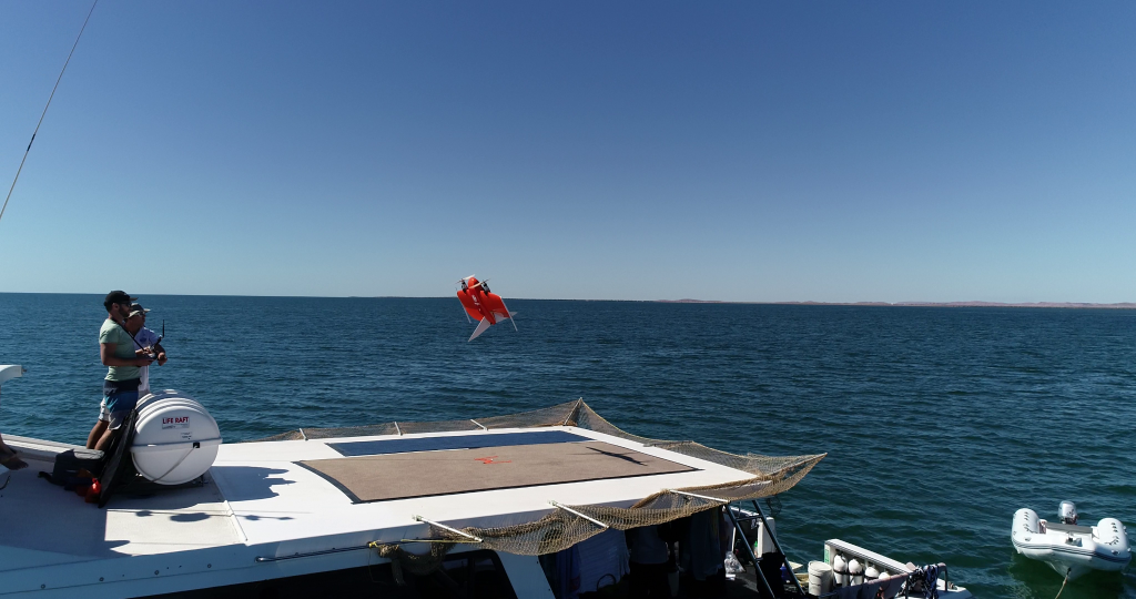
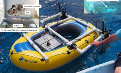
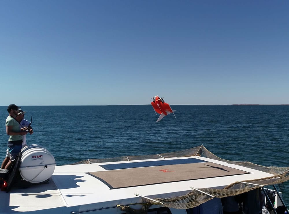
WingtraOne Landing on Keshi Mer II © Christophe Cleguer.
The VTOL aspect of the WingtraOne is crucial to this part of the research. “We needed a drone that could cover as much area as possible in one flight, while being able to be operated from a boat, by us as researchers, and was within our budget. With a price tag of less than $30,000, the WingtraOne met all these requirements,” says Dr. Cleguer.
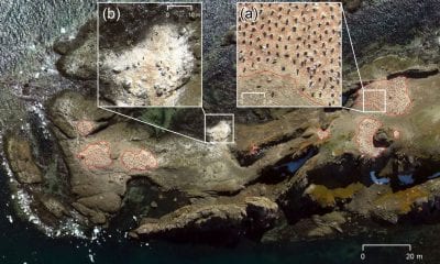
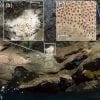
Dugongs can be seen in numerous pictures collected with the WingtraOne. In this particular example, it is possible to see small groups of them in the centre.

“This kind of technology would be accessible to scientists in developing countries who wanted to conduct surveys of species, and don’t have access to teams of expert observers or the budget to charter planes”, Dr Cleguer says.
Dr Cleguer and Hodgson conclude, “These advantages require us to rethink the methods we normally use for marine fauna surveys but will also allow us to answer different questions relevant to species conservation and management.”
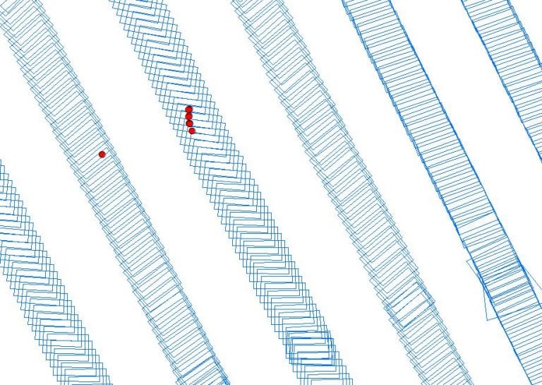
Georeferenced on-ground image footprints (blue rectangles) and dugong sighting positions (red circles) obtained from an aerial survey conducted with WingtraOne © Christophe Cleguer.
Read the Wingtra case study in full here.